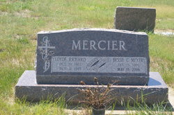
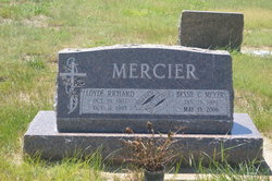
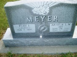
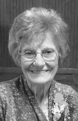
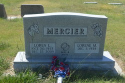
Bessie Catherine Meyer Mercier
| Birth | : | 15 Jan 1909 Campbell, Franklin County, Nebraska, USA |
| Death | : | 1 May 2006 Grant, Perkins County, Nebraska, USA |
| Burial | : | Trinity Lutheran Cemetery, Grant, Perkins County, USA |
| Coordinate | : | 40.9605000, -101.7478000 |
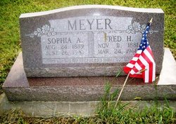
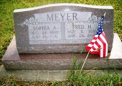
| Description | : | Bessie C. Meyer Mercier Jan 15,1909-May 13,2006 MERCIER, Bessie, 97, of Grant, formerly of Kearney, died Saturday, May 13, 2006, at Golden Hours Convalescent Home in Grant. Services: Tuesday, Trinity Lutheran Church north of Grant Burial: Trinity Lutheran Cemetery Mortuary: Bullock-Long Born Jan. 15, 1909, in Campbell Parents: Fred and Sophie (Nitzel) Meyer Married: Aug. 15, 1928, to Loyde Mercier in Burns, Wyo. He preceded her in death. Survivors include her son, Loren of Grant; daughter, Karen Mosel of Ogallala; sisters, Esther Schmale of Blue Hill, Elsie Rippen of Kearney and Niva Parks of Campbell; brother, Fredrick Meyer of Iowa; four Grandchildren; 10 great-grandchildren; and two great-great-grandchildren. ... Read More |
frequently asked questions (FAQ):
-
Where is Bessie Catherine Meyer Mercier's memorial?
Bessie Catherine Meyer Mercier's memorial is located at: Trinity Lutheran Cemetery, Grant, Perkins County, USA.
-
When did Bessie Catherine Meyer Mercier death?
Bessie Catherine Meyer Mercier death on 1 May 2006 in Grant, Perkins County, Nebraska, USA
-
Where are the coordinates of the Bessie Catherine Meyer Mercier's memorial?
Latitude: 40.9605000
Longitude: -101.7478000
Family Members:
Parent
Spouse
Siblings
Children
Flowers:
Nearby Cemetories:
1. Trinity Lutheran Cemetery
Grant, Perkins County, USA
Coordinate: 40.9605000, -101.7478000
2. Fairview Cemetery
Grant, Perkins County, USA
Coordinate: 40.8372002, -101.7391968
3. Saint John's Lutheran Church Cemetery
Ogallala, Keith County, USA
Coordinate: 41.0617000, -101.5983000
4. Ogallala Cemetery
Ogallala, Keith County, USA
Coordinate: 41.1286011, -101.7472000
5. Boot Hill Cemetery
Ogallala, Keith County, USA
Coordinate: 41.1324997, -101.7256012
6. Brule Cemetery
Brule, Keith County, USA
Coordinate: 41.1060982, -101.8822021
7. Madrid Cemetery
Madrid, Perkins County, USA
Coordinate: 40.8371510, -101.5380900
8. Pickard Cemetery
Keith County, USA
Coordinate: 41.0482240, -101.4809320
9. Big Springs Cemetery
Big Springs, Deuel County, USA
Coordinate: 41.0592003, -102.0931015
10. Venango Cemetery
Venango, Perkins County, USA
Coordinate: 40.7416992, -102.0175018
11. Elsie Cemetery
Elsie, Perkins County, USA
Coordinate: 40.8499050, -101.3666140
12. Walpole Cemetery
Perkins County, USA
Coordinate: 40.9157982, -101.3422012
13. Lemoyne Cemetery
Lemoyne, Keith County, USA
Coordinate: 41.2723000, -101.8123000
14. Paxton Cemetery
Paxton, Keith County, USA
Coordinate: 41.1088982, -101.3569031
15. Blanche Cemetery
Chase County, USA
Coordinate: 40.6841900, -101.4390900
16. Zion Cemetery
Deuel County, USA
Coordinate: 41.1641998, -102.1530991
17. Day Cemetery
Deuel County, USA
Coordinate: 41.1921997, -102.1331024
18. Hillside Cemetery
Julesburg, Sedgwick County, USA
Coordinate: 40.9692001, -102.2406006
19. Green Cemetery
Julesburg, Sedgwick County, USA
Coordinate: 40.8650000, -102.2284090
20. Frontier Cemetery
Sutherland, Lincoln County, USA
Coordinate: 41.0912000, -101.2531000
21. Amherst Cemetery
Phillips County, USA
Coordinate: 40.7056007, -102.1603012
22. Chase Cemetery
Chase, Chase County, USA
Coordinate: 40.5525017, -101.8078003
23. Dunkard Cemetery
Amherst, Phillips County, USA
Coordinate: 40.6438000, -102.1356400
24. Mount Hope Cemetery
Imperial, Chase County, USA
Coordinate: 40.5297012, -101.6607971

