| Birth | : | 24 Dec 1930 Cambridge, Furnas County, Nebraska, USA |
| Death | : | 28 Sep 2011 Bertrand, Phelps County, Nebraska, USA |
| Burial | : | Gladstone Cemetery, Greymouth, Grey District, New Zealand |
| Coordinate | : | -42.5381220, 171.1522540 |
| Plot | : | H 144 |
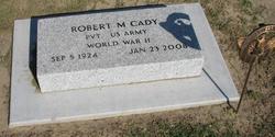
| Inscription | : | MARRIED JUNE 1, 1948. PARENTS OF DIANA and ROBERT. |
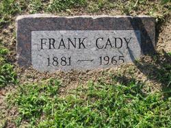
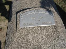
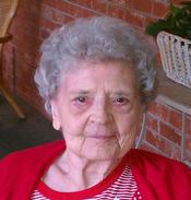
| Description | : | Betty Maxine Decker, 80, of Holdrege died Wednesday, Sept. 28, 2011, at Bertrand Nursing Home. Betty was born December 24, 1930 at Cambridge, Nebraska, the youngest of ten children born to Frank and Ida (Rheinheimer) Cady. Betty received her education at McCook, Nebraska, graduating from McCook High School with the class of 1948. On June 1, 1948 she was united in marriage to John Edward Decker and to this union two children were born: Diana and Robert. The family first made their home in Holbrook, Nebraska. In 1961, they moved to Holdrege, where Betty was employed by J.M. McDonald Department... Read More |
frequently asked questions (FAQ):
-
Where is Betty Maxine Cady Decker's memorial?
Betty Maxine Cady Decker's memorial is located at: Gladstone Cemetery, Greymouth, Grey District, New Zealand.
-
When did Betty Maxine Cady Decker death?
Betty Maxine Cady Decker death on 28 Sep 2011 in Bertrand, Phelps County, Nebraska, USA
-
Where are the coordinates of the Betty Maxine Cady Decker's memorial?
Latitude: -42.5381220
Longitude: 171.1522540
Family Members:
Parent
Spouse
Siblings
Flowers:
Nearby Cemetories:
1. Gladstone Cemetery
Greymouth, Grey District, New Zealand
Coordinate: -42.5381220, 171.1522540
2. Karoro Cemetery
Greymouth, Grey District, New Zealand
Coordinate: -42.4678260, 171.1893800
3. St Pauls Methodist Church (Defunct)
Greymouth, Grey District, New Zealand
Coordinate: -42.4500880, 171.2114610
4. Cobden Cemetery
Greymouth, Grey District, New Zealand
Coordinate: -42.4371700, 171.2019000
5. Kumara Cemetery
Kumara, Westland District, New Zealand
Coordinate: -42.6464650, 171.1721970
6. Greenstone Cemetery
Kumara, Westland District, New Zealand
Coordinate: -42.6361450, 171.2751350
7. Old Stafford Cemetery
Hokitika, Westland District, New Zealand
Coordinate: -42.6662370, 171.0893140
8. Stillwater Cemetery
Greymouth, Grey District, New Zealand
Coordinate: -42.4394820, 171.3494380
9. Hokitika Municipal Cemetery
Hokitika, Westland District, New Zealand
Coordinate: -42.7102940, 170.9759800
10. Notown Cemetery
Dobson, Grey District, New Zealand
Coordinate: -42.4514530, 171.4465670
11. Blackball Cemetery
Greymouth, Grey District, New Zealand
Coordinate: -42.3757410, 171.4135760
12. Nelson Creek Cemetery
Ngahere, Grey District, New Zealand
Coordinate: -42.3865620, 171.4595500
13. Barrytown Cemetery
Barrytown, Grey District, New Zealand
Coordinate: -42.2455150, 171.3166710
14. Ahaura Cemetery
Ahaura, Grey District, New Zealand
Coordinate: -42.3516790, 171.5581700
15. Evans Grave
Arthurs Pass, Selwyn District, New Zealand
Coordinate: -42.7723610, 171.6249940
16. Ross Cemetery
Ross, Westland District, New Zealand
Coordinate: -42.8898440, 170.8226160
17. Ross Historic Cemetery
Ross, Westland District, New Zealand
Coordinate: -42.9023200, 170.8113230
18. Charleston Catholic Cemetery
Charleston, Buller District, New Zealand
Coordinate: -41.9093390, 171.4359110
19. Nile Hill Cemetery
Charleston, Buller District, New Zealand
Coordinate: -41.8991610, 171.4394080
20. Old Reefton Cemetery
Reefton, Buller District, New Zealand
Coordinate: -42.1115220, 171.8590850
21. Reefton Cemetery
Reefton, Buller District, New Zealand
Coordinate: -42.0856940, 171.8470730
22. Boatmans Cemetery
Cronadun, Buller District, New Zealand
Coordinate: -42.0391020, 171.8775660
23. Hari Hari Cemetery
Hari Hari, Westland District, New Zealand
Coordinate: -43.1501430, 170.5576110
24. Addison's Flat Cemetery
Westport, Buller District, New Zealand
Coordinate: -41.8462220, 171.5569580


