
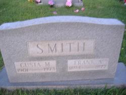
| Birth | : | 31 Oct 1900 Red Bush, Warrick County, Indiana, USA |
| Death | : | 25 Oct 1982 Boonville, Warrick County, Indiana, USA |
| Burial | : | Hall Cemetery, Delphos, Ottawa County, USA |
| Coordinate | : | 39.2404970, -97.6302360 |
frequently asked questions (FAQ):
-
Where is Boniface Andrew “Bone” Smith's memorial?
Boniface Andrew “Bone” Smith's memorial is located at: Hall Cemetery, Delphos, Ottawa County, USA.
-
When did Boniface Andrew “Bone” Smith death?
Boniface Andrew “Bone” Smith death on 25 Oct 1982 in Boonville, Warrick County, Indiana, USA
-
Where are the coordinates of the Boniface Andrew “Bone” Smith's memorial?
Latitude: 39.2404970
Longitude: -97.6302360
Family Members:
Parent

Siblings
Flowers:


Nearby Cemetories:
1. Hall Cemetery
Delphos, Ottawa County, USA
Coordinate: 39.2404970, -97.6302360
2. Crosson Cemetery
Minneapolis, Ottawa County, USA
Coordinate: 39.2011940, -97.6544720
3. Pleasant Hill Cemetery
Lamar, Ottawa County, USA
Coordinate: 39.2050018, -97.5832977
4. Fairview Cemetery
Lamar, Ottawa County, USA
Coordinate: 39.2928009, -97.5299988
5. Delphos Cemetery
Delphos, Ottawa County, USA
Coordinate: 39.2778015, -97.7416992
6. Saint Paul Cemetery
Delphos, Ottawa County, USA
Coordinate: 39.2677994, -97.7518997
7. Thomas Cemetery
Miltonvale, Cloud County, USA
Coordinate: 39.3300000, -97.5750000
8. Bethel Cemetery
Meredith Township, Cloud County, USA
Coordinate: 39.3506000, -97.7029000
9. Saint Peters Cemetery
Miltonvale, Cloud County, USA
Coordinate: 39.3652350, -97.6483570
10. Oakland Union Cemetery
Miltonvale, Cloud County, USA
Coordinate: 39.3647003, -97.5824966
11. Highland Cemetery
Minneapolis, Ottawa County, USA
Coordinate: 39.1175003, -97.6877975
12. Mount Liberty Church Cemetery
Ottawa County, USA
Coordinate: 39.2489400, -97.4356200
13. Miltonvale Cemetery
Miltonvale, Cloud County, USA
Coordinate: 39.3358002, -97.4447021
14. Enterprise Cemetery
Cloud County, USA
Coordinate: 39.4230995, -97.6106033
15. Pleasant Hill Cemetery
Henry Township, Ottawa County, USA
Coordinate: 39.1183014, -97.8078003
16. Saint Marys Catholic Cemetery
Glasco, Cloud County, USA
Coordinate: 39.3574000, -97.8245000
17. Ackley Cemetery
Ottawa County, USA
Coordinate: 39.0893160, -97.4797040
18. Glasco Cemetery
Glasco, Cloud County, USA
Coordinate: 39.3574000, -97.8265000
19. Sulphur Springs Cemetery
Aurora, Cloud County, USA
Coordinate: 39.4086610, -97.4986840
20. Smith Grave
Miltonvale, Cloud County, USA
Coordinate: 39.3645300, -97.4308700
21. Bennington Cemetery
Bennington, Ottawa County, USA
Coordinate: 39.0385200, -97.5937800
22. Vine Creek Cemetery
Ottawa County, USA
Coordinate: 39.1194000, -97.4180984
23. Fairview Cemetery
Ada, Ottawa County, USA
Coordinate: 39.1610985, -97.8735962
24. Saint Borgia Cemetery
Ada, Ottawa County, USA
Coordinate: 39.1612050, -97.8739330