| Birth | : | 25 Nov 1940 Stockton, San Joaquin County, California, USA |
| Death | : | 22 Nov 2017 Perris, Riverside County, California, USA |
| Burial | : | Menifee Valley Cemetery, Sun City, Riverside County, USA |
| Coordinate | : | 33.7290420, -117.2059910 |
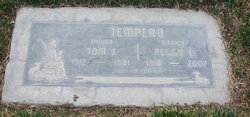
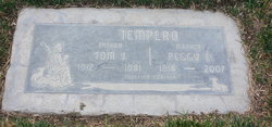
| Description | : | It is with great sadness that we announce the passing of Bonnie Jean Grable on November 22, 2017; she was born on November 25, 1940 in Stockton, California to Thomas James and Margaret Ileen Tempero. She grew up in El Monte, California with her sister Dixie and brother Tommy. She loved barrel racing and helping her dad on the farm. She graduated from Southgate High School in 1958 and married her high school sweetheart, James Grable that same year. James and Bonnie along with their kids moved to Perris in 1975 where they still reside. Bonnie is... Read More |
frequently asked questions (FAQ):
-
Where is Bonnie Jean Tempero Grable's memorial?
Bonnie Jean Tempero Grable's memorial is located at: Menifee Valley Cemetery, Sun City, Riverside County, USA.
-
When did Bonnie Jean Tempero Grable death?
Bonnie Jean Tempero Grable death on 22 Nov 2017 in Perris, Riverside County, California, USA
-
Where are the coordinates of the Bonnie Jean Tempero Grable's memorial?
Latitude: 33.7290420
Longitude: -117.2059910
Family Members:
Parent
Flowers:
Nearby Cemetories:
1. Menifee Valley Cemetery
Sun City, Riverside County, USA
Coordinate: 33.7290420, -117.2059910
2. Saint Stephen’s Episcopal Church Columbarium
Sun City, Riverside County, USA
Coordinate: 33.7330990, -117.2042950
3. McCanna Cemetery
Perris, Riverside County, USA
Coordinate: 33.7802300, -117.2159300
4. Perris Valley Cemetery
Perris, Riverside County, USA
Coordinate: 33.7947006, -117.2228012
5. Manker Family Cemetery
Lake Elsinore, Riverside County, USA
Coordinate: 33.6689800, -117.2451200
6. Elsinore Valley Cemetery
Lake Elsinore, Riverside County, USA
Coordinate: 33.6944008, -117.3405991
7. Home of Peace Cemetery
Lake Elsinore, Riverside County, USA
Coordinate: 33.6944500, -117.3440100
8. Wildomar Cemetery
Wildomar, Riverside County, USA
Coordinate: 33.6100006, -117.2699966
9. March Field Air Museum
March Field, Riverside County, USA
Coordinate: 33.8832245, -117.2668686
10. Riverside National Cemetery
Riverside, Riverside County, USA
Coordinate: 33.8875008, -117.2800980
11. Laurel Cemetery
Murrieta, Riverside County, USA
Coordinate: 33.5421982, -117.2210999
12. Holy Ghost Fathers Cemetery
Hemet, Riverside County, USA
Coordinate: 33.7362940, -116.9698520
13. Episcopal Church of the Good Shepherd Columbarium
Hemet, Riverside County, USA
Coordinate: 33.7440620, -116.9691790
14. Glen Eden Sun Club Chapel Cemetery
Corona, Riverside County, USA
Coordinate: 33.7422741, -117.4462294
15. San Jacinto Valley Cemetery
San Jacinto, Riverside County, USA
Coordinate: 33.7599983, -116.9599991
16. Temecula Cemetery
Temecula, Riverside County, USA
Coordinate: 33.4906010, -117.1416910
17. Soboba Indian Reservation Cemetery
San Jacinto, Riverside County, USA
Coordinate: 33.7796000, -116.9136000
18. Pechanga Tribal Cemetery
Temecula, Riverside County, USA
Coordinate: 33.4816840, -117.0908380
19. Olivewood Cemetery
Riverside, Riverside County, USA
Coordinate: 33.9528008, -117.3780975
20. Saint Thomas of Canterbury Episcopal Church Columb
Temecula, Riverside County, USA
Coordinate: 33.4753400, -117.1115300
21. Louis Wolf Tombstone
Temecula, Riverside County, USA
Coordinate: 33.4641480, -117.1199030
22. Desert Lawn Memorial Park
Calimesa, Riverside County, USA
Coordinate: 33.9566994, -117.0203018
23. Stewart Sunnyslope Cemetery
Beaumont, Riverside County, USA
Coordinate: 33.9196570, -116.9651700
24. Saint Stephens Episcopal Church Memorial Garden
Beaumont, Riverside County, USA
Coordinate: 33.9322860, -116.9795610


