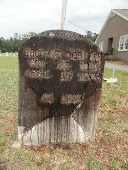
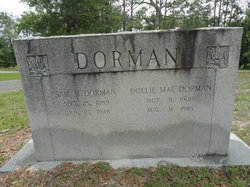
Brookie Dorman
| Birth | : | 28 Nov 1885 Horry County, South Carolina, USA |
| Death | : | 16 Apr 1908 Conway, Horry County, South Carolina, USA |
| Burial | : | Baptist Cemetery, West Lafayette, Coshocton County, USA |
| Coordinate | : | 40.2756310, -81.7585220 |
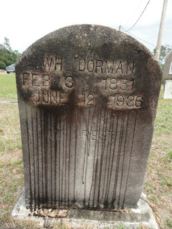
| Description | : | Horry Herald April 23, 1906 Brookie Dorman Loses Life From Being Mashed Between Two Timber Cars Suffered for two days from the mortal injuries received and died her at Vereen Hotel where he was being brought for medical attention. A young man named, Brookie Dorman, a son of Mr. W. H. Dorman of the Adrian section, while coupling timber cars for the Kanawha Lumber Corporation at this company's timber camps near Gunter's Island last week, was severely mashed through the middle of the body by two of the cars coming suddenly together before he could get out of the way.... Read More |
frequently asked questions (FAQ):
-
Where is Brookie Dorman's memorial?
Brookie Dorman's memorial is located at: Baptist Cemetery, West Lafayette, Coshocton County, USA.
-
When did Brookie Dorman death?
Brookie Dorman death on 16 Apr 1908 in Conway, Horry County, South Carolina, USA
-
Where are the coordinates of the Brookie Dorman's memorial?
Latitude: 40.2756310
Longitude: -81.7585220
Family Members:
Parent
Siblings
Flowers:
Nearby Cemetories:
1. Baptist Cemetery
West Lafayette, Coshocton County, USA
Coordinate: 40.2756310, -81.7585220
2. Wiggins Family Cemetery
West Lafayette, Coshocton County, USA
Coordinate: 40.2624080, -81.7585950
3. Fairfield Cemetery
West Lafayette, Coshocton County, USA
Coordinate: 40.2661018, -81.7463989
4. Ferguson Cemetery
West Lafayette, Coshocton County, USA
Coordinate: 40.2736015, -81.7253036
5. Claypoint Cemetery
West Lafayette, Coshocton County, USA
Coordinate: 40.2513720, -81.7292430
6. McClain Cemetery
West Lafayette, Coshocton County, USA
Coordinate: 40.2499130, -81.7251870
7. Bowman Cemetery
West Lafayette, Coshocton County, USA
Coordinate: 40.3031006, -81.7247009
8. Norman Family Cemetery
West Lafayette, Coshocton County, USA
Coordinate: 40.2859570, -81.7063340
9. Oak Grove Cemetery
Coshocton County, USA
Coordinate: 40.3032990, -81.8005981
10. Coshocton County Infirmary Cemetery
Coshocton, Coshocton County, USA
Coordinate: 40.2694450, -81.8166500
11. Hill Cemetery
Coshocton County, USA
Coordinate: 40.3208008, -81.7878036
12. Fairview Cemetery
Fresno, Coshocton County, USA
Coordinate: 40.3238983, -81.7328033
13. Waggoner Cemetery
Coshocton County, USA
Coordinate: 40.2728004, -81.6900024
14. Mount Zion Cemetery
Coshocton, Coshocton County, USA
Coordinate: 40.2344017, -81.8035965
15. Plainfield Presbyterian Church Cemetery
Plainfield, Coshocton County, USA
Coordinate: 40.2244020, -81.7310710
16. Powell's Cemetery
Coshocton, Coshocton County, USA
Coordinate: 40.3301239, -81.7438202
17. Evansburg Cemetery
Orange, Coshocton County, USA
Coordinate: 40.2873300, -81.6771800
18. Canal Lewisville Cemetery
Canal Lewisville, Coshocton County, USA
Coordinate: 40.3012500, -81.8357100
19. Saint Johns Lutheran Church Cemetery
Coshocton, Coshocton County, USA
Coordinate: 40.2103200, -81.7796000
20. Clapboard Cemetery
Coshocton County, USA
Coordinate: 40.3391991, -81.7244034
21. Reamer Cemetery
Coshocton County, USA
Coordinate: 40.3194008, -81.8317032
22. Coshocton County Memory Gardens
Coshocton, Coshocton County, USA
Coordinate: 40.3234825, -81.8310089
23. Plainfield Cemetery
Plainfield, Coshocton County, USA
Coordinate: 40.2070000, -81.7220000
24. Saint Marys Catholic Cemetery
Plainfield, Coshocton County, USA
Coordinate: 40.2011300, -81.7639850

