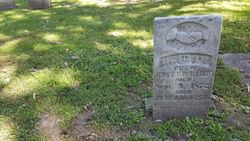
| Birth | : | 6 Nov 1831 Illinois, USA |
| Death | : | 28 Feb 1910 Norfolk, Madison County, Nebraska, USA |
| Burial | : | St. Mary the Virgin Churchyard, Morpeth, Northumberland Unitary Authority, England |
| Coordinate | : | 55.1597110, -1.6921530 |
| Description | : | Long time friend/neighbor of the Dolan family. One of their children was named after him - Lewis Cassius Dolan On the right, 1860 Census of Beverly, Washington County, Ohio... Civil War Draft -- his name spelled Albury. Was a postmaster in this town -- Marietta, Madison CO, Nebraska. The property was deeded by John and Margaret Allbery to the Methodist Episcopal Church for use as a cemetery in 1879. I’m assuming that is how the cemetery received its name. According to the deed, the property is 5 acres, more or less. My records don’t show that John and Margaret are buried there. No death records are filed... Read More |
frequently asked questions (FAQ):
-
Where is Caleb Cassius Allbery's memorial?
Caleb Cassius Allbery's memorial is located at: St. Mary the Virgin Churchyard, Morpeth, Northumberland Unitary Authority, England.
-
When did Caleb Cassius Allbery death?
Caleb Cassius Allbery death on 28 Feb 1910 in Norfolk, Madison County, Nebraska, USA
-
Where are the coordinates of the Caleb Cassius Allbery's memorial?
Latitude: 55.1597110
Longitude: -1.6921530
Family Members:
Parent
Spouse
Siblings
Children
Flowers:
Nearby Cemetories:
1. St. Mary the Virgin Churchyard
Morpeth, Northumberland Unitary Authority, England
Coordinate: 55.1597110, -1.6921530
2. St. Mary the Virgin Church
Morpeth, Northumberland Unitary Authority, England
Coordinate: 55.1598990, -1.6917760
3. Newminster Abbey
Morpeth, Northumberland Unitary Authority, England
Coordinate: 55.1664000, -1.7044070
4. Saint Mary Magdalene Churchyard
Mitford, Northumberland Unitary Authority, England
Coordinate: 55.1645410, -1.7363020
5. Fairmoor Cemetery
Morpeth, Northumberland Unitary Authority, England
Coordinate: 55.1861980, -1.7163260
6. Saint John's Churchyard
Longhirst, Northumberland Unitary Authority, England
Coordinate: 55.1936200, -1.6474840
7. St Cuthbert Churchyard
Hebron, Northumberland Unitary Authority, England
Coordinate: 55.2023450, -1.6963700
8. St Andrew's Churchyard
Bothal, Northumberland Unitary Authority, England
Coordinate: 55.1731340, -1.6205890
9. St. Paul's Churchyard
Choppington, Northumberland Unitary Authority, England
Coordinate: 55.1494290, -1.6009780
10. Netherton Lane Cemetery
Bedlington, Northumberland Unitary Authority, England
Coordinate: 55.1318960, -1.6106800
11. St. Cuthbert Churchyard
Bedlington, Northumberland Unitary Authority, England
Coordinate: 55.1303910, -1.5928880
12. Saint Aidens Churchyard
Ashington, Northumberland Unitary Authority, England
Coordinate: 55.1826900, -1.5781400
13. St. John Churchyard
Meldon, Northumberland Unitary Authority, England
Coordinate: 55.1489650, -1.8144770
14. St Peter Churchyard
Cambois, Northumberland Unitary Authority, England
Coordinate: 55.1615300, -1.5604100
15. North Seaton Cemetery
Ashington, Northumberland Unitary Authority, England
Coordinate: 55.1669770, -1.5575500
16. St. Mary's Churchyard
Horton, Northumberland Unitary Authority, England
Coordinate: 55.1106200, -1.5706200
17. Saint Helen’s Churchyard
Longhorsley, Northumberland Unitary Authority, England
Coordinate: 55.2432500, -1.7588200
18. Cowpen Roman Catholic Burial Ground
Blyth, Northumberland Unitary Authority, England
Coordinate: 55.1305300, -1.5386300
19. Saint Andrews Churchyard
Hartburn, Northumberland Unitary Authority, England
Coordinate: 55.1683350, -1.8596667
20. St Andrew Churchyard
Bolam, Northumberland Unitary Authority, England
Coordinate: 55.1376680, -1.8565600
21. St. Nicholas' Churchyard
Cramlington, Northumberland Unitary Authority, England
Coordinate: 55.0856460, -1.5834930
22. Cowpen Cemetery and Crematorium
Blyth, Northumberland Unitary Authority, England
Coordinate: 55.1311260, -1.5294460
23. Lynemouth Cemetery
Lynemouth, Northumberland Unitary Authority, England
Coordinate: 55.2031759, -1.5361996
24. Mayfield Cemetery
Cramlington, Northumberland Unitary Authority, England
Coordinate: 55.0837139, -1.5730931


