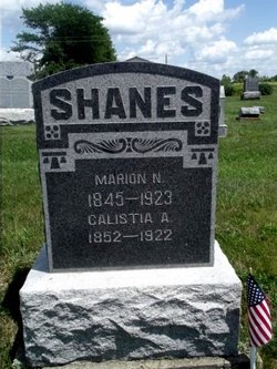
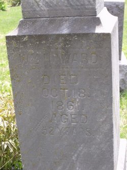
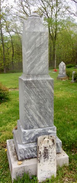
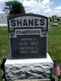
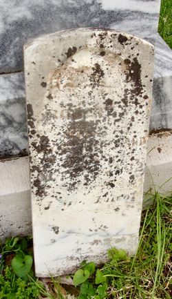
Calistia Adelaide “Addie” Howard Shanes
| Birth | : | 20 Feb 1852 Scotland County, Missouri, USA |
| Death | : | 1 Feb 1922 Gorin, Scotland County, Missouri, USA |
| Burial | : | Parsons Grove United Methodist Church Cemetery, Candor, Montgomery County, USA |
| Coordinate | : | 35.2707340, -79.8512050 |
frequently asked questions (FAQ):
-
Where is Calistia Adelaide “Addie” Howard Shanes's memorial?
Calistia Adelaide “Addie” Howard Shanes's memorial is located at: Parsons Grove United Methodist Church Cemetery, Candor, Montgomery County, USA.
-
When did Calistia Adelaide “Addie” Howard Shanes death?
Calistia Adelaide “Addie” Howard Shanes death on 1 Feb 1922 in Gorin, Scotland County, Missouri, USA
-
Where are the coordinates of the Calistia Adelaide “Addie” Howard Shanes's memorial?
Latitude: 35.2707340
Longitude: -79.8512050
Family Members:
Parent
Spouse
Siblings
Children
Flowers:
Nearby Cemetories:
1. Parsons Grove United Methodist Church Cemetery
Candor, Montgomery County, USA
Coordinate: 35.2707340, -79.8512050
2. Harris Family Cemetery
Onvil, Montgomery County, USA
Coordinate: 35.2596000, -79.8474400
3. Hickory Grove Pentecostal Holiness Church Cemetery
Candor, Montgomery County, USA
Coordinate: 35.2545300, -79.8531460
4. Piney Grove Cemetery
Montgomery County, USA
Coordinate: 35.2914009, -79.8467026
5. Blake Cemetery
Candor, Montgomery County, USA
Coordinate: 35.2742004, -79.8221970
6. Bruton Cemetery
Troy, Montgomery County, USA
Coordinate: 35.2941990, -79.8788770
7. Holly Mount Baptist Church Cemetery
Mount Gilead, Montgomery County, USA
Coordinate: 35.2434940, -79.8757530
8. Haywood Cemetery
Mount Gilead, Montgomery County, USA
Coordinate: 35.2592010, -79.8961029
9. Thompson-Yarboro Cemetery
Montgomery County, USA
Coordinate: 35.2394000, -79.8838000
10. Munn Cemetery
Montgomery County, USA
Coordinate: 35.2778015, -79.7996979
11. Pleasant Grove Baptist Church Cemetery
Mount Gilead, Montgomery County, USA
Coordinate: 35.2995000, -79.8937000
12. Greene Cemetery
Candor, Montgomery County, USA
Coordinate: 35.2559800, -79.7978000
13. Chisholm Cemetery
Wadeville, Montgomery County, USA
Coordinate: 35.2851790, -79.9099590
14. Chisholm Cemetery
Wadeville, Montgomery County, USA
Coordinate: 35.2800560, -79.9127050
15. Greenlake Congregational Cemetery
Candor, Montgomery County, USA
Coordinate: 35.2209120, -79.8706770
16. Long Hill Baptist Church Cemetery
Troy, Montgomery County, USA
Coordinate: 35.3253100, -79.8778800
17. Faith Baptist Church Cemetery
Candor, Montgomery County, USA
Coordinate: 35.3245000, -79.8203000
18. Community Baptist Church Cemetery
Candor, Montgomery County, USA
Coordinate: 35.2900030, -79.7814930
19. Blackwood Chapel Baptist Church Cemetery
Mount Gilead, Montgomery County, USA
Coordinate: 35.2115360, -79.8697200
20. McKenzie Family Cemetery
Pekin, Montgomery County, USA
Coordinate: 35.2101600, -79.8730200
21. Old McCaskill Cemetery
Biscoe, Montgomery County, USA
Coordinate: 35.3253000, -79.8111000
22. Calvary Baptist Church Cemetery
Mount Gilead, Montgomery County, USA
Coordinate: 35.2544310, -79.9284410
23. Laurel Hill Baptist Church Cemetery
Troy, Montgomery County, USA
Coordinate: 35.3366240, -79.8400710
24. Macedonia Presbyterian Church Cemetery
Candor, Montgomery County, USA
Coordinate: 35.3029330, -79.7795000

