
| Memorials | : | 0 |
| Location | : | Wadeville, Montgomery County, USA |
| Coordinate | : | 35.2800560, -79.9127050 |
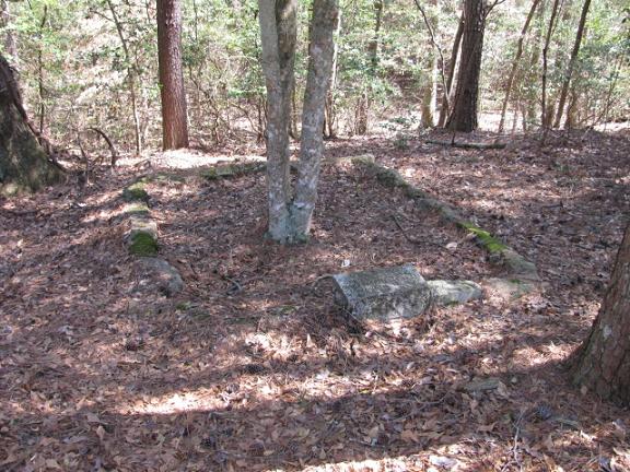
| Description | : | From Wadeville, N.C. take Shoe Factory Road. When this road runs into Pleasant Grove Church Road turn left. Pavement will end. After pavement ends there will be two small buildings on the right. The cemetery with only two graves will be down behind these buildings near a small pond. Note: GPS is approximate. Could not get exact location because of trees. Note: Private property. Please get permission. |
frequently asked questions (FAQ):
-
Where is Chisholm Cemetery?
Chisholm Cemetery is located at Pleasant Grove Church Road Wadeville, Montgomery County ,North Carolina ,USA.
-
Chisholm Cemetery cemetery's updated grave count on graveviews.com?
0 memorials
-
Where are the coordinates of the Chisholm Cemetery?
Latitude: 35.2800560
Longitude: -79.9127050
Nearby Cemetories:
1. Chisholm Cemetery
Wadeville, Montgomery County, USA
Coordinate: 35.2851790, -79.9099590
2. Haywood Cemetery
Mount Gilead, Montgomery County, USA
Coordinate: 35.2592010, -79.8961029
3. Pleasant Grove Baptist Church Cemetery
Mount Gilead, Montgomery County, USA
Coordinate: 35.2995000, -79.8937000
4. Calvary Baptist Church Cemetery
Mount Gilead, Montgomery County, USA
Coordinate: 35.2544310, -79.9284410
5. Bruton Cemetery
Troy, Montgomery County, USA
Coordinate: 35.2941990, -79.8788770
6. Wadeville Baptist Church Cemetery
Wadeville, Montgomery County, USA
Coordinate: 35.2824250, -79.9683770
7. Thompson-Yarboro Cemetery
Montgomery County, USA
Coordinate: 35.2394000, -79.8838000
8. Wadeville United Methodist Church Cemetery
Wadeville, Montgomery County, USA
Coordinate: 35.2796790, -79.9707540
9. Holly Mount Baptist Church Cemetery
Mount Gilead, Montgomery County, USA
Coordinate: 35.2434940, -79.8757530
10. Parsons Family Cemetery
Wadeville, Montgomery County, USA
Coordinate: 35.2819620, -79.9737970
11. Parsons Grove United Methodist Church Cemetery
Candor, Montgomery County, USA
Coordinate: 35.2707340, -79.8512050
12. Long Hill Baptist Church Cemetery
Troy, Montgomery County, USA
Coordinate: 35.3253100, -79.8778800
13. New Covenant Church Cemetery
Troy, Montgomery County, USA
Coordinate: 35.3337200, -79.9241600
14. Hickory Grove Pentecostal Holiness Church Cemetery
Candor, Montgomery County, USA
Coordinate: 35.2545300, -79.8531460
15. Piney Grove Cemetery
Montgomery County, USA
Coordinate: 35.2914009, -79.8467026
16. Harris Family Cemetery
Onvil, Montgomery County, USA
Coordinate: 35.2596000, -79.8474400
17. McRae Cemetery
Pee Dee, Montgomery County, USA
Coordinate: 35.2736015, -79.9946976
18. Greenlake Congregational Cemetery
Candor, Montgomery County, USA
Coordinate: 35.2209120, -79.8706770
19. Ropers Grove Cemetery
Mount Gilead, Montgomery County, USA
Coordinate: 35.2566986, -79.9966965
20. Panagia Prousiotissa Greek Orthodox Monastery
Troy, Montgomery County, USA
Coordinate: 35.3533330, -79.9155560
21. Blake Cemetery
Candor, Montgomery County, USA
Coordinate: 35.2742004, -79.8221970
22. Blackwood Chapel Baptist Church Cemetery
Mount Gilead, Montgomery County, USA
Coordinate: 35.2115360, -79.8697200
23. McKenzie Family Cemetery
Pekin, Montgomery County, USA
Coordinate: 35.2101600, -79.8730200
24. Little River United Methodist Church Cemetery
Mount Gilead, Montgomery County, USA
Coordinate: 35.2035280, -79.9015600