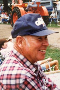
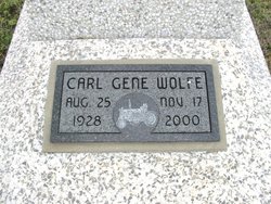
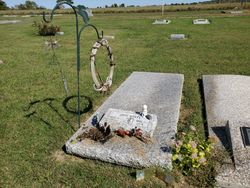
Carl Gene Wolfe
| Birth | : | 25 Aug 1928 Grenola, Elk County, Kansas, USA |
| Death | : | 17 Nov 2000 USA |
| Burial | : | Elmwood Cemetery, Perth, Lanark County, Canada |
| Coordinate | : | 44.9152500, -76.2622600 |
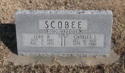
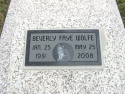
| Description | : | Wolfe, Carl Gene, 72, farmer, rancher and retired Boeing Aircraft Co. employee, died Friday, Nov. 17, 2000. Service 2 p.m. Tuesday, Grenola United Methodist Church. Survivors: wife, Beverly; sons, Elmer, Eugene, John all of Grenola; half-brothers, Wayne Scobee of Barstow, Calif., Wilbur Scobee of Wellington, Walter Scobee of Carthage, Mo.; five grandchildren. Memorials established with Grenola United Methodist Church and Ferguson-Spease American Legion Post, No. 388 of Moline. Zimmerman Funeral Home, Howard. Wichita Eagle Nov 19, 2000 Wolfe was born Aug. 25, 1928, on a farm south of Grenola, to Fern Adeline (Wolfe) and Ray Bagsley. He attended school in the... Read More |
frequently asked questions (FAQ):
-
Where is Carl Gene Wolfe's memorial?
Carl Gene Wolfe's memorial is located at: Elmwood Cemetery, Perth, Lanark County, Canada.
-
When did Carl Gene Wolfe death?
Carl Gene Wolfe death on 17 Nov 2000 in USA
-
Where are the coordinates of the Carl Gene Wolfe's memorial?
Latitude: 44.9152500
Longitude: -76.2622600
Family Members:
Parent
Spouse
Children
Flowers:
Nearby Cemetories:
1. Elmwood Cemetery
Perth, Lanark County, Canada
Coordinate: 44.9152500, -76.2622600
2. Saint Bridget's Catholic Church Cemetery (Defunct)
Perth, Lanark County, Canada
Coordinate: 44.8998300, -76.2447800
3. Old Burying Ground
Perth, Lanark County, Canada
Coordinate: 44.8990040, -76.2405260
4. Saint John the Baptist Catholic Church
Perth, Lanark County, Canada
Coordinate: 44.8952293, -76.2466666
5. Saint John's Parish Cemetery
Perth, Lanark County, Canada
Coordinate: 44.9055700, -76.2316700
6. Saint Paul's United Church Cemetery
Perth, Lanark County, Canada
Coordinate: 44.8963120, -76.2363810
7. Campbell Cemetery
Perth, Lanark County, Canada
Coordinate: 44.9241486, -76.1950183
8. Olde Burying Site
Bathurst, Lanark County, Canada
Coordinate: 44.8682970, -76.2904380
9. Campbell's Cemetery
Balderson, Lanark County, Canada
Coordinate: 44.9634420, -76.2879760
10. Millar Brooke Farm Cemetery
Lanark County, Canada
Coordinate: 44.8791300, -76.1973330
11. Scotch Line Cemetery
Scotch Line, Lanark County, Canada
Coordinate: 44.8397000, -76.3219100
12. Pioneer Cemetery
Drummond, Lanark County, Canada
Coordinate: 45.0010890, -76.2342690
13. Rideau Ferry Cemetery
Rideau Ferry, Lanark County, Canada
Coordinate: 44.8568700, -76.1634000
14. Drummond Centre Community Cemetery
Drummond, Lanark County, Canada
Coordinate: 45.0152470, -76.2346910
15. Saint James Anglican Cemetery
Port Elmsley, Lanark County, Canada
Coordinate: 44.8917210, -76.1153860
16. Prestonvale Cemetery
Prestonvale, Lanark County, Canada
Coordinate: 45.0213420, -76.2857260
17. McVeigh Cemetery
Bathurst, Lanark County, Canada
Coordinate: 44.8968580, -76.4134040
18. Saint Bridget's Cemetery
Stanleyville, Lanark County, Canada
Coordinate: 44.8048900, -76.3153700
19. Robertson Cemetery
Drummond, Lanark County, Canada
Coordinate: 45.0188425, -76.1858338
20. Sacred Heart Roman Catholic Cemetery
Lanark, Lanark County, Canada
Coordinate: 45.0137110, -76.3598740
21. Saint Paul's Anglican Cemetery
Lanark, Lanark County, Canada
Coordinate: 45.0158790, -76.3612520
22. Pinehurst Cemetery
Playfairville, Lanark County, Canada
Coordinate: 44.9748260, -76.4146990
23. Saint Stephen's Anglican Cemetery
Brooke, Lanark County, Canada
Coordinate: 44.8620605, -76.4229584
24. Lanark Village Cemetery
Lanark, Lanark County, Canada
Coordinate: 45.0187910, -76.3700450

