Carl Olov Wallin
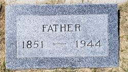
| Birth | : | 7 Nov 1851 Sweden |
| Death | : | 25 Mar 1944 Hill County, Montana, USA |
| Burial | : | Wing Cemetery, Hogeland, Blaine County, USA |
| Coordinate | : | 48.8125000, -108.5860000 |
| Plot | : | Blk 78 Lot 3 |
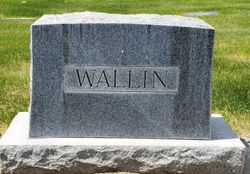
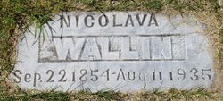
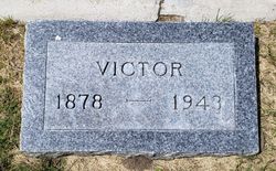
| Description | : | Note: Listed as "Father Wallin" on the cemetery roster. 1920 United States Federal Census Name: Carl O Wallin Age: 68 Birth Year: abt 1852 Birthplace: Sweden Home in 1920: Wing, Blaine, Montana Race: White Gender: Male Immigration Year: 1908 Marital Status: Married Spouse's Name: Nikolava Wallin Father's Birthplace: Sweden Mother's Birthplace: Sweden Home Owned: Own Able to Read: Yes Able to Write: Yes Household Members: Carl O Wallin 68 Nikolava Wallin 65 Victor Wallin 40 ----------------------------------------- 1940 United States Federal Census Name: Carl Wallin Age: 88 Estimated birth year: abt 1852 Gender: Male Race: White Birthplace: Sweden Marital Status: Married Relation to Head of House: Father-in-law Home in 1940: Savoy, Blaine, Montana Inferred Residence in 1935: Savoy, Blaine, Montana Residence... Read More |
frequently asked questions (FAQ):
-
Where is Carl Olov Wallin's memorial?
Carl Olov Wallin's memorial is located at: Wing Cemetery, Hogeland, Blaine County, USA.
-
When did Carl Olov Wallin death?
Carl Olov Wallin death on 25 Mar 1944 in Hill County, Montana, USA
-
Where are the coordinates of the Carl Olov Wallin's memorial?
Latitude: 48.8125000
Longitude: -108.5860000
Family Members:
Spouse
Children
Flowers:
Nearby Cemetories:
1. Wing Cemetery
Hogeland, Blaine County, USA
Coordinate: 48.8125000, -108.5860000
2. Turner Colony Cemetery
Turner Colony, Blaine County, USA
Coordinate: 48.7595000, -108.4369000
3. Silver Bow Cemetery
Hogeland, Blaine County, USA
Coordinate: 48.8870000, -108.7160000
4. Turner Cemetery
Turner, Blaine County, USA
Coordinate: 48.8610001, -108.4120026
5. North Harlem Colony Cemetery
North Harlem Colony, Blaine County, USA
Coordinate: 48.5855560, -108.7558330
6. Harlem Cemetery
Harlem, Blaine County, USA
Coordinate: 48.5444700, -108.7817200
7. Bethel Lutheran Cemetery
Frontier, Maple Creek Census Division, Canada
Coordinate: 49.1447730, -108.5891890
8. Agency Cemetery
Fort Belknap Agency, Blaine County, USA
Coordinate: 48.4767000, -108.7702000
9. Bethel Bruderthaler Mennonite Church Cemetery
Chinook, Blaine County, USA
Coordinate: 48.7552000, -109.1345000
10. Sacred Heart Catholic Cemetery
Fort Belknap Agency, Blaine County, USA
Coordinate: 48.4489000, -108.6582000
11. Zurich Cemetery
Zurich, Blaine County, USA
Coordinate: 48.5900000, -109.0459000
12. Fort Belknap Cemetery
Harlem, Blaine County, USA
Coordinate: 48.4347210, -108.5595860
13. Hollandville Cemetery
Chinook, Blaine County, USA
Coordinate: 48.6960310, -109.1557200
14. Frontier Municipal Cemetery
Frontier, Maple Creek Census Division, Canada
Coordinate: 49.2038040, -108.6506010
15. Mennonite Brethren Cemetery
Chinook, Blaine County, USA
Coordinate: 48.8012560, -109.1980620
16. Loring Colony Cemetery
Loring, Phillips County, USA
Coordinate: 48.7879148, -107.9747077
17. Climax Cemetery
Climax, Maple Creek Census Division, Canada
Coordinate: 49.2177000, -108.3832600
18. Divide Cemetery
Divide, Maple Creek Census Division, Canada
Coordinate: 49.1455840, -109.0491690
19. Graveyard Hill Cemetery
Phillips County, USA
Coordinate: 48.3847008, -108.3638992
20. Hillside Cemetery
Dodson, Phillips County, USA
Coordinate: 48.4122009, -108.2352982
21. Bracken Cemetery
Bracken, Maple Creek Census Division, Canada
Coordinate: 49.1751700, -108.1147000
22. Kuper Memorial Cemetery
Chinook, Blaine County, USA
Coordinate: 48.6083100, -109.2531200
23. Saint Gabriel Cemetery
Chinook, Blaine County, USA
Coordinate: 48.6065200, -109.2531200
24. Waldville Cemetery
Climax, Maple Creek Census Division, Canada
Coordinate: 49.2617900, -108.2928800

