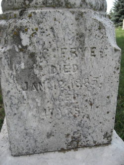
Carlisle L. Frye
| Birth | : | 1837 West Salem Township, Mercer County, Pennsylvania, USA |
| Death | : | 1885 Oakdale, Antelope County, Nebraska, USA |
| Burial | : | Great Cornard Cemetery, Great Cornard, Babergh District, England |
| Coordinate | : | 52.0332410, 0.7450320 |
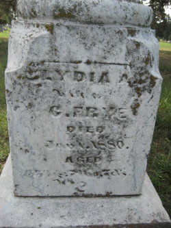
| Description | : | Married Lydia Marstow on September 25, 1862 Some records spell last name as Fry or Frye |
frequently asked questions (FAQ):
-
Where is Carlisle L. Frye's memorial?
Carlisle L. Frye's memorial is located at: Great Cornard Cemetery, Great Cornard, Babergh District, England.
-
When did Carlisle L. Frye death?
Carlisle L. Frye death on 1885 in Oakdale, Antelope County, Nebraska, USA
-
Where are the coordinates of the Carlisle L. Frye's memorial?
Latitude: 52.0332410
Longitude: 0.7450320
Family Members:
Parent
Spouse
Siblings
Children
Flowers:
Nearby Cemetories:
1. Great Cornard Cemetery
Great Cornard, Babergh District, England
Coordinate: 52.0332410, 0.7450320
2. Sudbury Cemetery
Sudbury, Babergh District, England
Coordinate: 52.0389500, 0.7404050
3. St Andrew Churchyard
Great Cornard, Babergh District, England
Coordinate: 52.0304820, 0.7602450
4. St Peter Churchyard
Sudbury, Babergh District, England
Coordinate: 52.0386820, 0.7314680
5. Sudbury Blackfriars Priory
Sudbury, Babergh District, England
Coordinate: 52.0357180, 0.7257820
6. Sudbury Baptist Church
Sudbury, Babergh District, England
Coordinate: 52.0361870, 0.7235530
7. St Gregory Churchyard
Sudbury, Babergh District, England
Coordinate: 52.0401820, 0.7260000
8. All Saints Churchyard
Sudbury, Babergh District, England
Coordinate: 52.0356470, 0.7232090
9. All Saints Churchyard
Middleton, Braintree District, England
Coordinate: 52.0238730, 0.7255760
10. St. Mary's Churchyard
Chilton, Babergh District, England
Coordinate: 52.0146121, 0.7541590
11. All Saints Churchyard
Little Cornard, Babergh District, England
Coordinate: 52.0175530, 0.7703720
12. St. Mary the Virgin Churchyard
Great Henny, Braintree District, England
Coordinate: 52.0073800, 0.7191400
13. All Saints Churchyard
Newton, Babergh District, England
Coordinate: 52.0364000, 0.7966500
14. St. Andrew's Churchyard
Bulmer, Braintree District, England
Coordinate: 52.0275300, 0.6865600
15. St Lawrence Churchyard
Great Waldingfield, Babergh District, England
Coordinate: 52.0606620, 0.7879070
16. Borley Parish Churchyard
Borley, Braintree District, England
Coordinate: 52.0551490, 0.6932870
17. All Saints Churchyard
Acton, Babergh District, England
Coordinate: 52.0729650, 0.7598490
18. St. John the Evangelist Churchyard
Twinstead, Braintree District, England
Coordinate: 51.9974900, 0.7096940
19. Liston Churchyard
Liston, Braintree District, England
Coordinate: 52.0703970, 0.7017420
20. Independent Chapel Cemetery
Long Melford, Babergh District, England
Coordinate: 52.0755010, 0.7157700
21. World War I Memorial
Assington, Babergh District, England
Coordinate: 52.0138200, 0.8193504
22. St Edmund King and Martyr Churchyard
Assington, Babergh District, England
Coordinate: 52.0138120, 0.8194260
23. St. Mary the Virgin Churchyard
Belchamp Walter, Braintree District, England
Coordinate: 52.0345600, 0.6627120
24. Belchamp Walter Cemetery
Belchamp Walter, Braintree District, England
Coordinate: 52.0346000, 0.6624000


