
| Memorials | : | 0 |
| Location | : | Long Melford, Babergh District, England |
| Coordinate | : | 52.0755010, 0.7157700 |
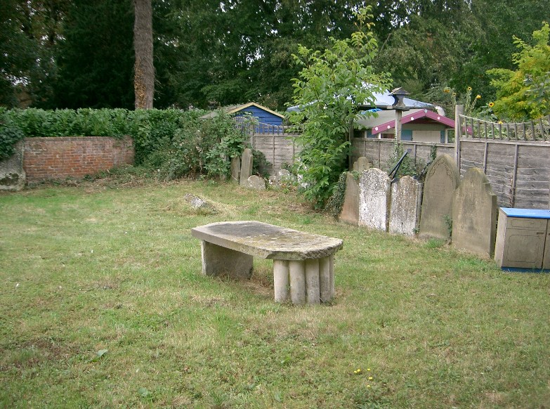
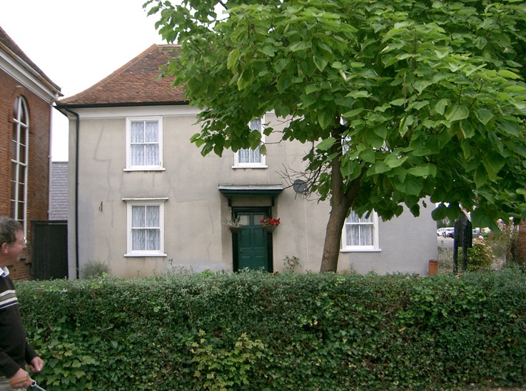
| Description | : | This is a tiny cemetery which is no longer in use. It lays within an ancient "crinkle crankle wall" The original Independent Chapel and tiny attached "school" is still thre and the Chapel is still a place of worship. The cemetery has since been divided into three plots. One plot belongs to the ministers house, another belongs to the chapel and is also used as a small childrens supervised play area. The remaining plot it appears is dedicated to the dead and all of the gravestones have been removed from the other areas ant placed here; consequently we don't know... Read More |
frequently asked questions (FAQ):
-
Where is Independent Chapel Cemetery?
Independent Chapel Cemetery is located at Hall Street Long Melford, Babergh District ,Suffolk ,England.
-
Independent Chapel Cemetery cemetery's updated grave count on graveviews.com?
0 memorials
-
Where are the coordinates of the Independent Chapel Cemetery?
Latitude: 52.0755010
Longitude: 0.7157700
Nearby Cemetories:
1. Liston Churchyard
Liston, Braintree District, England
Coordinate: 52.0703970, 0.7017420
2. Holy Trinity Churchyard
Long Melford, Babergh District, England
Coordinate: 52.0877110, 0.7207640
3. Borley Parish Churchyard
Borley, Braintree District, England
Coordinate: 52.0551490, 0.6932870
4. Ss Peter and Paul Churchyard
Foxearth, Braintree District, England
Coordinate: 52.0709200, 0.6763800
5. All Saints Churchyard
Acton, Babergh District, England
Coordinate: 52.0729650, 0.7598490
6. Ebenezer Baptist Chapel Burial Ground
Glemsford, Babergh District, England
Coordinate: 52.0957000, 0.6680000
7. St Gregory Churchyard
Sudbury, Babergh District, England
Coordinate: 52.0401820, 0.7260000
8. St Mary the Virgin Churchyard
Glemsford, Babergh District, England
Coordinate: 52.1033950, 0.6766070
9. St Peter Churchyard
Sudbury, Babergh District, England
Coordinate: 52.0386820, 0.7314680
10. St. James Churchyard
Stanstead, Babergh District, England
Coordinate: 52.1116820, 0.6909100
11. Sudbury Cemetery
Sudbury, Babergh District, England
Coordinate: 52.0389500, 0.7404050
12. Sudbury Baptist Church
Sudbury, Babergh District, England
Coordinate: 52.0361870, 0.7235530
13. All Saints Churchyard
Sudbury, Babergh District, England
Coordinate: 52.0356470, 0.7232090
14. Sudbury Blackfriars Priory
Sudbury, Babergh District, England
Coordinate: 52.0357180, 0.7257820
15. St. George and St. Gregory Churchyard
Pentlow, Braintree District, England
Coordinate: 52.0841020, 0.6441840
16. Great Cornard Cemetery
Great Cornard, Babergh District, England
Coordinate: 52.0332410, 0.7450320
17. Ss Peter & Paul Churchyard
Alpheton, Babergh District, England
Coordinate: 52.1207310, 0.7350230
18. St Lawrence Churchyard
Great Waldingfield, Babergh District, England
Coordinate: 52.0606620, 0.7879070
19. St. Mary's Church of England
Milton Keynes Borough, England
Coordinate: 52.0769560, 0.7937130
20. St. Andrew's Churchyard
Bulmer, Braintree District, England
Coordinate: 52.0275300, 0.6865600
21. St. Mary the Virgin Churchyard
Cavendish, St Edmundsbury Borough, England
Coordinate: 52.0873318, 0.6334569
22. All Saints Churchyard
Middleton, Braintree District, England
Coordinate: 52.0238730, 0.7255760
23. St. Mary the Virgin Churchyard
Belchamp Walter, Braintree District, England
Coordinate: 52.0345600, 0.6627120
24. Belchamp Walter Cemetery
Belchamp Walter, Braintree District, England
Coordinate: 52.0346000, 0.6624000