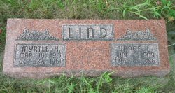
| Birth | : | 10 Dec 1879 Howard County, Nebraska, USA |
| Death | : | 1 Jun 1956 Saint Paul, Howard County, Nebraska, USA |
| Burial | : | All Saints Churchyard, Salhouse, Broadland District, England |
| Coordinate | : | 52.6833600, 1.4063280 |
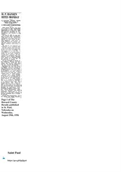
| Description | : | Grand Island (Nebraska) Daily Independent Saturday, June 2, 1956 Mrs. Paul Mortensen, 76, of St. Paul died Friday afternoon at her home here(St. Paul). Her death came as the family was preparing for a farewell family reunion to honor a grandson, Verlin Rasmussen, who was to leave with his family for Rochester, N. Y. Mrs. Mortensen was born Dec. 10, 1879, in Dannevirke Precinct to Nels and Anna Marie Hansen. She and Paul Mortensen were married April 1, 1899. They lived at Cotesfield prior to moving to St. Paul in 1945. They observed their 57th wedding anniversary... Read More |
frequently asked questions (FAQ):
-
Where is Carrie Sophie Hansen Mortensen's memorial?
Carrie Sophie Hansen Mortensen's memorial is located at: All Saints Churchyard, Salhouse, Broadland District, England.
-
When did Carrie Sophie Hansen Mortensen death?
Carrie Sophie Hansen Mortensen death on 1 Jun 1956 in Saint Paul, Howard County, Nebraska, USA
-
Where are the coordinates of the Carrie Sophie Hansen Mortensen's memorial?
Latitude: 52.6833600
Longitude: 1.4063280
Family Members:
Parent
Spouse
Siblings
Children
Flowers:
Nearby Cemetories:
1. All Saints Churchyard
Salhouse, Broadland District, England
Coordinate: 52.6833600, 1.4063280
2. Salhouse Baptist Church
Salhouse, Broadland District, England
Coordinate: 52.6807500, 1.4223800
3. St. Mary the Virgin Churchyard
Wroxham, Broadland District, England
Coordinate: 52.7067470, 1.3984620
4. Wroxham Parish Council Cemetery
Wroxham, Broadland District, England
Coordinate: 52.7079631, 1.3994432
5. St. Fabian & St. Sebastian Churchyard
Woodbastwick, Broadland District, England
Coordinate: 52.6841900, 1.4492890
6. St John's Churchyard
Hoveton, North Norfolk District, England
Coordinate: 52.7120040, 1.4174270
7. All Saints Churchyard
Rackheath, Broadland District, England
Coordinate: 52.6846160, 1.3573490
8. St. Peter's Churchyard
Belaugh, Broadland District, England
Coordinate: 52.7153080, 1.3867600
9. St Gervase and St Protase Churchyard
Little Plumstead, Broadland District, England
Coordinate: 52.6468000, 1.4093000
10. All Saints Churchyard
Panxworth, Broadland District, England
Coordinate: 52.6688790, 1.4703430
11. St. Peter Crostwick Church Cemetery
Crostwick, Broadland District, England
Coordinate: 52.6934480, 1.3395750
12. St. Peter's Churchyard
Hoveton, North Norfolk District, England
Coordinate: 52.7239790, 1.4256250
13. St. Mary the Virgin Churchyard
Great Plumstead, North Norfolk District, England
Coordinate: 52.6385560, 1.4007180
14. St. Mary the Virgin Churchyard
Great Plumstead, Broadland District, England
Coordinate: 52.6384790, 1.4008340
15. St. Helen's Churchyard
Ranworth, Broadland District, England
Coordinate: 52.6792260, 1.4836790
16. St. Benedict's Church Cemetery
Horning, North Norfolk District, England
Coordinate: 52.6955690, 1.4836570
17. St. John the Baptist Churchyard
Coltishall, Broadland District, England
Coordinate: 52.7278530, 1.3626450
18. Sprowston Cemetery
Sprowston, Broadland District, England
Coordinate: 52.6644440, 1.3249400
19. St. Mary and St. Margaret Churchyard
Sprowston, Broadland District, England
Coordinate: 52.6635430, 1.3248800
20. Neatishead Baptist Churchyard
Neatishead, North Norfolk District, England
Coordinate: 52.7240100, 1.4633560
21. All Saints Churchyard
Hemblington, Broadland District, England
Coordinate: 52.6505100, 1.4769600
22. Cucumber Lane Cemetery
Brundall, Broadland District, England
Coordinate: 52.6304330, 1.4259830
23. St. Peter Churchyard
Neatishead, North Norfolk District, England
Coordinate: 52.7244260, 1.4703220
24. St. Swithin's Churchyard
Ashmanhaugh, North Norfolk District, England
Coordinate: 52.7384470, 1.4271260


