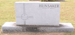
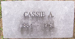
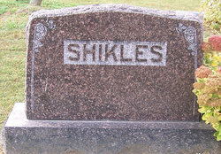
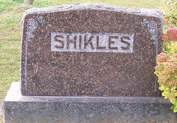
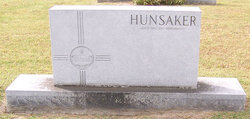
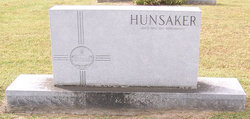
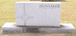
Cassie A Shikles Hunsaker
| Birth | : | 17 Jun 1884 Moniteau County, Missouri, USA |
| Death | : | 9 Jul 1961 Orange County, California, USA |
| Burial | : | Giles Chapel United Methodist Church Cemetery, Asheboro, Randolph County, USA |
| Coordinate | : | 35.7462270, -79.7752450 |
| Description | : | Jefferson City Post Tribune, Wednesday, July 12, 1961, Jefferson City, Missouri Services will be at 10 a.m. Thursday at Olean Christian Church for Mrs. Cassie Hunsaker, 77, formerly of Olean, who died Sunday at the home of her son, John L. Hunsaker, Orange, Calif. The Rev. A.L. Alexander will officiate with burial in Olean Cemetery. Mrs. Hunsaker was born June 17, 1884 in Moniteau County, the daughter of John and Katherine Slater Shikles. Survivors include her son of Orange, Calif.; three brothers, Stanley Shikles, Arvada, Colo., Sam Shikles, Littleton, Calif., and Harry Shikles, San Francisco; five sisters, Mrs.... Read More |
frequently asked questions (FAQ):
-
Where is Cassie A Shikles Hunsaker's memorial?
Cassie A Shikles Hunsaker's memorial is located at: Giles Chapel United Methodist Church Cemetery, Asheboro, Randolph County, USA.
-
When did Cassie A Shikles Hunsaker death?
Cassie A Shikles Hunsaker death on 9 Jul 1961 in Orange County, California, USA
-
Where are the coordinates of the Cassie A Shikles Hunsaker's memorial?
Latitude: 35.7462270
Longitude: -79.7752450
Family Members:
Parent
Spouse
Siblings
Children
Flowers:
Nearby Cemetories:
1. Giles Chapel United Methodist Church Cemetery
Asheboro, Randolph County, USA
Coordinate: 35.7462270, -79.7752450
2. God Outreach Ministries Cemetery
Asheboro, Randolph County, USA
Coordinate: 35.7473240, -79.7890130
3. Neighbors Grove Wesleyan Church Cemetery
Asheboro, Randolph County, USA
Coordinate: 35.7509200, -79.8045030
4. Liberty Road Baptist Church Cemetery
Randleman, Randolph County, USA
Coordinate: 35.7715500, -79.7808130
5. Baileys Grove Baptist Church Cemetery
Asheboro, Randolph County, USA
Coordinate: 35.7404060, -79.8075610
6. Cedar Falls Baptist Church Cemetery
Cedar Falls, Randolph County, USA
Coordinate: 35.7480800, -79.7357800
7. Cedar Falls United Methodist Church Cemetery
Asheboro, Randolph County, USA
Coordinate: 35.7472920, -79.7338990
8. Mount Calvary Cemetery
Asheboro, Randolph County, USA
Coordinate: 35.7095920, -79.7940450
9. Oddfellow-McAlister Cemetery
Asheboro, Randolph County, USA
Coordinate: 35.7090670, -79.7942090
10. Randolph Memorial Park
Asheboro, Randolph County, USA
Coordinate: 35.7793999, -79.8071976
11. Clear View Baptist Church Cemetery
Franklinville, Randolph County, USA
Coordinate: 35.7530800, -79.7234300
12. Billy Trogdon Cemetery
Asheboro, Randolph County, USA
Coordinate: 35.7392800, -79.7219100
13. Pleasant Cross Christian Church Cemetery
Asheboro, Randolph County, USA
Coordinate: 35.7254000, -79.7268740
14. Shady Grove Community Cemetery
Asheboro, Randolph County, USA
Coordinate: 35.7192180, -79.7287920
15. Providence Baptist Church Cemetery
Asheboro, Randolph County, USA
Coordinate: 35.7231400, -79.7237930
16. Asheboro City Cemetery
Asheboro, Randolph County, USA
Coordinate: 35.7090000, -79.8153330
17. Allen's Temple AME Church Cemetery
Asheboro, Randolph County, USA
Coordinate: 35.7099910, -79.8238500
18. Episcopal Church of Good Shepherd Memorial Garden
Asheboro, Randolph County, USA
Coordinate: 35.7152410, -79.8327260
19. Davis Chapel Methodist Protestant Church Cemetery
Asheboro, Randolph County, USA
Coordinate: 35.7836070, -79.8268640
20. J. E. Groce Memorial Cemetery
Worthville, Randolph County, USA
Coordinate: 35.8032620, -79.7813460
21. Franklinville United Methodist Church Cemetery
Franklinville, Randolph County, USA
Coordinate: 35.7462900, -79.7037500
22. Whitehall Evangelical Methodist Church Cemetery
Randleman, Randolph County, USA
Coordinate: 35.7950100, -79.8153900
23. Midway Wesleyan Church Cemetery
Randleman, Randolph County, USA
Coordinate: 35.8018900, -79.8006990
24. Country Holiness Cemetery
Randleman, Randolph County, USA
Coordinate: 35.8016800, -79.8016900

