| Memorials | : | 0 |
| Location | : | Asheboro, Randolph County, USA |
| Coordinate | : | 35.7099910, -79.8238500 |
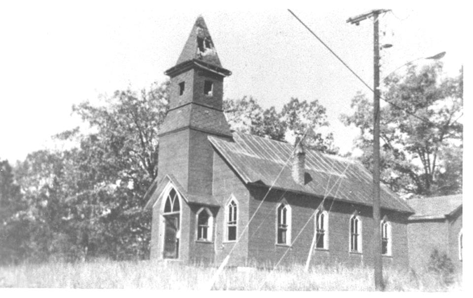
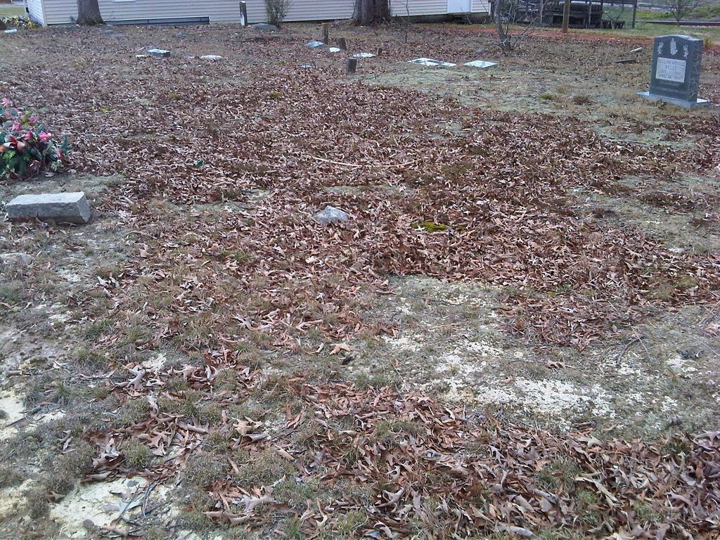
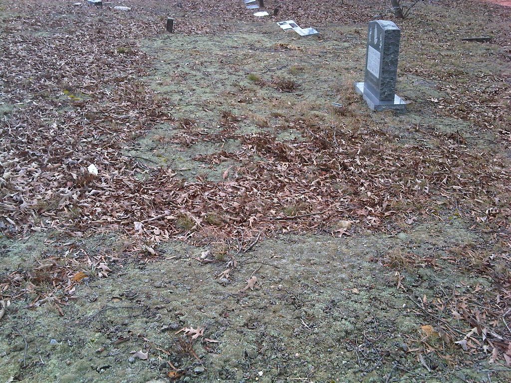
| Description | : | The church associated with this cemetery was sold and demolished sometime about the late 1970s or erly 1980s. The cemetery still exists but in poor condition with unmarked graves and some broken stones. This is a good project for some locals for clean up and maybe even repair of the broken stones. The cemetery is located off Peachtree St near the intersection with W Salisbury Street in Asheboro and behind the Peachtree Market. |
frequently asked questions (FAQ):
-
Where is Allen's Temple AME Church Cemetery?
Allen's Temple AME Church Cemetery is located at Near corner of W Salisbury St and Peachtree St Asheboro, Randolph County ,North Carolina ,USA.
-
Allen's Temple AME Church Cemetery cemetery's updated grave count on graveviews.com?
0 memorials
-
Where are the coordinates of the Allen's Temple AME Church Cemetery?
Latitude: 35.7099910
Longitude: -79.8238500
Nearby Cemetories:
1. Asheboro City Cemetery
Asheboro, Randolph County, USA
Coordinate: 35.7090000, -79.8153330
2. Episcopal Church of Good Shepherd Memorial Garden
Asheboro, Randolph County, USA
Coordinate: 35.7152410, -79.8327260
3. First Presbyterian Church Columbarium
Asheboro, Randolph County, USA
Coordinate: 35.6912790, -79.8196490
4. Oaklawn Cemetery
Asheboro, Randolph County, USA
Coordinate: 35.6885986, -79.8246994
5. Oddfellow-McAlister Cemetery
Asheboro, Randolph County, USA
Coordinate: 35.7090670, -79.7942090
6. Mount Calvary Cemetery
Asheboro, Randolph County, USA
Coordinate: 35.7095920, -79.7940450
7. West Bend United Methodist Church Cemetery
Asheboro, Randolph County, USA
Coordinate: 35.6872610, -79.8345780
8. Rock Hill Primitive Baptist Cemetery
Asheboro, Randolph County, USA
Coordinate: 35.6920480, -79.8466140
9. West Chapel United Methodist Church Cemetery
Asheboro, Randolph County, USA
Coordinate: 35.6981560, -79.8602220
10. Baileys Grove Baptist Church Cemetery
Asheboro, Randolph County, USA
Coordinate: 35.7404060, -79.8075610
11. Charlotte United Methodist Church Cemetery
Asheboro, Randolph County, USA
Coordinate: 35.7317772, -79.8685226
12. Neighbors Grove Wesleyan Church Cemetery
Asheboro, Randolph County, USA
Coordinate: 35.7509200, -79.8045030
13. God Outreach Ministries Cemetery
Asheboro, Randolph County, USA
Coordinate: 35.7473240, -79.7890130
14. Browers Chapel UMC Cemetery
Asheboro, Randolph County, USA
Coordinate: 35.6747290, -79.7854000
15. Giles Chapel United Methodist Church Cemetery
Asheboro, Randolph County, USA
Coordinate: 35.7462270, -79.7752450
16. Smyrna Grove Community Church Cemetery
Asheboro, Randolph County, USA
Coordinate: 35.7364540, -79.8826770
17. Back Creek Friends Meeting Cemetery
Asheboro, Randolph County, USA
Coordinate: 35.7065063, -79.8921153
18. New Union United Methodist Church Cemetery
Asheboro, Randolph County, USA
Coordinate: 35.6736920, -79.8880540
19. Randolph Memorial Park
Asheboro, Randolph County, USA
Coordinate: 35.7793999, -79.8071976
20. Sawyersville Wesleyan Church Cemetery
Asheboro, Randolph County, USA
Coordinate: 35.7155790, -79.9107290
21. Liberty Road Baptist Church Cemetery
Randleman, Randolph County, USA
Coordinate: 35.7715500, -79.7808130
22. John Wesley Stand Cemetery
Sophia, Randolph County, USA
Coordinate: 35.7726220, -79.8670520
23. Davis Chapel Methodist Protestant Church Cemetery
Asheboro, Randolph County, USA
Coordinate: 35.7836070, -79.8268640
24. Mount Tabor Community Church Cemetery
Asheboro, Randolph County, USA
Coordinate: 35.6892900, -79.7318400


