
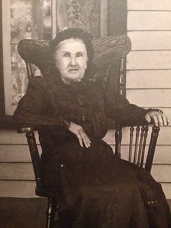

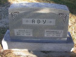
Catharina Barrick Berrier
| Birth | : | 28 Oct 1826 |
| Death | : | 18 Dec 1906 Clay County, Kansas, USA |
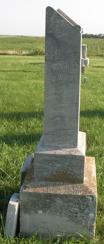
| Burial | : | Ebenezer Cemetery, Green, Clay County, USA |
| Coordinate | : | 39.3866997, -96.9974976 |
| Description | : | Mrs Catherine Berrier died Tuesday, December 18th at 7 o'clock A.M. at the home of her son Fred Berrier five miles east of Clay Center. Her death was due to a general decline, had been down sick for a month. Funeral occurred Wednesday afternoon at 3 o'clock from the U.B. church in Highland township. Rev. Pontius of Green officiating. The remains were laid to rest in the German cemetery. The deceased was about eighty years old. March 1844 she was married to William Berrier, Nine children survive her. They are George of Blue Rapids, Frank of Broughton, Mrs. Belle Hill... Read More |
frequently asked questions (FAQ):
-
Where is Catharina Barrick Berrier's memorial?
Catharina Barrick Berrier's memorial is located at: Ebenezer Cemetery, Green, Clay County, USA.
-
When did Catharina Barrick Berrier death?
Catharina Barrick Berrier death on 18 Dec 1906 in Clay County, Kansas, USA
-
Where are the coordinates of the Catharina Barrick Berrier's memorial?
Latitude: 39.3866997
Longitude: -96.9974976
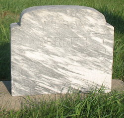
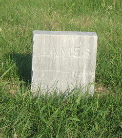
Family Members:
Spouse
Children

Flowers:


Nearby Cemetories:
1. Ebenezer Cemetery
Green, Clay County, USA
Coordinate: 39.3866997, -96.9974976
2. Green Cemetery
Green, Clay County, USA
Coordinate: 39.4235992, -96.9882965
3. Lasita Cemetery
Leonardville, Riley County, USA
Coordinate: 39.4092900, -96.9422900
4. Clay County Poor Farm Cemetery
Clay Center, Clay County, USA
Coordinate: 39.3772700, -97.0727000
5. Pleasant Hill Cemetery
Leonardville, Riley County, USA
Coordinate: 39.4371210, -96.9426730
6. Broughton Cemetery
Clay Center, Clay County, USA
Coordinate: 39.3306007, -97.0535965
7. Fancy Creek Cemetery
Green, Clay County, USA
Coordinate: 39.4668999, -96.9969025
8. Hayes Cemetery
Clay County, USA
Coordinate: 39.4516983, -97.0811005
9. Bala Cemetery
Bala, Riley County, USA
Coordinate: 39.3053017, -96.9341965
10. Saint Peter and Saint Pauls Catholic Cemetery
Clay Center, Clay County, USA
Coordinate: 39.4005450, -97.1236680
11. Brethren in Christ Cemetery
Clay County, USA
Coordinate: 39.4810982, -97.0344009
12. Greenwood Cemetery
Clay Center, Clay County, USA
Coordinate: 39.4011002, -97.1275024
13. Leonardville Cemetery
Leonardville, Riley County, USA
Coordinate: 39.3792000, -96.8589020
14. Gilbert Cemetery
Clay County, USA
Coordinate: 39.2853012, -97.0625000
15. Milo Chapman Gravesite
Broughton, Clay County, USA
Coordinate: 39.2888500, -97.0724400
16. Gatesville Cemetery
Wakefield, Clay County, USA
Coordinate: 39.2721460, -97.0041380
17. Leonardville United Methodist Cemetery
Leonardville, Riley County, USA
Coordinate: 39.3568700, -96.8493600
18. May Day Cemetery
Center Township, Riley County, USA
Coordinate: 39.4958000, -96.9302979
19. Goshen Central Cemetery
Clay Center, Clay County, USA
Coordinate: 39.5099983, -97.0160980
20. Joseph Sender Family Cemetery
Clay County, USA
Coordinate: 39.5090600, -97.0348800
21. Crooked Creek Cemetery
Randolph, Riley County, USA
Coordinate: 39.4369011, -96.8480988
22. Swedish Pleasant Hill Cemetery
Clay Center, Clay County, USA
Coordinate: 39.4735985, -97.1268997
23. Republican City Cemetery
Clay Center, Clay County, USA
Coordinate: 39.3431015, -97.1628036
24. Idylwilde Cemetery
Clay Center, Clay County, USA
Coordinate: 39.5097900, -97.0713000