
| Birth | : | 27 Apr 1790 Maryland, USA |
| Death | : | 1828 Baltimore County, Maryland, USA |
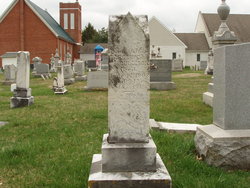
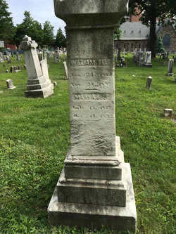
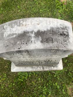
| Burial | : | Dover United Methodist Church Cemetery, Baltimore County, USA |
| Coordinate | : | 39.5221519, -76.7687454 |
| Description | : | Catherine Almack was a daughter of William Almack and she's probably buried with her husband in the Dover Cemetery. |
frequently asked questions (FAQ):
-
Where is Catherine Almack Belt's memorial?
Catherine Almack Belt's memorial is located at: Dover United Methodist Church Cemetery, Baltimore County, USA.
-
When did Catherine Almack Belt death?
Catherine Almack Belt death on 1828 in Baltimore County, Maryland, USA
-
Where are the coordinates of the Catherine Almack Belt's memorial?
Latitude: 39.5221519
Longitude: -76.7687454
Family Members:
Parent
Spouse

Siblings
Children
Flowers:


Nearby Cemetories:
1. Dover United Methodist Church Cemetery
Baltimore County, USA
Coordinate: 39.5221519, -76.7687454
2. Saint Johns Episcopal Church Cemetery
Reisterstown, Baltimore County, USA
Coordinate: 39.5027600, -76.7800500
3. Sagamore Farm Grounds
Glyndon, Baltimore County, USA
Coordinate: 39.4912400, -76.7732000
4. Falls Road United Methodist Church Cemetery
Baltimore County, USA
Coordinate: 39.5443200, -76.7384400
5. Black Rock Cemetery
Butler, Baltimore County, USA
Coordinate: 39.5363400, -76.7288600
6. Pleasant Grove United Methodist Church Cemetery
Reisterstown, Baltimore County, USA
Coordinate: 39.5448000, -76.8049100
7. Piney Grove Cemetery
Reisterstown, Baltimore County, USA
Coordinate: 39.5186200, -76.8212100
8. Geist Meeting House Cemetery
Cockeysville, Baltimore County, USA
Coordinate: 39.5045600, -76.7165800
9. Saint Paul's Evangelical Lutheran Church Cemetery
Shawan, Baltimore County, USA
Coordinate: 39.4716830, -76.7174190
10. Grace Falls Road United Methodist Church Cemetery
Reisterstown, Baltimore County, USA
Coordinate: 39.4771300, -76.7081700
11. O'Grady Chapel Cemetery
Reisterstown, Baltimore County, USA
Coordinate: 39.4993550, -76.8478630
12. Emory United Methodist Church Cemetery
Carroll County, USA
Coordinate: 39.5303100, -76.8574700
13. Price Family Cemetery
Oregon, Baltimore County, USA
Coordinate: 39.4968583, -76.6840278
14. Conrad Uhler Family Cemetery
Reisterstown, Baltimore County, USA
Coordinate: 39.4714170, -76.8326930
15. Saint Lukes Cemetery
Reisterstown, Baltimore County, USA
Coordinate: 39.4626900, -76.8210900
16. Cedar Grove United Methodist Church Cemetery
Parkton, Baltimore County, USA
Coordinate: 39.5830900, -76.7170900
17. All Saints Episcopal Church Cemetery
Reisterstown, Baltimore County, USA
Coordinate: 39.4625100, -76.8233200
18. Bosley United Methodist Church Cemetery
Sparks, Baltimore County, USA
Coordinate: 39.5279400, -76.6734100
19. Baltimore County Graveyard #86
Sparks, Baltimore County, USA
Coordinate: 39.4606500, -76.7146800
20. Reisterstown Community Cemetery
Reisterstown, Baltimore County, USA
Coordinate: 39.4639400, -76.8308000
21. Mount Carmel United Methodist Church Cemetery
Parkton, Baltimore County, USA
Coordinate: 39.5935600, -76.7352200
22. Reisterstown United Methodist Church Cemetery
Reisterstown, Baltimore County, USA
Coordinate: 39.4621110, -76.8296450
23. Gunpowder Friends Meeting House Cemetery
Sparks, Baltimore County, USA
Coordinate: 39.5356300, -76.6710400
24. Garrison Forest Veterans Cemetery
Owings Mills, Baltimore County, USA
Coordinate: 39.4407600, -76.7680800