
| Memorials | : | 8289 |
| Location | : | Owings Mills, Baltimore County, USA |
| Phone | : | 410-363-6090 |
| Website | : | veterans.maryland.gov/cemetery-and-memorial-program/ |
| Coordinate | : | 39.4407600, -76.7680800 |
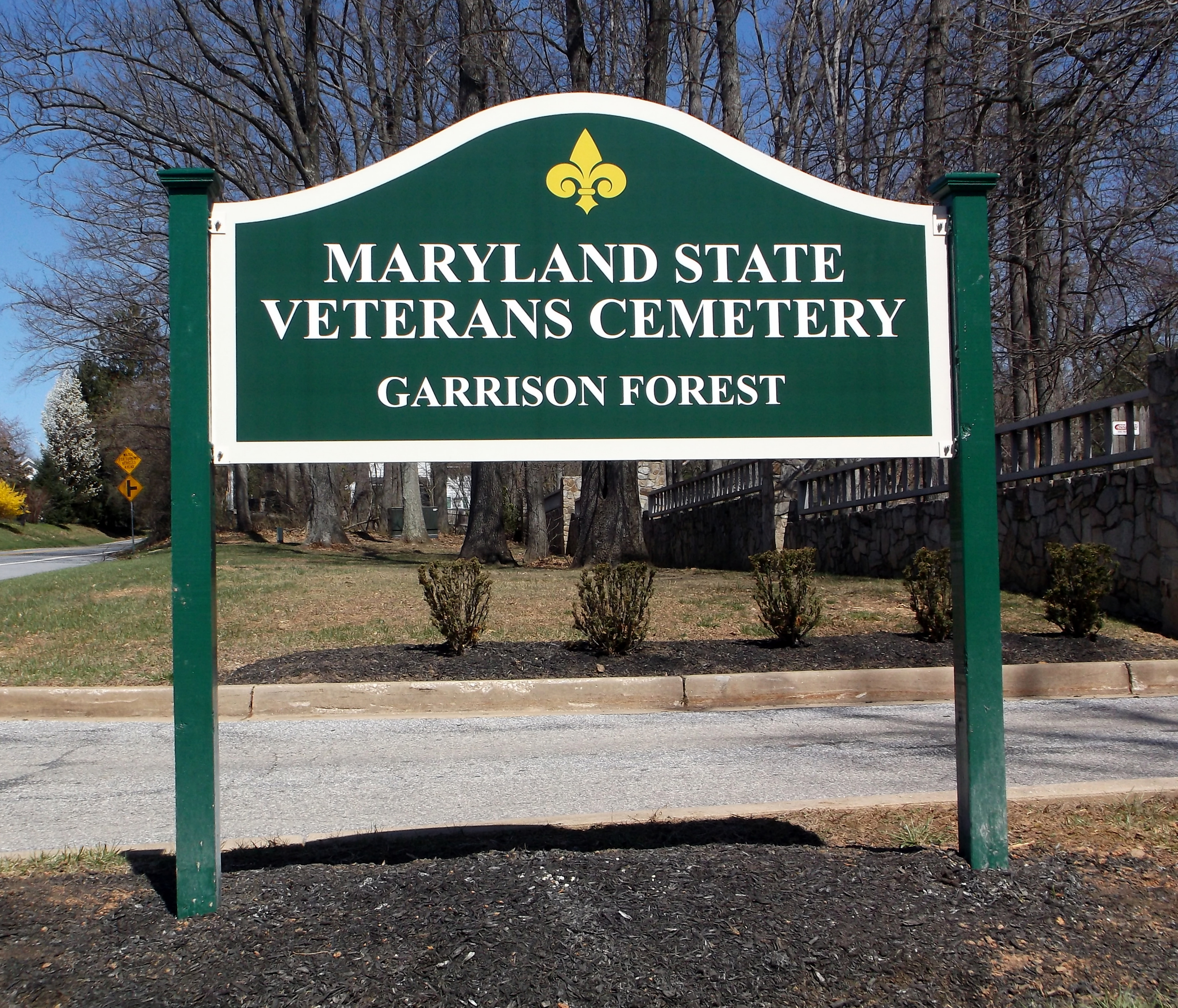
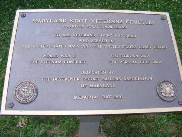
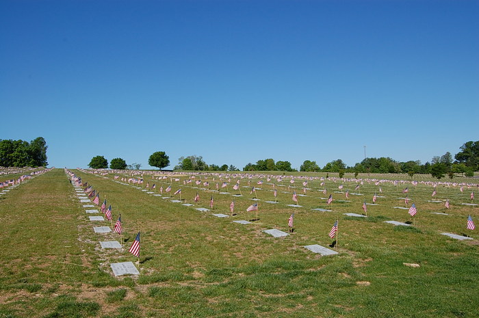
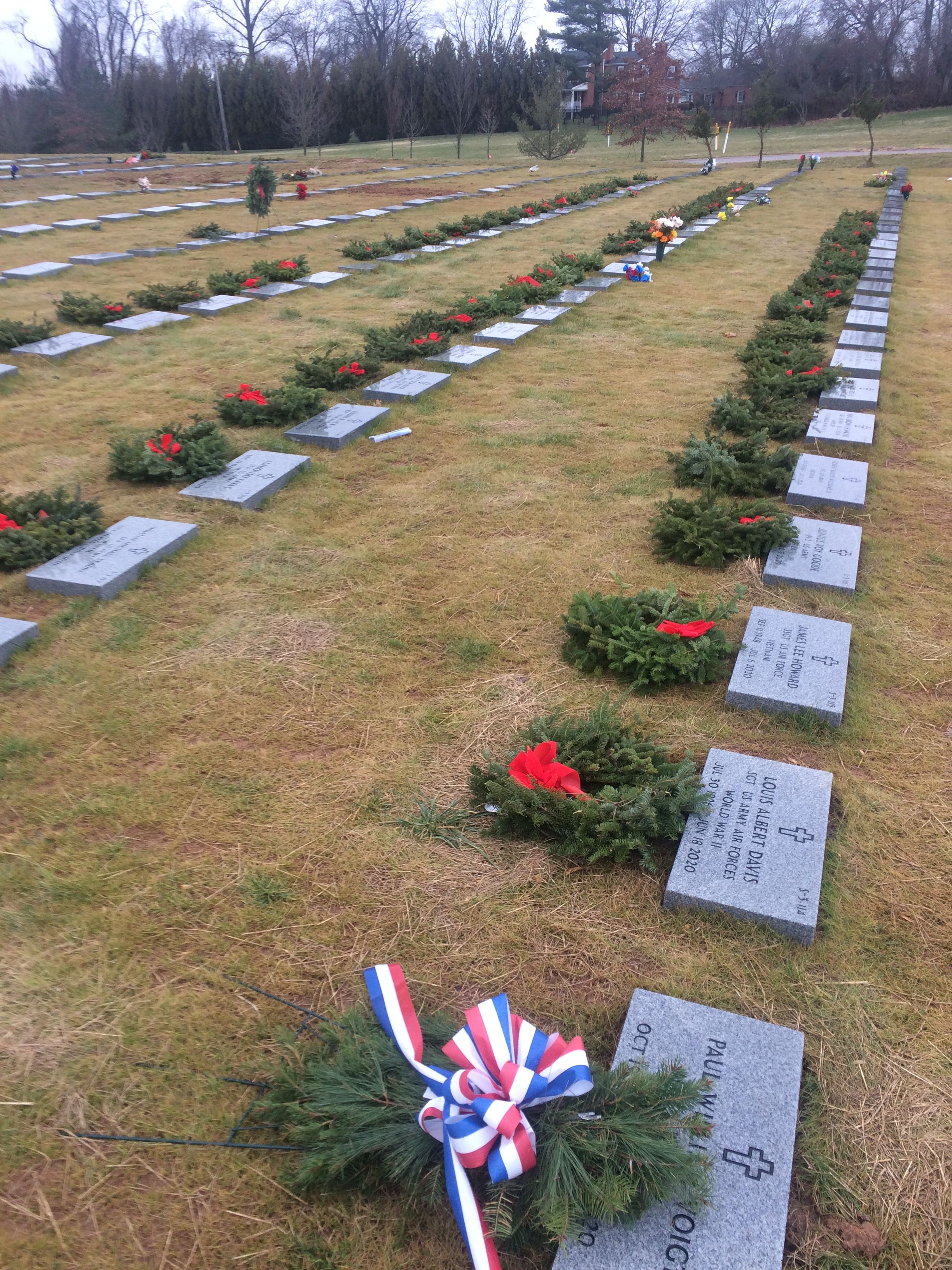
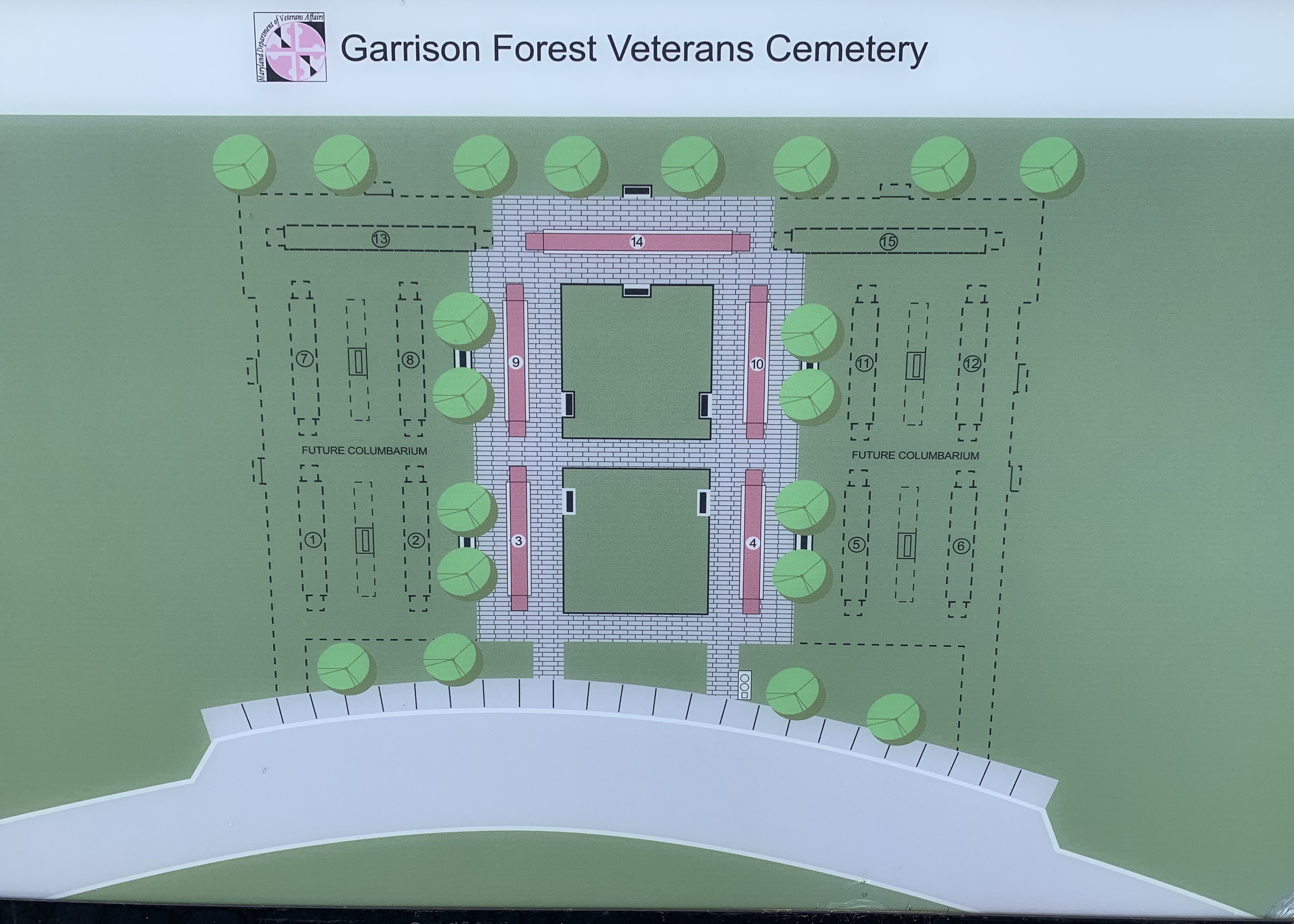
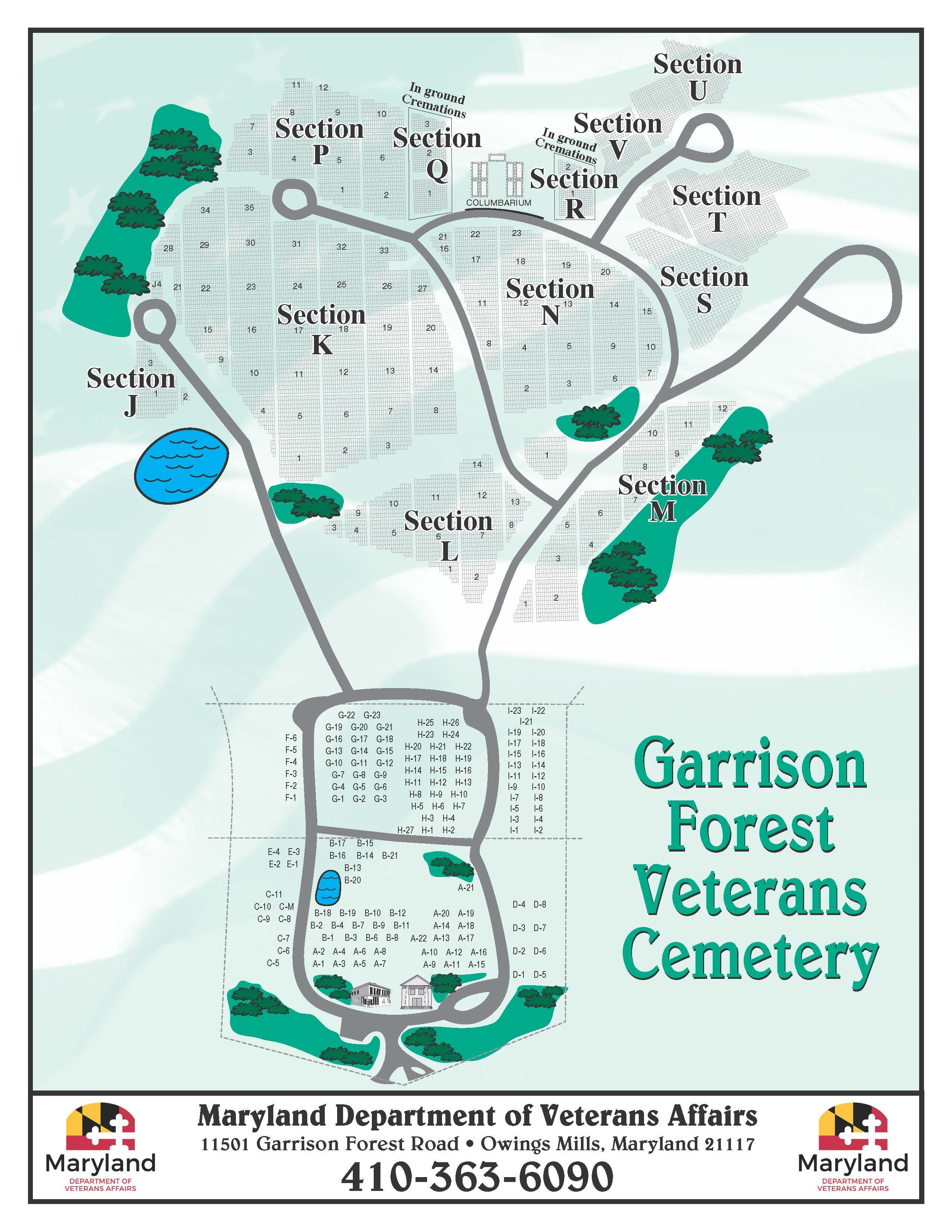
| Description | : | Garrison Forest Veterans Cemetery located in Owings Mills, Baltimore County, Maryland is the most active of Maryland’s 5 Veterans Cemeteries, conducting more than 1,500 burials per year. Since December 1983, when the facility opened, more than 43,000 veterans and their dependents have selected this cemetery as a final resting place. Five phases of cemetery development are expected to provide approximately 46,000 burial sites at this location. The Garrison Forest Veterans Cemetery is located on Garrison Forest Road, near the Rosewood State Hospital, in Owings Mills, Maryland. Formerly used for agricultural purposes, the site consists of 110 acres bounded... Read More |
frequently asked questions (FAQ):
-
Where is Garrison Forest Veterans Cemetery?
Garrison Forest Veterans Cemetery is located at 11501 Garrison Forest Road Owings Mills, Baltimore County ,Maryland , 21117USA.
-
Garrison Forest Veterans Cemetery cemetery's updated grave count on graveviews.com?
8289 memorials
-
Where are the coordinates of the Garrison Forest Veterans Cemetery?
Latitude: 39.4407600
Longitude: -76.7680800
Nearby Cemetories:
1. Garrison Forest Cemetery
Owings Mills, Baltimore County, USA
Coordinate: 39.4363000, -76.7674800
2. Har Sinai Cemetery
Owings Mills, Baltimore County, USA
Coordinate: 39.4353900, -76.7683800
3. Rosewood State Hospital Cemetery
Owings Mills, Baltimore County, USA
Coordinate: 39.4215500, -76.7619000
4. Saint Thomas Episcopal Church Cemetery
Owings Mills, Baltimore County, USA
Coordinate: 39.4215500, -76.7619000
5. Pleasant Hill United Methodist Church Cemetery
Owings Mills, Baltimore County, USA
Coordinate: 39.4294400, -76.7912700
6. Lowe Family Cemetery
Owings Mills, Baltimore County, USA
Coordinate: 39.4292600, -76.8135900
7. Carrolls-Gills United Methodist Church Cemetery
Lutherville, Baltimore County, USA
Coordinate: 39.4465300, -76.7185900
8. Baltimore County Graveyard #86
Sparks, Baltimore County, USA
Coordinate: 39.4606500, -76.7146800
9. Saint Lukes Cemetery
Reisterstown, Baltimore County, USA
Coordinate: 39.4626900, -76.8210900
10. All Saints Episcopal Church Cemetery
Reisterstown, Baltimore County, USA
Coordinate: 39.4625100, -76.8233200
11. Saint Paul's Evangelical Lutheran Church Cemetery
Shawan, Baltimore County, USA
Coordinate: 39.4716830, -76.7174190
12. Sagamore Farm Grounds
Glyndon, Baltimore County, USA
Coordinate: 39.4912400, -76.7732000
13. Baltimore Hebrew Cemetery
Reisterstown, Baltimore County, USA
Coordinate: 39.4507828, -76.8328094
14. Howard Graveyard at Grayrock
Pikesville, Baltimore County, USA
Coordinate: 39.3954560, -76.7367020
15. Stone Chapel United Methodist Church Cemetery
Pikesville, Baltimore County, USA
Coordinate: 39.3934000, -76.7407500
16. Reisterstown United Methodist Church Cemetery
Reisterstown, Baltimore County, USA
Coordinate: 39.4621110, -76.8296450
17. Holy Trinity Monastery Cemetery
Pikesville, Baltimore County, USA
Coordinate: 39.3971991, -76.7277734
18. Reisterstown Community Cemetery
Reisterstown, Baltimore County, USA
Coordinate: 39.4639400, -76.8308000
19. Oheb Shalom Memorial Park
Reisterstown, Baltimore County, USA
Coordinate: 39.4490013, -76.8368073
20. Croxall Family Cemetery
Baltimore County, USA
Coordinate: 39.3968735, -76.7207870
21. Conrad Uhler Family Cemetery
Reisterstown, Baltimore County, USA
Coordinate: 39.4714170, -76.8326930
22. Grace Falls Road United Methodist Church Cemetery
Reisterstown, Baltimore County, USA
Coordinate: 39.4771300, -76.7081700
23. Saint Johns Episcopal Church Cemetery
Reisterstown, Baltimore County, USA
Coordinate: 39.5027600, -76.7800500
24. Saters Baptist Historical Church Cemetery
Timonium, Baltimore County, USA
Coordinate: 39.4362920, -76.6870810