
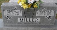
| Birth | : | 12 Aug 1912 Kansas, USA |
| Death | : | 23 Apr 1991 Abilene, Dickinson County, Kansas, USA |
| Burial | : | Saint Michael's Churchyard, Alnwick, Northumberland Unitary Authority, England |
| Coordinate | : | 55.4169400, -1.7111000 |
| Description | : | HOPE — Services for Cecelia M. Gantenbein, 78, Hope, will be at 1:30 p.m. Saturday at the New Basel United Church of Christ with the Rev. Everett Mitchell officiating. Burial will be in the New Basel Church Cemetery. Mrs. Gantenbein died Tuesday at Abilene Memorial Hospital. She was born Aug. 12, 1912, in Dayton, Kan. She attended Dayton schools and was a homemaker. She belonged to the New Basel United Church of Christ and the Dayton Circle. She married Andrew C. Gantenbein on Dec. 31, 1931, in Abilene. He survives of the home. Other survivors include two sons, Kenny, of Hope, and Leon, Lawrence;... Read More |
frequently asked questions (FAQ):
-
Where is Cecelia Mae Miller Gantenbein's memorial?
Cecelia Mae Miller Gantenbein's memorial is located at: Saint Michael's Churchyard, Alnwick, Northumberland Unitary Authority, England.
-
When did Cecelia Mae Miller Gantenbein death?
Cecelia Mae Miller Gantenbein death on 23 Apr 1991 in Abilene, Dickinson County, Kansas, USA
-
Where are the coordinates of the Cecelia Mae Miller Gantenbein's memorial?
Latitude: 55.4169400
Longitude: -1.7111000
Family Members:
Parent

Spouse
Siblings
Flowers:


Nearby Cemetories:
1. Saint Michael's Churchyard
Alnwick, Northumberland Unitary Authority, England
Coordinate: 55.4169400, -1.7111000
2. Alnwick Abbey
Alnwick, Northumberland Unitary Authority, England
Coordinate: 55.4198500, -1.7191400
3. Alnwick Cemetery
Alnwick, Northumberland Unitary Authority, England
Coordinate: 55.4037170, -1.6919940
4. Hulne Priory
Alnwick, Northumberland Unitary Authority, England
Coordinate: 55.4350530, -1.7430160
5. St. Mary The Virgin Churchyard
Lesbury, Northumberland Unitary Authority, England
Coordinate: 55.3986820, -1.6277570
6. St Peter's & St Paul's Churchyard
Longhoughton, Northumberland Unitary Authority, England
Coordinate: 55.4289930, -1.6169950
7. Rock Church of St. Philip and St. James
Alnwick, Northumberland Unitary Authority, England
Coordinate: 55.4755200, -1.6817200
8. St John The Baptist Churchyard
Alnmouth, Northumberland Unitary Authority, England
Coordinate: 55.3882090, -1.6124020
9. Alnmouth Cemetery
Alnmouth, Northumberland Unitary Authority, England
Coordinate: 55.3951400, -1.6064100
10. St Michael and All Angels Churchyard
Alnwick, Northumberland Unitary Authority, England
Coordinate: 55.4506080, -1.6096700
11. Bolton Chapel
Edlingham, Northumberland Unitary Authority, England
Coordinate: 55.4168580, -1.8335818
12. St John the Baptist Churchyard
Edlingham, Northumberland Unitary Authority, England
Coordinate: 55.3758250, -1.8212200
13. Embleton Churchyard
Embleton, Northumberland Unitary Authority, England
Coordinate: 55.4884280, -1.6333460
14. St Maurice Churchyard
Eglingham, Northumberland Unitary Authority, England
Coordinate: 55.4689000, -1.8336000
15. Holy Trinity Churchyard
Embleton, Northumberland Unitary Authority, England
Coordinate: 55.4955790, -1.6360190
16. Grey Family Cemetery
Fallodon, Northumberland Unitary Authority, England
Coordinate: 55.5058580, -1.6760530
17. St Maurice's Churchyard
Ellingham, Northumberland Unitary Authority, England
Coordinate: 55.5245000, -1.7245300
18. Amble West Cemetery
Amble, Northumberland Unitary Authority, England
Coordinate: 55.3311820, -1.5922950
19. St. John the Divine Churchyard
Acklington, Northumberland Unitary Authority, England
Coordinate: 55.3106000, -1.6435000
20. Felton Cemetery
Felton, Northumberland Unitary Authority, England
Coordinate: 55.3020920, -1.7118410
21. Amble East Cemetery
Amble, Northumberland Unitary Authority, England
Coordinate: 55.3333190, -1.5696400
22. Longframlington Cemetery
Longframlington, Northumberland Unitary Authority, England
Coordinate: 55.3085440, -1.8003926
23. St Mary the Virgin Churchyard
Longframlington, Northumberland Unitary Authority, England
Coordinate: 55.3028950, -1.7952920
24. Longframlington Church Cemetery Extension
Longframlington, Northumberland Unitary Authority, England
Coordinate: 55.3014700, -1.7950600