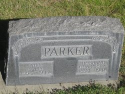
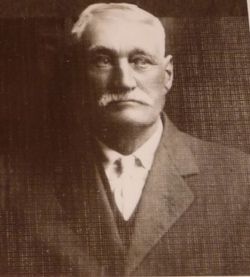
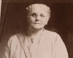
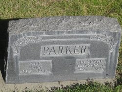
Charles Albert Parker
| Birth | : | 17 Aug 1854 Cass County, Michigan, USA |
| Death | : | 16 Mar 1941 Gordon, Sheridan County, Nebraska, USA |
| Burial | : | Rossville Cemetery, Rossville, Shawnee County, USA |
| Coordinate | : | 39.1437111, -95.9375992 |
frequently asked questions (FAQ):
-
Where is Charles Albert Parker's memorial?
Charles Albert Parker's memorial is located at: Rossville Cemetery, Rossville, Shawnee County, USA.
-
When did Charles Albert Parker death?
Charles Albert Parker death on 16 Mar 1941 in Gordon, Sheridan County, Nebraska, USA
-
Where are the coordinates of the Charles Albert Parker's memorial?
Latitude: 39.1437111
Longitude: -95.9375992
Family Members:
Parent
Spouse
Children
Flowers:
Nearby Cemetories:
1. Rossville Cemetery
Rossville, Shawnee County, USA
Coordinate: 39.1437111, -95.9375992
2. Uniontown Cemetery
Willard, Shawnee County, USA
Coordinate: 39.0847015, -95.9377136
3. Silver Lake Cemetery
Silver Lake, Shawnee County, USA
Coordinate: 39.1189003, -95.8617020
4. Hosack Grave
Wabaunsee County, USA
Coordinate: 39.0798080, -95.9510280
5. Olive Branch Cemetery
Shawnee County, USA
Coordinate: 39.2014008, -95.9794006
6. Eleanore Willmett Burial Site
Maple Hill, Wabaunsee County, USA
Coordinate: 39.1188700, -96.0236200
7. Czech-Moravian Cemetery
Rossville, Shawnee County, USA
Coordinate: 39.2160988, -95.9381027
8. Walnut Hill Cemetery
Silver Lake, Shawnee County, USA
Coordinate: 39.1940498, -95.8500671
9. Valencia Cemetery
Valencia, Shawnee County, USA
Coordinate: 39.0586014, -95.8806000
10. Mount Calvary Cemetery
Saint Marys, Pottawatomie County, USA
Coordinate: 39.2019615, -96.0457001
11. Maple Hill Cemetery
Maple Hill, Wabaunsee County, USA
Coordinate: 39.0795000, -96.0430500
12. Saint Mary's College Assumption Chapel Relic Altar
Saint Marys, Pottawatomie County, USA
Coordinate: 39.1919000, -96.0606400
13. Our Lady of Peace Cemetery
Saint Marys, Pottawatomie County, USA
Coordinate: 39.2024600, -96.0634300
14. Delia Cemetery
Delia, Jackson County, USA
Coordinate: 39.2606010, -95.9599991
15. Valley View Cemetery
Saint Marys, Pottawatomie County, USA
Coordinate: 39.2052994, -96.0721970
16. Rosetta Rice Cemetery
Delia, Jackson County, USA
Coordinate: 39.2640300, -95.9012400
17. West Lawn Memorial Gardens
Topeka, Shawnee County, USA
Coordinate: 39.0518112, -95.8167419
18. Prairie Home Cemetery
Topeka, Shawnee County, USA
Coordinate: 39.1077118, -95.7482910
19. O'Bennick Cemetery
Mayetta, Jackson County, USA
Coordinate: 39.2884780, -95.8703270
20. Holy Cross Cemetery
Emmett, Pottawatomie County, USA
Coordinate: 39.2743988, -96.0466995
21. Security Benefit Association Cemetery
Topeka, Shawnee County, USA
Coordinate: 39.0630989, -95.7606583
22. John Mitchell Cemetery
Delia, Jackson County, USA
Coordinate: 39.3031500, -95.9178900
23. Danceground Cemetery
Mayetta, Jackson County, USA
Coordinate: 39.3102989, -95.8966980
24. Greenwood Cemetery
Kaw Township, Wabaunsee County, USA
Coordinate: 39.1819000, -96.1541977

