
| Memorials | : | 2 |
| Location | : | Topeka, Shawnee County, USA |
| Coordinate | : | 39.0630989, -95.7606583 |
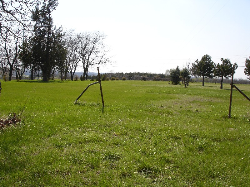
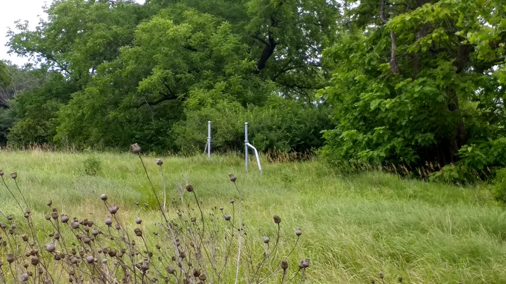
| Description | : | Directions: Exit 356 & I-70. Travel north on Wanamaker Road taking the second available right turn and follow the slight curve. The cemetery is on your left in the open field. If you've driven to the KS Wildlife & Parks Dept. Office the cemetery is directly across the street to the south. The Security Benefit Association Cemetery is a cemetery with no sign or markings of its existence. The graves surround the perimeter of the cemetery with two rows on the west, one row each on the south and north, and no graves on the east... Read More |
frequently asked questions (FAQ):
-
Where is Security Benefit Association Cemetery?
Security Benefit Association Cemetery is located at Topeka, Shawnee County ,Kansas ,USA.
-
Security Benefit Association Cemetery cemetery's updated grave count on graveviews.com?
2 memorials
-
Where are the coordinates of the Security Benefit Association Cemetery?
Latitude: 39.0630989
Longitude: -95.7606583
Nearby Cemetories:
1. Mount Calvary Cemetery
Topeka, Shawnee County, USA
Coordinate: 39.0532990, -95.7360992
2. Memorial Park Cemetery
Topeka, Shawnee County, USA
Coordinate: 39.0619011, -95.7221985
3. Mount Hope Cemetery
Topeka, Shawnee County, USA
Coordinate: 39.0367393, -95.7386703
4. Saint Davids Episcopal Church Columbarium
Topeka, Shawnee County, USA
Coordinate: 39.0369860, -95.7259480
5. Topeka State Hospital Cemetery
Topeka, Shawnee County, USA
Coordinate: 39.0671005, -95.7080994
6. West Lawn Memorial Gardens
Topeka, Shawnee County, USA
Coordinate: 39.0518112, -95.8167419
7. Prairie Home Cemetery
Topeka, Shawnee County, USA
Coordinate: 39.1077118, -95.7482910
8. Westminster Presbyterian Church Memorial Garden
Topeka, Shawnee County, USA
Coordinate: 39.0430400, -95.7021700
9. Mission Center Cemetery
Topeka, Shawnee County, USA
Coordinate: 39.0145493, -95.7819290
10. Abram Burnett Burial Site
Topeka, Shawnee County, USA
Coordinate: 39.0102997, -95.7685776
11. Carnegie Hall
Topeka, Shawnee County, USA
Coordinate: 39.0350600, -95.6999100
12. Ritchie Cemetery
Topeka, Shawnee County, USA
Coordinate: 39.0228010, -95.7027530
13. Grace Episcopal Cathedral Columbarium
Topeka, Shawnee County, USA
Coordinate: 39.0511284, -95.6843719
14. Grace Episcopal Cathedral Sanctuary
Topeka, Shawnee County, USA
Coordinate: 39.0506925, -95.6839273
15. Bennie Lee Graham Memorial Cemetery
Shawnee County, USA
Coordinate: 39.1020584, -95.6836472
16. Curtis Family Cemetery
North Topeka, Shawnee County, USA
Coordinate: 39.0792870, -95.6702270
17. Rochester Cemetery
Topeka, Shawnee County, USA
Coordinate: 39.1044006, -95.6800003
18. Elevation Cemetery
Shawnee County, USA
Coordinate: 38.9832993, -95.7613983
19. Foster Cemetery
Topeka, Shawnee County, USA
Coordinate: 38.9942017, -95.7061005
20. Topeka Cemetery
Topeka, Shawnee County, USA
Coordinate: 39.0388985, -95.6528015
21. Mount Auburn Cemetery
Topeka, Shawnee County, USA
Coordinate: 39.0393982, -95.6500015
22. Valencia Cemetery
Valencia, Shawnee County, USA
Coordinate: 39.0586014, -95.8806000
23. Silver Lake Cemetery
Silver Lake, Shawnee County, USA
Coordinate: 39.1189003, -95.8617020
24. Half-Day Cemetery
Elmont, Shawnee County, USA
Coordinate: 39.1584702, -95.7143402