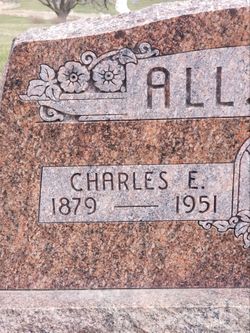
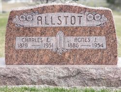
Charles Edward Allstot
| Birth | : | 18 Jan 1879 Bennet, Lancaster County, Nebraska, USA |
| Death | : | 19 Aug 1951 Council Bluffs, Pottawattamie County, Iowa, USA |
| Burial | : | St. John the Baptist Churchyard, Coltishall, Broadland District, England |
| Coordinate | : | 52.7278530, 1.3626450 |
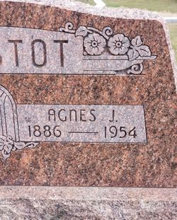
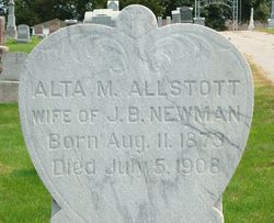
| Description | : | Charles E. Allstot, 72 Charles Edward Allstot, son of William K. and Nancy Allstot was born January 16, 1897 near Bennett, Nebr. and passed away August 19, 1951 at the Gilmore Rest Home in Council Bluffs, Ia. at the age of 72 years, seven months and three days. On July 17, 1949 he suffered a paralytic stroke from which he never fully recovered. At the age of two years he moved with his parents to Defiance, Iowa where he lived the remainder of his life. On October 27, 1906 he was united in marriage to Agnes Miller, youngest daughter of Jefferson and Samantha... Read More |
frequently asked questions (FAQ):
-
Where is Charles Edward Allstot's memorial?
Charles Edward Allstot's memorial is located at: St. John the Baptist Churchyard, Coltishall, Broadland District, England.
-
When did Charles Edward Allstot death?
Charles Edward Allstot death on 19 Aug 1951 in Council Bluffs, Pottawattamie County, Iowa, USA
-
Where are the coordinates of the Charles Edward Allstot's memorial?
Latitude: 52.7278530
Longitude: 1.3626450
Family Members:
Parent
Spouse
Siblings
Children
Flowers:
Nearby Cemetories:
1. St. John the Baptist Churchyard
Coltishall, Broadland District, England
Coordinate: 52.7278530, 1.3626450
2. All Saints Churchyard
Horstead, Broadland District, England
Coordinate: 52.7294900, 1.3499140
3. St. Peter's Churchyard
Belaugh, Broadland District, England
Coordinate: 52.7153080, 1.3867600
4. St Swithin Churchyard
Frettenham, Broadland District, England
Coordinate: 52.7177780, 1.3223060
5. Wroxham Parish Council Cemetery
Wroxham, Broadland District, England
Coordinate: 52.7079631, 1.3994432
6. St. Mary the Virgin Churchyard
Wroxham, Broadland District, England
Coordinate: 52.7067470, 1.3984620
7. St John's Churchyard
Hoveton, North Norfolk District, England
Coordinate: 52.7120040, 1.4174270
8. St. Peter Crostwick Church Cemetery
Crostwick, Broadland District, England
Coordinate: 52.6934480, 1.3395750
9. All Saints Churchyard (Old Church)
Hainford, Broadland District, England
Coordinate: 52.7284190, 1.3004104
10. St. Peter's Churchyard
Hoveton, North Norfolk District, England
Coordinate: 52.7239790, 1.4256250
11. Quaker Burial Ground
Lamas, Broadland District, England
Coordinate: 52.7584960, 1.3235840
12. St. Andrew Churchyard
Lamas, Broadland District, England
Coordinate: 52.7598010, 1.3262770
13. St. Swithin's Churchyard
Ashmanhaugh, North Norfolk District, England
Coordinate: 52.7384470, 1.4271260
14. St Andrew Churchyard
Buxton, Broadland District, England
Coordinate: 52.7557360, 1.3083760
15. All Saints Churchyard
Rackheath, Broadland District, England
Coordinate: 52.6846160, 1.3573490
16. Saint Peter's Churchyard
Spixworth, Broadland District, England
Coordinate: 52.6933240, 1.3145170
17. St. Margaret's Churchyard
Stratton Strawless, Broadland District, England
Coordinate: 52.7387400, 1.2899900
18. All Saints Churchyard
Salhouse, Broadland District, England
Coordinate: 52.6833600, 1.4063280
19. St. Michael & All Angels Churchyard
Oxnead, Broadland District, England
Coordinate: 52.7680820, 1.3042030
20. Saint Lawrence Churchyard
Beeston St Lawrence, North Norfolk District, England
Coordinate: 52.7451100, 1.4474500
21. St Faith Crematorium
Horsham St Faith, Broadland District, England
Coordinate: 52.6967970, 1.2817680
22. Salhouse Baptist Church
Salhouse, Broadland District, England
Coordinate: 52.6807500, 1.4223800
23. Garendon Abbey
Shepshed, Charnwood Borough, England
Coordinate: 52.7711000, 1.2951000
24. Neatishead Baptist Churchyard
Neatishead, North Norfolk District, England
Coordinate: 52.7240100, 1.4633560

