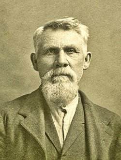
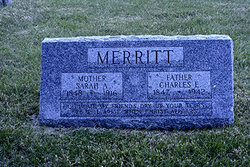
Charles Edward Merritt
| Birth | : | 23 Apr 1847 Olin, Jones County, Iowa, USA |
| Death | : | 20 Apr 1942 Ponca, Dixon County, Nebraska, USA |
| Burial | : | St James Old Burial Ground, Bath, Bath and North East Somerset Unitary Authority, England |
| Coordinate | : | 51.3798600, -2.3610100 |
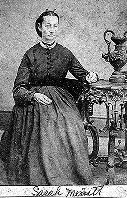
| Description | : | Charles Edward Merritt was born in Jones county, Iowa, on April 23, 1847, the fourth son of Joseph H. Merritt and first child of Joseph's "second family" by mother Mary Thorpe nee Jones. At age five, Charles Edward Merritt moved with his parents and brothers and sisters from Jones county to Jackson County. There he grew to adulthood. There Charles met Sarah Ann Irwin, born in August of 1848, whom he married in Jackson county on New Year's Day, January 1, 1868. (From the Jackson County History by James Whitcomb Ellis: Chas. E. Merritt to Sarah A. Irwin, January 1,... Read More |
frequently asked questions (FAQ):
-
Where is Charles Edward Merritt's memorial?
Charles Edward Merritt's memorial is located at: St James Old Burial Ground, Bath, Bath and North East Somerset Unitary Authority, England.
-
When did Charles Edward Merritt death?
Charles Edward Merritt death on 20 Apr 1942 in Ponca, Dixon County, Nebraska, USA
-
Where are the coordinates of the Charles Edward Merritt's memorial?
Latitude: 51.3798600
Longitude: -2.3610100
Family Members:
Spouse
Siblings
Children
Flowers:
Nearby Cemetories:
1. St. Mary de Stall Churchyard (Defunct)
Bath, Bath and North East Somerset Unitary Authority, England
Coordinate: 51.3813350, -2.3600353
2. Old Orchard Street Catholic Burial Vault
Bath, Bath and North East Somerset Unitary Authority, England
Coordinate: 51.3800370, -2.3579910
3. Bath Abbey
Bath, Bath and North East Somerset Unitary Authority, England
Coordinate: 51.3815310, -2.3586640
4. Quaker Meeting House
Bath, Bath and North East Somerset Unitary Authority, England
Coordinate: 51.3823280, -2.3604380
5. Bath General Hospital Burial Ground
Bath and North East Somerset Unitary Authority, England
Coordinate: 51.3824715, -2.3614742
6. Saint Mark's Churchyard
Widcombe, Bath and North East Somerset Unitary Authority, England
Coordinate: 51.3766660, -2.3588010
7. Ss Michael & Paul Churchyard
Bath, Bath and North East Somerset Unitary Authority, England
Coordinate: 51.3834970, -2.3596980
8. St Mary's Chapel, Queens Square
Bath, Bath and North East Somerset Unitary Authority, England
Coordinate: 51.3827790, -2.3649790
9. St. Michael's Burial Ground
Bath, Bath and North East Somerset Unitary Authority, England
Coordinate: 51.3838810, -2.3594090
10. St Mary Magdalen Chapel
Widcombe, Bath and North East Somerset Unitary Authority, England
Coordinate: 51.3760486, -2.3643405
11. Baptist Burial Ground
Widcombe, Bath and North East Somerset Unitary Authority, England
Coordinate: 51.3764216, -2.3556947
12. Old Baptist Burial Ground
Walcot, Bath and North East Somerset Unitary Authority, England
Coordinate: 51.3755070, -2.3544360
13. Abbey & St James' Graveyard for the Poor
Widcombe, Bath and North East Somerset Unitary Authority, England
Coordinate: 51.3753550, -2.3545640
14. St. James' Cemetery
Bath, Bath and North East Somerset Unitary Authority, England
Coordinate: 51.3802000, -2.3722200
15. St. Swithin Churchyard
Bath, Bath and North East Somerset Unitary Authority, England
Coordinate: 51.3885480, -2.3594500
16. St. Mary's Churchyard
Bathwick, Bath and North East Somerset Unitary Authority, England
Coordinate: 51.3876120, -2.3543540
17. Quaker Burial Ground
Widcombe, Bath and North East Somerset Unitary Authority, England
Coordinate: 51.3744350, -2.3498460
18. St. John the Baptist Churchyard
Bathwick, Bath and North East Somerset Unitary Authority, England
Coordinate: 51.3886890, -2.3547030
19. Walcot Methodist Chapel Burial Ground
Bath, Bath and North East Somerset Unitary Authority, England
Coordinate: 51.3897080, -2.3579610
20. Unitarian Chapel Burial Ground
Widcombe, Bath and North East Somerset Unitary Authority, England
Coordinate: 51.3704650, -2.3539270
21. St Thomas à Becket's Church
Widcombe, Bath and North East Somerset Unitary Authority, England
Coordinate: 51.3734250, -2.3465560
22. Bath Abbey Cemetery
Widcombe, Bath and North East Somerset Unitary Authority, England
Coordinate: 51.3712850, -2.3483060
23. Smallcombe Vale Cemetery
Bathwick, Bath and North East Somerset Unitary Authority, England
Coordinate: 51.3757400, -2.3429400
24. St John the Evangelist Cemetery
Bath, Bath and North East Somerset Unitary Authority, England
Coordinate: 51.3696700, -2.3487400

