
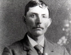


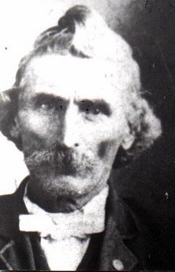
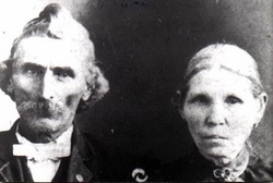
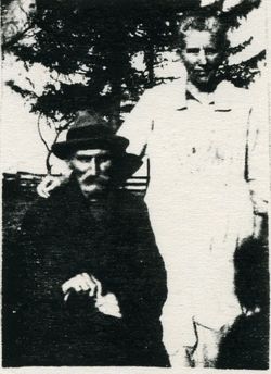
Charles Levi Bean
| Birth | : | 29 Jun 1866 Bradford, Chickasaw County, Iowa, USA |
| Death | : | 17 Dec 1947 Bradford, Chickasaw County, Iowa, USA |
| Burial | : | Fort Pitt Military Cemetery, Rochester, Medway Unitary Authority, England |
| Coordinate | : | 51.3769790, 0.5114570 |
| Plot | : | Section 19 |
| Description | : | Charles Levi Bean was the son of Richard Rufus and Mary Ellen Ripley Bean. [Waterloo Daily Courier, Wednesday, December 17, 1947, Waterloo, Iowa] NASHUA - Levi Bean, 81, died Wednesday at his home here of complications of age. Born June 29, 1866, at Bradford, son of R. R. and Mary Ellen Bean. He leaves his wife, 10 children: Mrs. William Weinberg and Francis B., 114 East 11th and Mrs. E. E. Howard, 1218 Sycamore, all of Waterloo; Mrs. William Schmidt, Amos and Clara, all of Nashua; Mrs. Harold Baldwin, Ionia; Mrs. Wesley Wilkerson, Mason City; Mrs. Rollin Allsup, Des Moines; Mrs. Walter Onken,... Read More |
frequently asked questions (FAQ):
-
Where is Charles Levi Bean's memorial?
Charles Levi Bean's memorial is located at: Fort Pitt Military Cemetery, Rochester, Medway Unitary Authority, England.
-
When did Charles Levi Bean death?
Charles Levi Bean death on 17 Dec 1947 in Bradford, Chickasaw County, Iowa, USA
-
Where are the coordinates of the Charles Levi Bean's memorial?
Latitude: 51.3769790
Longitude: 0.5114570
Family Members:
Parent
Spouse
Siblings

Children

Flowers:


Nearby Cemetories:
1. St. Nicholas's Cemetery
Rochester, Medway Unitary Authority, England
Coordinate: 51.3780081, 0.5021076
2. St. Margaret's Cemetery
Rochester, Medway Unitary Authority, England
Coordinate: 51.3777000, 0.5011600
3. Chatham Unitarian Church
Chatham, Medway Unitary Authority, England
Coordinate: 51.3826090, 0.5195850
4. Chatham Maidstone Road Cemetery
Chatham, Medway Unitary Authority, England
Coordinate: 51.3703300, 0.5227600
5. Rochester Baptist Church
Rochester, Medway Unitary Authority, England
Coordinate: 51.3871570, 0.5052370
6. St Margaret Churchyard
Rochester, Medway Unitary Authority, England
Coordinate: 51.3849380, 0.4993630
7. Chatham Burial Ground
Chatham, Medway Unitary Authority, England
Coordinate: 51.3849900, 0.5272600
8. Rochester Cathedral
Rochester, Medway Unitary Authority, England
Coordinate: 51.3889750, 0.5031160
9. Chatham Palmerston Road Cemetery
Chatham, Medway Unitary Authority, England
Coordinate: 51.3678600, 0.5267300
10. St Mary Churchyard
Chatham, Medway Unitary Authority, England
Coordinate: 51.3874550, 0.5244280
11. St Nicholas Churchyard
Rochester, Medway Unitary Authority, England
Coordinate: 51.3894170, 0.5035320
12. Rochester Castle Moat Burial Ground
Rochester, Medway Unitary Authority, England
Coordinate: 51.3894140, 0.5024580
13. Chatham Naval Memorial
Chatham, Medway Unitary Authority, England
Coordinate: 51.3836479, 0.5321670
14. St Matthew Churchyard
Borstal, Medway Unitary Authority, England
Coordinate: 51.3736150, 0.4868020
15. Brompton War Memorial
Chatham, Medway Unitary Authority, England
Coordinate: 51.3932140, 0.5293660
16. Strood Cemetery
Strood, Medway Unitary Authority, England
Coordinate: 51.3900220, 0.4838640
17. St Nicholas with St Mary Churchyard
Strood, Medway Unitary Authority, England
Coordinate: 51.3959790, 0.4931350
18. Christ Church Cemetery
Chatham, Medway Unitary Authority, England
Coordinate: 51.3716730, 0.5462690
19. St. Augustine's Church
Gillingham, Medway Unitary Authority, England
Coordinate: 51.3745050, 0.5474930
20. All Saints Churchyard
Frindsbury, Medway Unitary Authority, England
Coordinate: 51.4004440, 0.5058970
21. St. Barnabas Church
Gillingham, Medway Unitary Authority, England
Coordinate: 51.3801400, 0.5505370
22. St George Churchyard
Chatham, Medway Unitary Authority, England
Coordinate: 51.3974070, 0.5346770
23. St Mary Magdalene Churchyard
Gillingham, Medway Unitary Authority, England
Coordinate: 51.3903530, 0.5622230
24. St Philip and St James Churchyard
Upnor, Medway Unitary Authority, England
Coordinate: 51.4106250, 0.5250480