| Birth | : | 3 Dec 1911 Ottumwa, Wapello County, Iowa, USA |
| Death | : | 10 Dec 1983 Ottumwa, Wapello County, Iowa, USA |
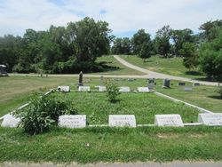
| Burial | : | Garfield Cemetery, Garfield, Pawnee County, USA |
| Coordinate | : | 38.0738983, -99.2667007 |
| Description | : | Ottumwa Courier Dec. 10, 1983 Son of Anthony and Catherine Hannon Canny. |
frequently asked questions (FAQ):
-
Where is Charles Phillip “Charlie” Canny's memorial?
Charles Phillip “Charlie” Canny's memorial is located at: Garfield Cemetery, Garfield, Pawnee County, USA.
-
When did Charles Phillip “Charlie” Canny death?
Charles Phillip “Charlie” Canny death on 10 Dec 1983 in Ottumwa, Wapello County, Iowa, USA
-
Where are the coordinates of the Charles Phillip “Charlie” Canny's memorial?
Latitude: 38.0738983
Longitude: -99.2667007
Family Members:
Parent
Spouse
Siblings
Children
Flowers:
Nearby Cemetories:
1. Garfield Cemetery
Garfield, Pawnee County, USA
Coordinate: 38.0738983, -99.2667007
2. Fitch Family Cemetery
Nettleton, Edwards County, USA
Coordinate: 38.0007540, -99.3256550
3. Fort Larned Cemetery
Larned, Pawnee County, USA
Coordinate: 38.1839100, -99.2163200
4. Peace Lutheran Cemetery
Kinsley, Edwards County, USA
Coordinate: 38.0285988, -99.4047012
5. Wayne Cemetery
Lewis, Edwards County, USA
Coordinate: 37.9550018, -99.2144012
6. Larned State Hospital Cemetery
Larned, Pawnee County, USA
Coordinate: 38.1722800, -99.1566200
7. Pleasant Valley Cemetery
Larned, Pawnee County, USA
Coordinate: 38.0718994, -99.0955963
8. Salem Cemetery
Edwards County, USA
Coordinate: 38.0331001, -99.4421997
9. Larned Cemetery
Larned, Pawnee County, USA
Coordinate: 38.1861000, -99.1333008
10. Saint Peter and Saint Paul Cemetery
Kinsley, Edwards County, USA
Coordinate: 38.0015400, -99.4587400
11. Rozel Cemetery
Rozel, Pawnee County, USA
Coordinate: 38.2042007, -99.4052963
12. Belpre Cemetery
Belpre, Edwards County, USA
Coordinate: 37.9528950, -99.1017510
13. Selig Cemetery
Pawnee County, USA
Coordinate: 38.1385160, -99.4969800
14. Old Kinsley Cemetery
Kinsley, Edwards County, USA
Coordinate: 37.9272003, -99.4310989
15. Hillside Cemetery
Kinsley, Edwards County, USA
Coordinate: 37.9375000, -99.4486008
16. Saint Nicholas Cemetery
Kinsley, Edwards County, USA
Coordinate: 37.9152985, -99.4235992
17. Ash Valley Cemetery
Pawnee County, USA
Coordinate: 38.2905998, -99.2174988
18. Browns Grove Cemetery
Burdett, Pawnee County, USA
Coordinate: 38.1741982, -99.5325012
19. Trotter Cemetery
Lewis, Edwards County, USA
Coordinate: 37.8394012, -99.2780991
20. Fertig Cemetery
Pawnee County, USA
Coordinate: 38.1458015, -98.9492035
21. Farmington Cemetery
Macksville, Stafford County, USA
Coordinate: 37.9574510, -98.9608270
22. Township Cemetery
Macksville, Stafford County, USA
Coordinate: 37.9569016, -98.9582977
23. Wire Family Cemetery
Kinsley, Edwards County, USA
Coordinate: 37.8430200, -99.4510100
24. Fellsburg Cemetery
Edwards County, USA
Coordinate: 37.8069000, -99.1688995

