
| Birth | : | 9 Jan 1904 Foster, Pierce County, Nebraska, USA |
| Death | : | 22 Nov 1984 Omaha, Douglas County, Nebraska, USA |
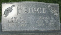
| Burial | : | Park Cemetery, Fairmount, Grant County, USA |
| Coordinate | : | 40.4346008, -85.6447372 |
| Plot | : | Block 6 Lot 32 - (Row 7 South Section Lot 2 Space 4) |
| Description | : | Charles and Lois (Denman) Boschult moved to the Al Roam farm, two miles north of Neligh, Nebraska, in March 1944. Included in the family were Carl, who was then a Junior in High School and Naomi who was a Freshman in High School and Eunice and Paul, who attended rural school. Charles farmed for several years. He also had a cow-calf herd of cattle. He usually fatted the calves. For a few years, he also had a flock of sheep, which proved profitable for the lamb crop as well as the wool produced. In... Read More |
frequently asked questions (FAQ):
-
Where is Charles Reuben Boschult's memorial?
Charles Reuben Boschult's memorial is located at: Park Cemetery, Fairmount, Grant County, USA.
-
When did Charles Reuben Boschult death?
Charles Reuben Boschult death on 22 Nov 1984 in Omaha, Douglas County, Nebraska, USA
-
Where are the coordinates of the Charles Reuben Boschult's memorial?
Latitude: 40.4346008
Longitude: -85.6447372
Family Members:
Parent

Spouse
Siblings
Children
Flowers:


Nearby Cemetories:
1. Park Cemetery
Fairmount, Grant County, USA
Coordinate: 40.4346008, -85.6447372
2. Back Creek Friends Cemetery
Fairmount, Grant County, USA
Coordinate: 40.4450798, -85.6450119
3. Oak Ridge Cemetery
Liberty Township, Grant County, USA
Coordinate: 40.4368477, -85.6928635
4. Bethel Cemetery
Jonesboro, Grant County, USA
Coordinate: 40.4557910, -85.5971240
5. Union Cemetery
Fairmount, Grant County, USA
Coordinate: 40.3923940, -85.6364710
6. Center Cemetery
Fairmount, Grant County, USA
Coordinate: 40.4307404, -85.7007828
7. McCormick Cemetery
Jonesboro, Grant County, USA
Coordinate: 40.4546967, -85.5833054
8. Riverside Cemetery
Gas City, Grant County, USA
Coordinate: 40.4858017, -85.6226807
9. Gas City Cemetery
Gas City, Grant County, USA
Coordinate: 40.4803960, -85.6023840
10. Little Ridge Friends Cemetery
Grant County, USA
Coordinate: 40.4006271, -85.7042847
11. Deer Creek Cemetery
Marion, Grant County, USA
Coordinate: 40.4934769, -85.6685638
12. Walnut Creek Cemetery
Gas City, Grant County, USA
Coordinate: 40.4949570, -85.6062170
13. Weaver Cemetery
Weaver, Grant County, USA
Coordinate: 40.4660034, -85.7267838
14. Mount Hope Cemetery
Gas City, Grant County, USA
Coordinate: 40.5049591, -85.6156311
15. Musick Cemetery
Van Buren Township, Madison County, USA
Coordinate: 40.3581009, -85.6481018
16. Broyles Cemetery
Van Buren Township, Madison County, USA
Coordinate: 40.3732650, -85.5819297
17. Baptist Cemetery
Weaver, Grant County, USA
Coordinate: 40.4761930, -85.7345130
18. Griffin Cemetery
Home Corner, Grant County, USA
Coordinate: 40.5182037, -85.6174011
19. Marion National Cemetery
Marion, Grant County, USA
Coordinate: 40.5237732, -85.6303406
20. Paxton Farm Cemetery
Grant County, USA
Coordinate: 40.5240288, -85.5993729
21. Pet Rest Cemetery
Marion, Grant County, USA
Coordinate: 40.5314636, -85.6350555
22. Mittank Cemetery
Upland, Grant County, USA
Coordinate: 40.4358177, -85.5134506
23. Ballinger Cemetery
Upland, Grant County, USA
Coordinate: 40.4774437, -85.5230713
24. Jefferson Cemetery
Upland, Grant County, USA
Coordinate: 40.4801941, -85.5239792