| Birth | : | 23 Dec 1943 Clay County, Tennessee, USA |
| Death | : | 22 Nov 2010 Celina, Clay County, Tennessee, USA |
| Burial | : | Thompson Webb Cemetery, Celina, Clay County, USA |
| Coordinate | : | 36.6090110, -85.4202270 |
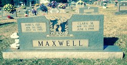
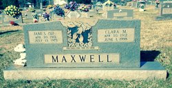
| Description | : | Upton Funeral Home in Celina, Tennessee Jan 3, 2012 Charles William Maxwell passed away Monday, November 22, 2010 at the Cumberland River Hospital in Celina. Charles William Maxwell was born December 23, 1943 in Clay County, Tennessee to the late James amd Clara (Kerr) Maxwell. Charles was the retired from Osh Kosh B'Gosh and was affiliated with the Church of Christ. His family includes wife, Teresa Adams Maxwell of Celina; sons & daughters-in-law, James William &Vickie Maxwell, Wallace & Maurene Maxwell & Charles Dwayne &Janett Maxwell all of Celina; daughters & son-in-law, Vickie Ann McLerran of Hilham & Patricia Lynn (Terry) Spears of Celina; Sister,... Read More |
frequently asked questions (FAQ):
-
Where is Charles William Maxwell's memorial?
Charles William Maxwell's memorial is located at: Thompson Webb Cemetery, Celina, Clay County, USA.
-
When did Charles William Maxwell death?
Charles William Maxwell death on 22 Nov 2010 in Celina, Clay County, Tennessee, USA
-
Where are the coordinates of the Charles William Maxwell's memorial?
Latitude: 36.6090110
Longitude: -85.4202270
Family Members:
Parent
Siblings
Children
Flowers:
Nearby Cemetories:
1. Thompson Webb Cemetery
Celina, Clay County, USA
Coordinate: 36.6090110, -85.4202270
2. Crossroads Cemetery
Clay County, USA
Coordinate: 36.6074982, -85.4210968
3. Rock Springs Cemetery
Celina, Clay County, USA
Coordinate: 36.6096992, -85.4167023
4. Williams Cemetery
Pea Ridge, Clay County, USA
Coordinate: 36.6150017, -85.4169006
5. Ashlock Cemetery
Ashlock, Cumberland County, USA
Coordinate: 36.6208380, -85.4283620
6. Hattie's Houses Cemetery
Pea Ridge, Clay County, USA
Coordinate: 36.6159200, -85.4360040
7. Mullins - Kerr Cemetery
Pea Ridge, Clay County, USA
Coordinate: 36.5951330, -85.4317470
8. Donaldson Cemetery
Pea Ridge, Clay County, USA
Coordinate: 36.5952988, -85.4424973
9. Killman Cemetery
Ashlock, Cumberland County, USA
Coordinate: 36.6325850, -85.4256430
10. Bowe Cemetery
Pea Ridge, Clay County, USA
Coordinate: 36.5833015, -85.4439011
11. Key Cemetery
Pea Ridge, Clay County, USA
Coordinate: 36.5875015, -85.4518967
12. Smith Cemetery
Monroe County, USA
Coordinate: 36.6439881, -85.4203414
13. Grover Rich Cemetery
Pea Ridge, Clay County, USA
Coordinate: 36.5946370, -85.4602970
14. Short's Chapel Cemetery
Monroe County, USA
Coordinate: 36.6281013, -85.4589005
15. Lester and Winnie Spears Cemetery
Burkesville, Cumberland County, USA
Coordinate: 36.6304420, -85.3829600
16. Thompson Cemetery
Clay County, USA
Coordinate: 36.6123700, -85.4666600
17. Ray Williams Cemetery
Pea Ridge, Clay County, USA
Coordinate: 36.5856130, -85.4598120
18. Dulworth Cemetery
Cumberland County, USA
Coordinate: 36.6292100, -85.3757900
19. Riley Cemetery
Littrell, Cumberland County, USA
Coordinate: 36.6509768, -85.3853975
20. Capps-Key Cemetery
Burkesville, Cumberland County, USA
Coordinate: 36.6605280, -85.4129330
21. Peyton Spear Cemetery
Peytonsburg, Cumberland County, USA
Coordinate: 36.6481590, -85.3778400
22. Pruitt Cemetery
Peytonsburg, Cumberland County, USA
Coordinate: 36.6571270, -85.3874590
23. Spears Chapel Cemetery
Peytonsburg, Cumberland County, USA
Coordinate: 36.6495790, -85.3714410
24. Poplar Grove Cemetery
Kettle, Cumberland County, USA
Coordinate: 36.6680090, -85.4074180

