
| Birth | : | 30 Aug 1911 |
| Death | : | 6 Apr 1995 |
| Burial | : | Leeds Cemetery, Leeds, Benson County, USA |
| Coordinate | : | 48.3036003, -99.4368973 |
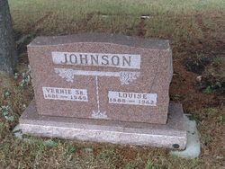
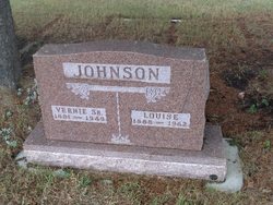
| Description | : | MINOT DAILY NEWS 08 Apr 1995 Chester C. Johnson LEEDS -- Chester C. Johnson, 83, Leeds, died Thursday, April 6, 1995, in a Devils Lake nursing home. He was born Aug. 30, 1911, in Donnybrook, to Vernie and Louise Johnson. He was educated in the Aurelia rural school, northwest of Donnybrook. He then farmed with his parents until November 1941. He married Lucille Feldman Nov. 9, 1941, in Kenmare. They moved to a farm in Leeds Township, Benson County, and farmed until retiring in 1977. He became a resident of the Lake Region Lutheran Home in Devils Lake in 1992. He was a member of the... Read More |
frequently asked questions (FAQ):
-
Where is Chester C. Johnson's memorial?
Chester C. Johnson's memorial is located at: Leeds Cemetery, Leeds, Benson County, USA.
-
When did Chester C. Johnson death?
Chester C. Johnson death on 6 Apr 1995 in
-
Where are the coordinates of the Chester C. Johnson's memorial?
Latitude: 48.3036003
Longitude: -99.4368973
Family Members:
Parent
Spouse

Siblings
Children
Flowers:


Nearby Cemetories:
1. Leeds Cemetery
Leeds, Benson County, USA
Coordinate: 48.3036003, -99.4368973
2. Saint Vincent DePaul Catholic Cemetery
Leeds, Benson County, USA
Coordinate: 48.2966240, -99.4267850
3. Ostreim Cemetery
Towner County, USA
Coordinate: 48.3852997, -99.4049988
4. North Prairie Lutheran Church Cemetery
Towner County, USA
Coordinate: 48.3894610, -99.4284490
5. Wahl Cemetery
Towner County, USA
Coordinate: 48.3891983, -99.4049988
6. Wilmerth Cemetery
Benson County, USA
Coordinate: 48.2155991, -99.4135971
7. York Cemetery
Benson County, USA
Coordinate: 48.3173940, -99.5740700
8. Lebanon Cemetery
Benson County, USA
Coordinate: 48.2243650, -99.3278750
9. Hurricane Lake Cemetery
Wolford, Pierce County, USA
Coordinate: 48.4148400, -99.5389000
10. Pleasant Valley Cemetery
Knox, Benson County, USA
Coordinate: 48.2810211, -99.6305466
11. Saint Johns Catholic Cemetery
Brinsmade, Benson County, USA
Coordinate: 48.1879060, -99.3189280
12. Brinsmade Lutheran Cemetery
Brinsmade, Benson County, USA
Coordinate: 48.1796989, -99.3394012
13. Our Saviour Lutheran Church Cemetery
Harlow, Benson County, USA
Coordinate: 48.1702995, -99.5025024
14. Saint Petri Lutheran Cemetery
York, Benson County, USA
Coordinate: 48.1944430, -99.5891760
15. Antiochia Cemetery
Benson County, USA
Coordinate: 48.2242310, -99.2136320
16. Churchs Ferry Cemetery
Churchs Ferry, Ramsey County, USA
Coordinate: 48.2522011, -99.1883011
17. Saint Marys Cemetery
Knox, Benson County, USA
Coordinate: 48.3347015, -99.6967010
18. Knox Cemetery
Knox, Benson County, USA
Coordinate: 48.3358002, -99.6964035
19. Knox Lutheran Cemetery
Knox, Benson County, USA
Coordinate: 48.3542100, -99.6948500
20. Olson Cemetery
Maza, Towner County, USA
Coordinate: 48.4291992, -99.2097015
21. Zion Cemetery
Cando, Towner County, USA
Coordinate: 48.5014000, -99.3843994
22. Big Coulee Cemetery
Ramsey County, USA
Coordinate: 48.1786170, -99.1794710
23. Presbyterian Cemetery
Ramsey County, USA
Coordinate: 48.2235985, -99.1371994
24. Halling Cemetery
Towner County, USA
Coordinate: 48.5299988, -99.4375000