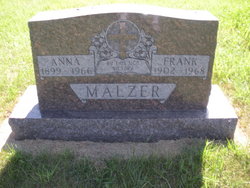
| Birth | : | 1882 |
| Death | : | 1965 South Dakota, USA |
| Burial | : | Saint Boniface Cemetery, Turkey Ridge, Turner County, USA |
| Coordinate | : | 43.2271100, -97.3189800 |
| Description | : | ground reading published in Dakota Territory |
frequently asked questions (FAQ):
-
Where is Christina Goettertz Weier's memorial?
Christina Goettertz Weier's memorial is located at: Saint Boniface Cemetery, Turkey Ridge, Turner County, USA.
-
When did Christina Goettertz Weier death?
Christina Goettertz Weier death on 1965 in South Dakota, USA
-
Where are the coordinates of the Christina Goettertz Weier's memorial?
Latitude: 43.2271100
Longitude: -97.3189800
Family Members:
Parent
Spouse
Siblings
Children
Flowers:
Nearby Cemetories:
1. Saint Boniface Cemetery
Turkey Ridge, Turner County, USA
Coordinate: 43.2271100, -97.3189800
2. Bang Cemetery
Turner County, USA
Coordinate: 43.1997500, -97.3392000
3. Spring Valley Baptist Cemetery
Spring Valley, Turner County, USA
Coordinate: 43.2277000, -97.2694000
4. Carlson Cemetery
Turner County, USA
Coordinate: 43.1843987, -97.3174973
5. Spring Valley Lutheran Cemetery
Spring Valley, Turner County, USA
Coordinate: 43.1985500, -97.2605000
6. Unruh Family Cemetery
Turner County, USA
Coordinate: 43.2801000, -97.3019500
7. Salem Community Cemetery
Turner County, USA
Coordinate: 43.2433500, -97.3995200
8. West Side Cemetery
Turner County, USA
Coordinate: 43.2849998, -97.2891998
9. Zion Cemetery
Hutchinson County, USA
Coordinate: 43.1842003, -97.4030991
10. Ogstad Cemetery
Yankton County, USA
Coordinate: 43.1549988, -97.2794037
11. Elim Cemetery
Yankton County, USA
Coordinate: 43.1511002, -97.3574982
12. Meldal Cemetery
Yankton County, USA
Coordinate: 43.1641998, -97.2394028
13. Zion EUB Cemetery
Molan Township, Hutchinson County, USA
Coordinate: 43.1840200, -97.4204610
14. Zion Oswald Congregational Cemetery
Menno, Hutchinson County, USA
Coordinate: 43.1839240, -97.4204710
15. Salem Mennonite Church Cemetery
Turner County, USA
Coordinate: 43.3141890, -97.3364110
16. Turkey Valley Cemetery
Parker, Turner County, USA
Coordinate: 43.3280600, -97.2505500
17. Zion Cemetery
Hurley, Turner County, USA
Coordinate: 43.2994003, -97.2003021
18. Bethany Cemetery
Hurley, Turner County, USA
Coordinate: 43.3003006, -97.1999969
19. Evergreen Cemetery
Viborg, Turner County, USA
Coordinate: 43.1994019, -97.1607971
20. North Bethlehem Cemetery
Yankton County, USA
Coordinate: 43.1403700, -97.4388700
21. Salem Zion Mennonite Cemetery
Turner County, USA
Coordinate: 43.3507996, -97.3296967
22. Saint Columba Catholic Cemetery
Mayfield, Yankton County, USA
Coordinate: 43.0967000, -97.3192000
23. Knodel Cemetery
Hutchinson County, USA
Coordinate: 43.2574997, -97.4938965
24. Saron Reformed Cemetery
Yankton County, USA
Coordinate: 43.1537500, -97.4686700


