


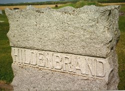
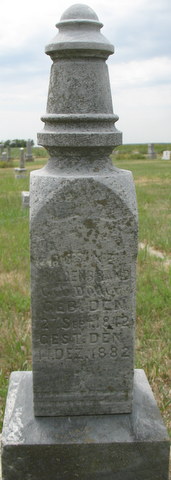
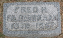
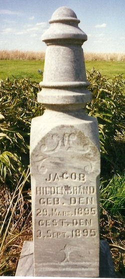
Christof Jakob “Jacob” Hildenbrand
| Birth | : | 29 Aug 1843 Germany |
| Death | : | 10 Apr 1922 Clay Center, Clay County, Kansas, USA |
| Burial | : | Ebenezer Cemetery, Green, Clay County, USA |
| Coordinate | : | 39.3866997, -96.9974976 |
| Description | : | The life of a good man was ended Monday morning at 11:30 o'clock, when Jacob Hildenbrand died very suddenly just as he as coming from the court house, where he had been transacting some business in the register of deeds' office. He had not complained of being ill and had helped with some work around his home in Highland Township before coming to town with Mrs. Hildenbrand, their son Herman and daughter, Louise. They had recently bought the Doyle home at 628 Court Street and were preparing to move to Clay Center this week. As they were coming... Read More |
frequently asked questions (FAQ):
-
Where is Christof Jakob “Jacob” Hildenbrand's memorial?
Christof Jakob “Jacob” Hildenbrand's memorial is located at: Ebenezer Cemetery, Green, Clay County, USA.
-
When did Christof Jakob “Jacob” Hildenbrand death?
Christof Jakob “Jacob” Hildenbrand death on 10 Apr 1922 in Clay Center, Clay County, Kansas, USA
-
Where are the coordinates of the Christof Jakob “Jacob” Hildenbrand's memorial?
Latitude: 39.3866997
Longitude: -96.9974976
Family Members:
Spouse
Children

Flowers:


Nearby Cemetories:
1. Ebenezer Cemetery
Green, Clay County, USA
Coordinate: 39.3866997, -96.9974976
2. Green Cemetery
Green, Clay County, USA
Coordinate: 39.4235992, -96.9882965
3. Lasita Cemetery
Leonardville, Riley County, USA
Coordinate: 39.4092900, -96.9422900
4. Clay County Poor Farm Cemetery
Clay Center, Clay County, USA
Coordinate: 39.3772700, -97.0727000
5. Pleasant Hill Cemetery
Leonardville, Riley County, USA
Coordinate: 39.4371210, -96.9426730
6. Broughton Cemetery
Clay Center, Clay County, USA
Coordinate: 39.3306007, -97.0535965
7. Fancy Creek Cemetery
Green, Clay County, USA
Coordinate: 39.4668999, -96.9969025
8. Hayes Cemetery
Clay County, USA
Coordinate: 39.4516983, -97.0811005
9. Bala Cemetery
Bala, Riley County, USA
Coordinate: 39.3053017, -96.9341965
10. Saint Peter and Saint Pauls Catholic Cemetery
Clay Center, Clay County, USA
Coordinate: 39.4005450, -97.1236680
11. Brethren in Christ Cemetery
Clay County, USA
Coordinate: 39.4810982, -97.0344009
12. Greenwood Cemetery
Clay Center, Clay County, USA
Coordinate: 39.4011002, -97.1275024
13. Leonardville Cemetery
Leonardville, Riley County, USA
Coordinate: 39.3792000, -96.8589020
14. Gilbert Cemetery
Clay County, USA
Coordinate: 39.2853012, -97.0625000
15. Milo Chapman Gravesite
Broughton, Clay County, USA
Coordinate: 39.2888500, -97.0724400
16. Gatesville Cemetery
Wakefield, Clay County, USA
Coordinate: 39.2721460, -97.0041380
17. Leonardville United Methodist Cemetery
Leonardville, Riley County, USA
Coordinate: 39.3568700, -96.8493600
18. May Day Cemetery
Center Township, Riley County, USA
Coordinate: 39.4958000, -96.9302979
19. Goshen Central Cemetery
Clay Center, Clay County, USA
Coordinate: 39.5099983, -97.0160980
20. Joseph Sender Family Cemetery
Clay County, USA
Coordinate: 39.5090600, -97.0348800
21. Crooked Creek Cemetery
Randolph, Riley County, USA
Coordinate: 39.4369011, -96.8480988
22. Swedish Pleasant Hill Cemetery
Clay Center, Clay County, USA
Coordinate: 39.4735985, -97.1268997
23. Republican City Cemetery
Clay Center, Clay County, USA
Coordinate: 39.3431015, -97.1628036
24. Idylwilde Cemetery
Clay Center, Clay County, USA
Coordinate: 39.5097900, -97.0713000