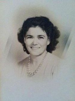
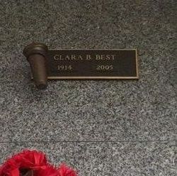
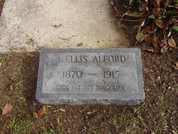
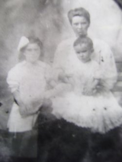
Clara Bell Alford Best
| Birth | : | 1 Nov 1914 Horry County, South Carolina, USA |
| Death | : | 12 Aug 2005 Myrtle Beach, Horry County, South Carolina, USA |
| Burial | : | Saint Lawrence Cemetery, Saint Lawrence, Washington County, USA |
| Coordinate | : | 43.3686300, -88.3320000 |
| Description | : | Obituary: SUN NEWS Myrtle Beach, Horry Co., SC Saturday, 13 August 2005 MYRTLE BEACH [Horry Co.]—Clara Alford Best, age 90, of Berrywood Court died Friday, Aug. 12, 2005 at Grand Strand Regional Medical Center. Born Nov. 1, 1914 in Horry County, S.C., she was the daughter of the late John E. and Ellen Atkinson Alford. Mrs. Best was preceded in death by her husband, William F. Best Sr. in 1986. Surviving are her son, William ‘‘Billy'' F. Best Jr. and wife, Susan, of Myrtle Beach; grandson, Patrick Scot Best and wife, Jennifer, of Ridge, Md.; granddaughter, Florence Denise Carlson and husband, Jeff, of... Read More |
frequently asked questions (FAQ):
-
Where is Clara Bell Alford Best's memorial?
Clara Bell Alford Best's memorial is located at: Saint Lawrence Cemetery, Saint Lawrence, Washington County, USA.
-
When did Clara Bell Alford Best death?
Clara Bell Alford Best death on 12 Aug 2005 in Myrtle Beach, Horry County, South Carolina, USA
-
Where are the coordinates of the Clara Bell Alford Best's memorial?
Latitude: 43.3686300
Longitude: -88.3320000
Family Members:
Parent
Siblings
Flowers:
Nearby Cemetories:
1. Saint Lawrence Cemetery
Saint Lawrence, Washington County, USA
Coordinate: 43.3686300, -88.3320000
2. Rettler Farm Cemetery
Hartford, Washington County, USA
Coordinate: 43.3501690, -88.3595430
3. Peaceful Hills Pet Cemetery
Slinger, Washington County, USA
Coordinate: 43.3690450, -88.2894670
4. Saint Peter Cemetery New
Slinger, Washington County, USA
Coordinate: 43.3437500, -88.3042200
5. Rosenheimer Cemetery
Slinger, Washington County, USA
Coordinate: 43.3365900, -88.2875600
6. Union Cemetery
Slinger, Washington County, USA
Coordinate: 43.3396988, -88.2822037
7. Saint John United Church of Christ Cemetery
Slinger, Washington County, USA
Coordinate: 43.3299190, -88.2878160
8. Saint Peter Cemetery Old
Slinger, Washington County, USA
Coordinate: 43.3335100, -88.2821600
9. Fueiten Cemetery
Huilsburg, Dodge County, USA
Coordinate: 43.3844400, -88.4017600
10. Saint Kilian Cemetery Old
Hartford, Washington County, USA
Coordinate: 43.3210600, -88.3651500
11. Diefenbachs Corner Cemetery
Slinger, Washington County, USA
Coordinate: 43.3537000, -88.2613100
12. Saint Paul Lutheran Cemetery
Slinger, Washington County, USA
Coordinate: 43.3279720, -88.2758120
13. Sacred Heart Cemetery
Allenton, Washington County, USA
Coordinate: 43.4268990, -88.3285980
14. Saint Kilian Cemetery New
Hartford, Washington County, USA
Coordinate: 43.3306000, -88.3942000
15. Union Cemetery
Hartford, Washington County, USA
Coordinate: 43.3147011, -88.3831024
16. Saint Matthias Catholic Cemetery
Nabob, Washington County, USA
Coordinate: 43.4201700, -88.2713200
17. Saint Pauls Evangelical Lutheran Cemetery
West Bend, Washington County, USA
Coordinate: 43.3871640, -88.2409970
18. Pleasant Hill Cemetery
Hartford, Washington County, USA
Coordinate: 43.3196983, -88.3996964
19. Cedar Community Memorial Garden
West Bend, Washington County, USA
Coordinate: 43.3944500, -88.2410500
20. Trinity Evangelical Lutheran Church Cemetery
Herman Center, Dodge County, USA
Coordinate: 43.3839440, -88.4304360
21. Saint Anthonys Catholic Cemetery
Saint Anthony, Washington County, USA
Coordinate: 43.4427800, -88.3405200
22. Methodist Cemetery
Herman Center, Dodge County, USA
Coordinate: 43.3867350, -88.4314760
23. Faith Cemetery
Slinger, Washington County, USA
Coordinate: 43.2950400, -88.2807900
24. Cedar Creek Cemetery
Cedar Creek, Washington County, USA
Coordinate: 43.3450012, -88.2208023

