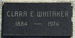
Clara Ethel Moon Whitaker
| Birth | : | 12 Sep 1884 Hall, Morgan County, Indiana, USA |
| Death | : | 24 Nov 1974 Garnett, Anderson County, Kansas, USA |
| Burial | : | Clover Hill Park Cemetery, Birmingham, Oakland County, USA |
| Coordinate | : | 42.5349998, -83.1885986 |
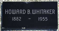
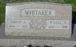
| Description | : | Clara Ethel Moon married Howard B. Whitaker September 29, 1901 Morgan County, Indiana They had 3 children Urban George, Anna Loretta and Leota Ethel Clara mother Loretta Florance Nicholas Moon died in 1888 she lived with her father and stepmother Emma Frances Dalton Moon |
frequently asked questions (FAQ):
-
Where is Clara Ethel Moon Whitaker's memorial?
Clara Ethel Moon Whitaker's memorial is located at: Clover Hill Park Cemetery, Birmingham, Oakland County, USA.
-
When did Clara Ethel Moon Whitaker death?
Clara Ethel Moon Whitaker death on 24 Nov 1974 in Garnett, Anderson County, Kansas, USA
-
Where are the coordinates of the Clara Ethel Moon Whitaker's memorial?
Latitude: 42.5349998
Longitude: -83.1885986
Family Members:
Parent
Spouse
Siblings
Children
Flowers:
Nearby Cemetories:
1. Clover Hill Park Cemetery
Birmingham, Oakland County, USA
Coordinate: 42.5349998, -83.1885986
2. Perrin Cemetery
Troy, Oakland County, USA
Coordinate: 42.5398254, -83.1857605
3. Saint James Episcopal Church Columbarium
Birmingham, Oakland County, USA
Coordinate: 42.5465088, -83.2179642
4. Acacia Park Cemetery
Beverly Hills, Oakland County, USA
Coordinate: 42.5217018, -83.2197037
5. Roseland Park Cemetery
Berkley, Oakland County, USA
Coordinate: 42.5060997, -83.1797028
6. Saint Andrews Memorial Garden
Clawson, Oakland County, USA
Coordinate: 42.5359612, -83.1460571
7. Greenwood Cemetery
Birmingham, Oakland County, USA
Coordinate: 42.5539017, -83.2238998
8. Beekman Cemetery
Southfield, Oakland County, USA
Coordinate: 42.5098076, -83.2176285
9. First United Methodist Church Memorial Garden
Birmingham, Oakland County, USA
Coordinate: 42.5454370, -83.2330870
10. Saint David Episcopal Church Columbarium
Southfield, Oakland County, USA
Coordinate: 42.5030990, -83.2096400
11. First Presbyterian Church Columbarium
Birmingham, Oakland County, USA
Coordinate: 42.5463380, -83.2351040
12. Lutheran Church of the Redeemer Columbarium
Birmingham, Oakland County, USA
Coordinate: 42.5463540, -83.2373950
13. Crooks Road Cemetery
Troy, Oakland County, USA
Coordinate: 42.5727997, -83.1680984
14. Royal Oak Cemetery
Royal Oak, Oakland County, USA
Coordinate: 42.5036011, -83.1442032
15. Saint Marys Cemetery
Royal Oak, Oakland County, USA
Coordinate: 42.5002430, -83.1444560
16. Oakview Cemetery
Royal Oak, Oakland County, USA
Coordinate: 42.5005989, -83.1393967
17. Saint Johns Episcopal Church Resurrection Garden
Royal Oak, Oakland County, USA
Coordinate: 42.4892970, -83.1574120
18. Christ Church Cranbrook Columbarium
Bloomfield Hills, Oakland County, USA
Coordinate: 42.5672188, -83.2440186
19. White Chapel Memorial Park Cemetery
Troy, Oakland County, USA
Coordinate: 42.5856018, -83.1635971
20. Northbrook Presbyterian Church Columbarium
Beverly Hills, Oakland County, USA
Coordinate: 42.5297550, -83.2657280
21. Beach Cemetery
Troy, Oakland County, USA
Coordinate: 42.5936012, -83.1980972
22. Southfield Reformed Cemetery
Southfield, Oakland County, USA
Coordinate: 42.4848420, -83.2405580
23. Beautiful Savior Lutheran Church Columbarium
Bloomfield Hills, Oakland County, USA
Coordinate: 42.5984290, -83.2092050
24. Bloomfield Hills Cemetery (Defunct)
Bloomfield Hills, Oakland County, USA
Coordinate: 42.5811111, -83.2563889


