

Clara Mae Hamilton Elson
| Birth | : | 2 Oct 1900 Maywood, Frontier County, Nebraska, USA |
| Death | : | 27 Apr 1953 North Platte, Lincoln County, Nebraska, USA |
| Burial | : | Grafton National Cemetery, Grafton, Taylor County, USA |
| Coordinate | : | 39.3350296, -80.0312500 |
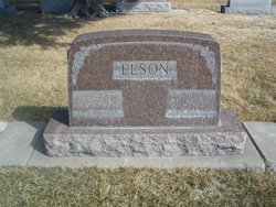
| Description | : | Buried April 30, 1953 Lot 488 Section E Space-02 Clara Mae Hamilton Elson Oct 2,1900-April 27,1953 Clara Elson Dies Suddenly Here Clara May Elson, 53, wife of Clarence R. Elson, 106 North Hayes, died Monday evening suddenly in a local hospital after a very brief illness. Born in Maywood, she leaves besides her husband, one daughter, Mary Ann, at home; three sons, Kenneth, Grand Island; Rodney and John, both of North Platte; and an aunt, Mrs. V. A.Artley, of North Platte.Funeral arrangements are pending at the Maloney, Cox and Kuhns Funeral... Read More |
frequently asked questions (FAQ):
-
Where is Clara Mae Hamilton Elson's memorial?
Clara Mae Hamilton Elson's memorial is located at: Grafton National Cemetery, Grafton, Taylor County, USA.
-
When did Clara Mae Hamilton Elson death?
Clara Mae Hamilton Elson death on 27 Apr 1953 in North Platte, Lincoln County, Nebraska, USA
-
Where are the coordinates of the Clara Mae Hamilton Elson's memorial?
Latitude: 39.3350296
Longitude: -80.0312500
Family Members:
Parent

Spouse
Siblings
Children
Flowers:


Nearby Cemetories:
1. Grafton National Cemetery
Grafton, Taylor County, USA
Coordinate: 39.3350296, -80.0312500
2. Old Catholic Cemetery
Taylor County, USA
Coordinate: 39.3445200, -80.0243000
3. Bluemont Cemetery
Grafton, Taylor County, USA
Coordinate: 39.3446999, -80.0121994
4. Mount Calvary Catholic Cemetery
Grafton, Taylor County, USA
Coordinate: 39.3492012, -80.0171967
5. Warder Cemetery
Pruntytown, Taylor County, USA
Coordinate: 39.3360670, -80.0549330
6. Lantz Ford Cemetery
Grafton, Taylor County, USA
Coordinate: 39.3219370, -80.0132820
7. Keener Cemetery
Grafton, Taylor County, USA
Coordinate: 39.3502370, -80.0503460
8. Knotts Cemetery
Grafton, Taylor County, USA
Coordinate: 39.3550030, -80.0170860
9. Woodsdale Memorial Park
Pruntytown, Taylor County, USA
Coordinate: 39.3408012, -80.0658035
10. Carder Cemetery
Fetterman, Taylor County, USA
Coordinate: 39.3618760, -80.0409150
11. Reese Cemetery
Grafton, Taylor County, USA
Coordinate: 39.3604990, -80.0068620
12. West Virginia National Cemetery
Pruntytown, Taylor County, USA
Coordinate: 39.3350190, -80.0730590
13. Abram Smith Cemetery
Pruntytown, Taylor County, USA
Coordinate: 39.3314018, -80.0811005
14. Beulah Cemetery
Pruntytown, Taylor County, USA
Coordinate: 39.3336590, -80.0817140
15. Wesley Chapel Cemetery
Grafton, Taylor County, USA
Coordinate: 39.3044014, -79.9922028
16. Arnold Cemetery
Grafton, Taylor County, USA
Coordinate: 39.2985115, -80.0014712
17. Wiseman Cemetery
Pruntytown, Taylor County, USA
Coordinate: 39.3602170, -80.0782840
18. Brown Cemetery
Taylor County, USA
Coordinate: 39.3841630, -80.0295590
19. Current Cemetery
Taylor County, USA
Coordinate: 39.3642006, -79.9753036
20. Walnut Grove Cemetery
Webster, Taylor County, USA
Coordinate: 39.2813988, -80.0472031
21. Knottsville Cemetery
Knottsville, Taylor County, USA
Coordinate: 39.3125000, -79.9642029
22. West Hill Cemetery
Taylor County, USA
Coordinate: 39.2782810, -80.0284830
23. Gawthrop Cemetery
Pruntytown, Taylor County, USA
Coordinate: 39.3292360, -80.1095210
24. Linn and Hickman Cemetery
Marion County, USA
Coordinate: 39.4007988, -80.0286026