
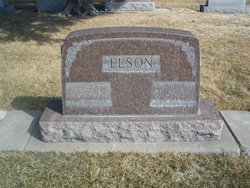

Clarence Roland Elson Sr.
| Birth | : | 1 Aug 1894 Curtis, Frontier County, Nebraska, USA |
| Death | : | 20 Dec 1957 North Platte, Lincoln County, Nebraska, USA |
| Burial | : | Grafton National Cemetery, Grafton, Taylor County, USA |
| Coordinate | : | 39.3350296, -80.0312500 |
| Description | : | Buried Dec 23,1957 Lot 488 Section E Space-01 Clarence Roland Elson, Sr Aug 1,1894-Dec 20,1957 C.R.Elson, 63 Dies Here Friday Clarence R. Elson, 63, who resided at the Mohawk Apts, died Friday after an illness of several months. He was born Aug 1,1894 at Curtis and had lived in North Platte since 1939. Survivors include one daughter, Mrs. LeRoy Sibal of Paxton; three sons, Kenneth of .Grand Island, Rod and Jon of North Platte; five grandchildren; two sisters,... Read More |
frequently asked questions (FAQ):
-
Where is Clarence Roland Elson Sr.'s memorial?
Clarence Roland Elson Sr.'s memorial is located at: Grafton National Cemetery, Grafton, Taylor County, USA.
-
When did Clarence Roland Elson Sr. death?
Clarence Roland Elson Sr. death on 20 Dec 1957 in North Platte, Lincoln County, Nebraska, USA
-
Where are the coordinates of the Clarence Roland Elson Sr.'s memorial?
Latitude: 39.3350296
Longitude: -80.0312500
Family Members:
Parent
Spouse

Siblings
Children

Flowers:


Nearby Cemetories:
1. Grafton National Cemetery
Grafton, Taylor County, USA
Coordinate: 39.3350296, -80.0312500
2. Old Catholic Cemetery
Taylor County, USA
Coordinate: 39.3445200, -80.0243000
3. Bluemont Cemetery
Grafton, Taylor County, USA
Coordinate: 39.3446999, -80.0121994
4. Mount Calvary Catholic Cemetery
Grafton, Taylor County, USA
Coordinate: 39.3492012, -80.0171967
5. Warder Cemetery
Pruntytown, Taylor County, USA
Coordinate: 39.3360670, -80.0549330
6. Lantz Ford Cemetery
Grafton, Taylor County, USA
Coordinate: 39.3219370, -80.0132820
7. Keener Cemetery
Grafton, Taylor County, USA
Coordinate: 39.3502370, -80.0503460
8. Knotts Cemetery
Grafton, Taylor County, USA
Coordinate: 39.3550030, -80.0170860
9. Woodsdale Memorial Park
Pruntytown, Taylor County, USA
Coordinate: 39.3408012, -80.0658035
10. Carder Cemetery
Fetterman, Taylor County, USA
Coordinate: 39.3618760, -80.0409150
11. Reese Cemetery
Grafton, Taylor County, USA
Coordinate: 39.3604990, -80.0068620
12. West Virginia National Cemetery
Pruntytown, Taylor County, USA
Coordinate: 39.3350190, -80.0730590
13. Abram Smith Cemetery
Pruntytown, Taylor County, USA
Coordinate: 39.3314018, -80.0811005
14. Beulah Cemetery
Pruntytown, Taylor County, USA
Coordinate: 39.3336590, -80.0817140
15. Wesley Chapel Cemetery
Grafton, Taylor County, USA
Coordinate: 39.3044014, -79.9922028
16. Arnold Cemetery
Grafton, Taylor County, USA
Coordinate: 39.2985115, -80.0014712
17. Wiseman Cemetery
Pruntytown, Taylor County, USA
Coordinate: 39.3602170, -80.0782840
18. Brown Cemetery
Taylor County, USA
Coordinate: 39.3841630, -80.0295590
19. Current Cemetery
Taylor County, USA
Coordinate: 39.3642006, -79.9753036
20. Walnut Grove Cemetery
Webster, Taylor County, USA
Coordinate: 39.2813988, -80.0472031
21. Knottsville Cemetery
Knottsville, Taylor County, USA
Coordinate: 39.3125000, -79.9642029
22. West Hill Cemetery
Taylor County, USA
Coordinate: 39.2782810, -80.0284830
23. Gawthrop Cemetery
Pruntytown, Taylor County, USA
Coordinate: 39.3292360, -80.1095210
24. Linn and Hickman Cemetery
Marion County, USA
Coordinate: 39.4007988, -80.0286026