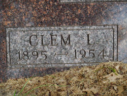
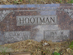
Clementine Loche “Clem” Hootman
| Birth | : | 11 Oct 1895 Mount Zion, Van Buren County, Iowa, USA |
| Death | : | 1 Jun 1954 Fairfield, Jefferson County, Iowa, USA |
| Burial | : | Maple Hill Cemetery, Birmingham, Van Buren County, USA |
| Coordinate | : | 40.8778020, -91.9354496 |
| Plot | : | Section 1 Row 3 |
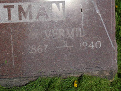
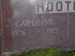
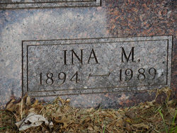
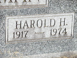
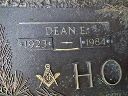
| Description | : | Note: this memorial updated February 1, 2017 with parent relationship links per edit request. ----------- Husband of Ina Marie Dille Hootman. ----------- Re: Obituary - Transcription courtesy Betty Hootman Unknown Van Buren Co. Newspaper Date of publication not known Clementine Loche Hootman, 59-year-old Mt. Zion farmer, died in Jefferson county hospital June 1, after a long illness. Hootman was the son of Vermil and Caroline Patrick Hootman, and was born near Mt. Zion on Oct. 11, 1895. On Nov. 4, 1914, he was married to Ina Marie Dille, who survives, as do six sons and five daughters: Dean Hootman, Ottumwa; Harold and Keith Hootman, Mrs. Reva... Read More |
frequently asked questions (FAQ):
-
Where is Clementine Loche “Clem” Hootman's memorial?
Clementine Loche “Clem” Hootman's memorial is located at: Maple Hill Cemetery, Birmingham, Van Buren County, USA.
-
When did Clementine Loche “Clem” Hootman death?
Clementine Loche “Clem” Hootman death on 1 Jun 1954 in Fairfield, Jefferson County, Iowa, USA
-
Where are the coordinates of the Clementine Loche “Clem” Hootman's memorial?
Latitude: 40.8778020
Longitude: -91.9354496
Family Members:
Parent
Spouse
Siblings
Children
Flowers:
Nearby Cemetories:
1. Maple Hill Cemetery
Birmingham, Van Buren County, USA
Coordinate: 40.8778020, -91.9354496
2. Methodist Episcopal Cemetery
Birmingham, Van Buren County, USA
Coordinate: 40.8788000, -91.9427000
3. United Presbyterian Cemetery
Birmingham, Van Buren County, USA
Coordinate: 40.8796000, -91.9438000
4. Parkerville Cemetery
Birmingham, Van Buren County, USA
Coordinate: 40.8666920, -91.9001710
5. Smith Cemetery
Birmingham, Van Buren County, USA
Coordinate: 40.8807983, -91.8964005
6. Clinkinbeard Family Cemetery
Libertyville, Jefferson County, USA
Coordinate: 40.9083300, -91.9583300
7. Winchester Cemetery
Winchester, Van Buren County, USA
Coordinate: 40.8499985, -91.9047012
8. Topping Cemetery
Stockport, Van Buren County, USA
Coordinate: 40.8500000, -91.8879670
9. Thompson Cemetery
Jefferson County, USA
Coordinate: 40.9155998, -91.9772034
10. Bethel Cemetery
Birmingham, Van Buren County, USA
Coordinate: 40.8967018, -92.0056000
11. Cumberland Cemetery
Jefferson County, USA
Coordinate: 40.9248000, -91.9903000
12. Pattison Cemetery
Fairfield, Jefferson County, USA
Coordinate: 40.9444008, -91.9049988
13. Fordyce Cemetery
Stockport, Van Buren County, USA
Coordinate: 40.8388000, -91.8556000
14. White Chapel Cemetery
Birmingham, Van Buren County, USA
Coordinate: 40.8417015, -92.0203018
15. Wiley Pioneer Cemetery
Jefferson County, USA
Coordinate: 40.9087000, -91.8457000
16. Kilbourne Cemetery
Van Buren County, USA
Coordinate: 40.8045000, -91.9705000
17. Jefferson County Poor Farm Cemetery
Libertyville, Jefferson County, USA
Coordinate: 40.9416900, -91.9996200
18. Miller Chapel Cemetery
Mount Zion, Van Buren County, USA
Coordinate: 40.8045000, -91.8905000
19. Roth Cemetery
Fairfield, Jefferson County, USA
Coordinate: 40.9589005, -91.9574966
20. Wilson Family Cemetery
Van Buren County, USA
Coordinate: 40.7951500, -91.9681000
21. Wright Cemetery
Fairfield, Jefferson County, USA
Coordinate: 40.9524000, -91.8728000
22. Gilbert Cemetery
Kilbourn, Van Buren County, USA
Coordinate: 40.7916926, -91.9779510
23. Rogers Cemetery
Mount Zion, Van Buren County, USA
Coordinate: 40.7916800, -91.8890600
24. Trumbo Cemetery
Stockport, Van Buren County, USA
Coordinate: 40.8166943, -91.8418354

