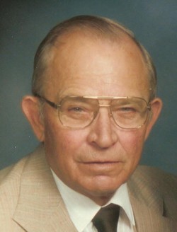
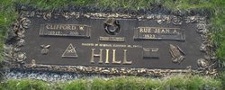
Clifford Hill
| Birth | : | 8 Jul 1919 Tama County, Iowa, USA |
| Death | : | 18 Oct 2006 Grinnell, Poweshiek County, Iowa, USA |
| Burial | : | Barrow-Upon-Humber Cemetery, Barrow upon Humber, North Lincolnshire Unitary Authority, England |
| Coordinate | : | 53.6678740, -0.3755040 |
| Description | : | Clifford Hill, 87, of Gilman, died Wednesday morning, October 18th, at the Friendship Manor in Grinnell. Funeral services and a celebration of his life will be held at 11:00 a.m. Saturday at the Mitchell Family Funeral Home. He will be laid to rest in the Rose Hill Memorial Gardens with a time of fellowship and refreshments to follow at the hospitality room of the funeral home. Friends may call at the Mitchell Family Funeral Home in Marshalltown from 6-8:00 p.m. on Friday. There will be a Masonic service conducted at 8:00 p.m. For... Read More |
frequently asked questions (FAQ):
-
Where is Clifford Hill's memorial?
Clifford Hill's memorial is located at: Barrow-Upon-Humber Cemetery, Barrow upon Humber, North Lincolnshire Unitary Authority, England.
-
When did Clifford Hill death?
Clifford Hill death on 18 Oct 2006 in Grinnell, Poweshiek County, Iowa, USA
-
Where are the coordinates of the Clifford Hill's memorial?
Latitude: 53.6678740
Longitude: -0.3755040
Family Members:
Spouse
Children
Flowers:
Nearby Cemetories:
1. Barrow-Upon-Humber Cemetery
Barrow upon Humber, North Lincolnshire Unitary Authority, England
Coordinate: 53.6678740, -0.3755040
2. Holy Trinity Churchyard
Barrow upon Humber, North Lincolnshire Unitary Authority, England
Coordinate: 53.6783720, -0.3787880
3. All Saints Churchyard
Goxhill, North Lincolnshire Unitary Authority, England
Coordinate: 53.6759810, -0.3329040
4. Goxhill Cemetery
Goxhill, North Lincolnshire Unitary Authority, England
Coordinate: 53.6798690, -0.3246480
5. Barton-Upon-Humber Cemetery
Barton-upon-Humber, North Lincolnshire Unitary Authority, England
Coordinate: 53.6817370, -0.4279560
6. Barton-upon-Humber Old Cemetery
Barton-upon-Humber, North Lincolnshire Unitary Authority, England
Coordinate: 53.6818650, -0.4284450
7. St Andrew's Churchyard
Wootton, North Lincolnshire Unitary Authority, England
Coordinate: 53.6306857, -0.3549418
8. St Mary's Churchyard
Barton-upon-Humber, North Lincolnshire Unitary Authority, England
Coordinate: 53.6844300, -0.4367800
9. Thornton Abbey
Thornton Curtis, North Lincolnshire Unitary Authority, England
Coordinate: 53.6550000, -0.3098000
10. St Michael Churchyard
East Halton, North Lincolnshire Unitary Authority, England
Coordinate: 53.6667000, -0.2833000
11. St Nicholas Churchyard
Ulceby, North Lincolnshire Unitary Authority, England
Coordinate: 53.6163770, -0.3334470
12. East Halton Cemetery
East Halton, North Lincolnshire Unitary Authority, England
Coordinate: 53.6502840, -0.2797070
13. St. Peter's Churchyard
East Halton, North Lincolnshire Unitary Authority, England
Coordinate: 53.6501230, -0.2744760
14. All Saints Churchyard
Hessle, East Riding of Yorkshire Unitary Authority, England
Coordinate: 53.7240270, -0.4358490
15. Division Road Cemetery
Kingston upon Hull, Kingston upon Hull Unitary Authority, England
Coordinate: 53.7358194, -0.3679444
16. St Denys churchyard
North Killingholme, North Lincolnshire Unitary Authority, England
Coordinate: 53.6404250, -0.2701730
17. Hessle Cemetery
Hessle, East Riding of Yorkshire Unitary Authority, England
Coordinate: 53.7270800, -0.4379100
18. Hessle Road Jewish Cemetery
Kingston upon Hull, Kingston upon Hull Unitary Authority, England
Coordinate: 53.7374970, -0.3533980
19. Villa Place Jewish Cemetery
Kingston upon Hull, Kingston upon Hull Unitary Authority, England
Coordinate: 53.7396530, -0.3516970
20. St John's Church
Croxton, North Lincolnshire Unitary Authority, England
Coordinate: 53.5955990, -0.3477220
21. Trinity Burial Ground
Kingston upon Hull, Kingston upon Hull Unitary Authority, England
Coordinate: 53.7404389, -0.3422722
22. St Andrew Churchyard
Bonby, North Lincolnshire Unitary Authority, England
Coordinate: 53.6266000, -0.4838000
23. St Nicholas Churchyard
South Ferriby, North Lincolnshire Unitary Authority, England
Coordinate: 53.6746420, -0.5051450
24. St. Clement's Churchyard
Worlaby, North Lincolnshire Unitary Authority, England
Coordinate: 53.6129220, -0.4667760


