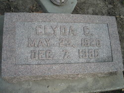
Clyda Clay Warren Bass
| Birth | : | 23 May 1920 Mills County, Iowa, USA |
| Death | : | 7 Dec 1995 Norwalk, Warren County, Iowa, USA |
| Burial | : | Saint Johns Cemetery, Garfield, Douglas County, USA |
| Coordinate | : | 45.9411011, -95.4824982 |
| Plot | : | 2nd Addition, Lot 131 |
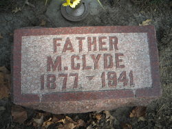
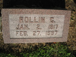
| Description | : | Clyda Bass, age 75, of Red Oak, passed away on Thursday, December 7, 1995 at the Regency Care Center in Norwalk, Iowa after an extended illness. Clyda Clay Bass was born on May 23, 1920 in Mills County, Iowa, the daughter of Clyde and Edith Gilmore Warren, She was raised in Mills County, near Emerson and graduated from Emerson High School and attended Iowa State College. On August 11, 1940, she was united in marriage to Rollin Bass. They farmed west of Red Oak until she entered the Regency Care Center in Norwalk, Iowa, eight years ago. Clyda is survived... Read More |
frequently asked questions (FAQ):
-
Where is Clyda Clay Warren Bass's memorial?
Clyda Clay Warren Bass's memorial is located at: Saint Johns Cemetery, Garfield, Douglas County, USA.
-
When did Clyda Clay Warren Bass death?
Clyda Clay Warren Bass death on 7 Dec 1995 in Norwalk, Warren County, Iowa, USA
-
Where are the coordinates of the Clyda Clay Warren Bass's memorial?
Latitude: 45.9411011
Longitude: -95.4824982
Family Members:
Parent
Spouse
Flowers:
Nearby Cemetories:
1. Saint Johns Cemetery
Garfield, Douglas County, USA
Coordinate: 45.9411011, -95.4824982
2. Lake Ida Cemetery
Garfield, Douglas County, USA
Coordinate: 45.9486008, -95.4421997
3. Saint Lukes Cemetery
Garfield, Douglas County, USA
Coordinate: 45.9721985, -95.4805984
4. Oak Hill Cemetery
Garfield, Douglas County, USA
Coordinate: 45.9723470, -95.4817660
5. East Moe Lutheran Church Cemetery
Garfield, Douglas County, USA
Coordinate: 45.9285000, -95.5305700
6. Lake Charley Cemetery
Douglas County, USA
Coordinate: 45.9444008, -95.4116974
7. Kinkead Cemetery
Alexandria, Douglas County, USA
Coordinate: 45.8989000, -95.3913900
8. Chippewa Cemetery
Brandon, Douglas County, USA
Coordinate: 45.9481010, -95.5932999
9. Saint Marys Cemetery and Mausoleum
Alexandria, Douglas County, USA
Coordinate: 45.8824997, -95.4072037
10. White Garden Cemetery
Douglas County, USA
Coordinate: 45.8619003, -95.5068970
11. Saint Ann's Cemetery
Brandon, Douglas County, USA
Coordinate: 45.9669100, -95.5936100
12. Chippewa Lutheran Church Burial Site
Brandon, Douglas County, USA
Coordinate: 45.9618100, -95.6003300
13. Adkinsville Cemetery
Douglas County, USA
Coordinate: 45.9073700, -95.5965600
14. Evergreen Cemetery
Alexandria, Douglas County, USA
Coordinate: 45.8614006, -95.4282990
15. Ebenezer Cemetery
Leaf Valley, Douglas County, USA
Coordinate: 46.0278015, -95.4419022
16. Brandon Cemetery
Brandon, Douglas County, USA
Coordinate: 45.9702988, -95.6128006
17. West Moe Lutheran Cemetery
Douglas County, USA
Coordinate: 45.9053200, -95.6153600
18. Moe Heights Cemetery
Douglas County, USA
Coordinate: 45.8746986, -95.5931015
19. Mount Carmel Cemetery
Douglas County, USA
Coordinate: 46.0056000, -95.3647003
20. Zunker Cemetery
Carlos, Douglas County, USA
Coordinate: 46.0059590, -95.3649060
21. Rose Hill Cemetery
Holmes City, Douglas County, USA
Coordinate: 45.8408012, -95.5361023
22. Trinity Lutheran Cemetery
Holmes City, Douglas County, USA
Coordinate: 45.8405800, -95.5359060
23. Saint Pauls Lutheran Church Cemetery
Holmes City, Douglas County, USA
Coordinate: 45.8604700, -95.5878100
24. Ellis Family Burial Site
Leaf Valley, Douglas County, USA
Coordinate: 46.0491200, -95.4589400


