| Birth | : | 12 Aug 1912 Trenton, Grundy County, Missouri, USA |
| Death | : | 30 Jul 1986 Rapid City, Pennington County, South Dakota, USA |
| Burial | : | Memorial Vale Cemetery, Hysham, Treasure County, USA |
| Coordinate | : | 46.2552986, -107.2307968 |
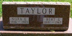
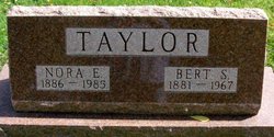
| Description | : | The Bibillings Gazette (MT) Clyde B. Taylor HYSHAM --- Clyde B. Taylor drove the Myers and Sarpy Creek scholl bus routes for 25 yeard and the Sarpy Creek mail rout for 23 years. He also worked in the family service station business, retiring in 1983. He was a member of Hysham Senior Citizens. Mr. Taylor, 73, died saturday morning at Rapid City (S.D.) Regional Hospital. He was born in Trenton, MO., a son of Bert and Nora Buzzard Taylor, and came with his family to Hysham in 1917. He graduated from Hysham High School. |
frequently asked questions (FAQ):
-
Where is Clyde Barton Taylor's memorial?
Clyde Barton Taylor's memorial is located at: Memorial Vale Cemetery, Hysham, Treasure County, USA.
-
When did Clyde Barton Taylor death?
Clyde Barton Taylor death on 30 Jul 1986 in Rapid City, Pennington County, South Dakota, USA
-
Where are the coordinates of the Clyde Barton Taylor's memorial?
Latitude: 46.2552986
Longitude: -107.2307968
Family Members:
Parent
Spouse
Siblings
Children
Flowers:
Nearby Cemetories:
1. Memorial Vale Cemetery
Hysham, Treasure County, USA
Coordinate: 46.2552986, -107.2307968
2. Rancher Cemetery
Myers, Treasure County, USA
Coordinate: 46.2580986, -107.4197006
3. Howard Cemetery
Rosebud County, USA
Coordinate: 46.2621994, -106.9222031
4. Junction City Cemetery
Yellowstone County, USA
Coordinate: 46.1437320, -107.5493300
5. Custer Cemetery
Custer, Yellowstone County, USA
Coordinate: 46.1270690, -107.5700030
6. Forsyth Cemetery
Forsyth, Rosebud County, USA
Coordinate: 46.2689018, -106.6528015
7. Sumatra Cemetery
Rosebud County, USA
Coordinate: 46.6136017, -107.5674973
8. Mount Vera Cemetery
Foster, Big Horn County, USA
Coordinate: 45.9067982, -107.6333357
9. Cabin Creek Cemetery
Musselshell County, USA
Coordinate: 46.4794006, -107.8122025
10. Castle Butte Cemetery
Yellowstone County, USA
Coordinate: 46.1721992, -107.9242020
11. Colstrip Cemetery
Colstrip, Rosebud County, USA
Coordinate: 45.9096985, -106.6194000
12. Rosebud Cemetery
Rosebud, Rosebud County, USA
Coordinate: 46.2689018, -106.4381027
13. Melstone Cemetery
Melstone, Musselshell County, USA
Coordinate: 46.6068993, -107.8507996
14. Vanstel Cemetery
Rosebud County, USA
Coordinate: 46.7872009, -106.8942032
15. Fairview Cemetery
Hardin, Big Horn County, USA
Coordinate: 45.7394981, -107.6415024
16. Musselshell Cemetery
Musselshell County, USA
Coordinate: 46.4989014, -108.0888977
17. Apsaalooke Veterans Cemetery
Crow Agency, Big Horn County, USA
Coordinate: 45.6055500, -107.4776900
18. Crow Agency Cemetery
Crow Agency, Big Horn County, USA
Coordinate: 45.6044006, -107.4730988
19. Lee Cemetery
Rosebud County, USA
Coordinate: 45.7792015, -106.5413971
20. Little Bighorn Battlefield National Monument
Little Big Horn Battle Site, Big Horn County, USA
Coordinate: 45.5703000, -107.4273500
21. Custer National Cemetery
Crow Agency, Big Horn County, USA
Coordinate: 45.5699000, -107.4318000
22. Hathaway Cemetery
Rosebud County, USA
Coordinate: 46.2616997, -106.2185974
23. Bean Cemetery
Rosebud County, USA
Coordinate: 45.8535995, -106.4011002
24. Brown Cemetery
Colstrip, Rosebud County, USA
Coordinate: 45.8321991, -106.4180984


