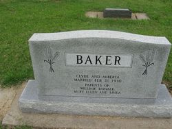
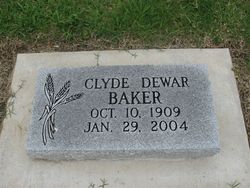
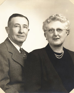
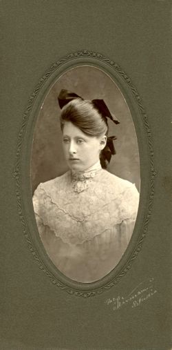
Clyde Dewar Baker
| Birth | : | 10 Oct 1909 El Dorado, Butler County, Kansas, USA |
| Death | : | 29 Jan 2004 El Dorado, Butler County, Kansas, USA |
| Burial | : | Blair Cemetery, Blair, Washington County, USA |
| Coordinate | : | 41.5508003, -96.1185989 |
| Plot | : | Section: E Lot: 20 Space: W2 |
| Description | : | Clyde B. Baker, 94, of El Dorado, died Thursday, Jan. 29, 2004, at Beverly Health and Rehabilitation. Services are 10 a.m. Tuesday at Carlson Funeral Home. Burial will follow in Sunset Lawns Cemetery. He was born Oct. 10, 1909, at El Dorado, the son of Charles G. and Ellen B. (DeWar) Baker. He spent all of his life in this area and was a farmer and dairyman. He was a member of the First United Methodist Church; Farm Bureau and had served on the Vanora School Board. He loved to go to livestock sales, collect caps and take in stray dogs. On... Read More |
frequently asked questions (FAQ):
-
Where is Clyde Dewar Baker's memorial?
Clyde Dewar Baker's memorial is located at: Blair Cemetery, Blair, Washington County, USA.
-
When did Clyde Dewar Baker death?
Clyde Dewar Baker death on 29 Jan 2004 in El Dorado, Butler County, Kansas, USA
-
Where are the coordinates of the Clyde Dewar Baker's memorial?
Latitude: 41.5508003
Longitude: -96.1185989
Family Members:
Parent
Spouse
Siblings
Children
Flowers:
Nearby Cemetories:
1. Blair Cemetery
Blair, Washington County, USA
Coordinate: 41.5508003, -96.1185989
2. Holy Cross Cemetery
Blair, Washington County, USA
Coordinate: 41.5493600, -96.1187700
3. Blair Potters Field
Washington County, USA
Coordinate: 41.5521900, -96.1179000
4. Saint Marys Episcopal Church Columbarium
Blair, Washington County, USA
Coordinate: 41.5419239, -96.1379580
5. Prayer Garden at First Lutheran Church
Blair, Washington County, USA
Coordinate: 41.5504880, -96.1452950
6. Cuming City Cemetery
Blair, Washington County, USA
Coordinate: 41.5867004, -96.1727982
7. Brewster Cemetery
Kennard, Washington County, USA
Coordinate: 41.5088250, -96.2042950
8. Wilcox Cemetery
Fort Calhoun, Washington County, USA
Coordinate: 41.4509380, -96.1098340
9. Hauger-Rumbaugh Cemetery
Modale, Harrison County, USA
Coordinate: 41.6388797, -96.0502906
10. Pioneer Memorial Cemetery
Fort Calhoun, Washington County, USA
Coordinate: 41.4472008, -96.0971985
11. Kennard Cemetery
Kennard, Washington County, USA
Coordinate: 41.4738998, -96.2138977
12. Fort Calhoun Cemetery
Fort Calhoun, Washington County, USA
Coordinate: 41.4581375, -96.0352020
13. Rose Hill Cemetery
Orum, Washington County, USA
Coordinate: 41.5814060, -96.2698940
14. Thone Cemetery
Herman, Washington County, USA
Coordinate: 41.6286011, -96.2466965
15. Herman Cemetery
Herman, Washington County, USA
Coordinate: 41.6575012, -96.2033005
16. Lincoln Lutheran Cemetery
Orum, Washington County, USA
Coordinate: 41.5538390, -96.2889030
17. Yutesler Cemetery
Harrison County, USA
Coordinate: 41.6684000, -96.0373000
18. German Cemetery
Washington County, USA
Coordinate: 41.4150600, -96.1366900
19. Prairie View Cemetery
Washington, Washington County, USA
Coordinate: 41.4225006, -96.2241974
20. Colby-Morley Cemetery
Arlington, Washington County, USA
Coordinate: 41.4664050, -96.3126470
21. Champan Frazier Cemetery
Harrison County, USA
Coordinate: 41.5773500, -95.8933500
22. Rose Hill Memorial Gardens
Missouri Valley, Harrison County, USA
Coordinate: 41.5656000, -95.8897000
23. Mount Carmel Cemetery
Missouri Valley, Harrison County, USA
Coordinate: 41.5675011, -95.8897018
24. Noyes Cemetery
Mondamin, Harrison County, USA
Coordinate: 41.7188988, -96.0325012

