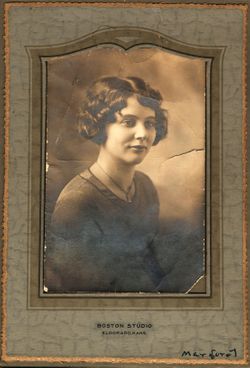
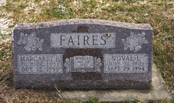
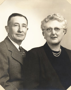
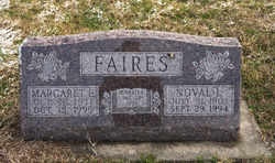
Margaret Eloise Baker Faires
| Birth | : | 25 Oct 1911 El Dorado, Butler County, Kansas, USA |
| Death | : | 15 Oct 1995 El Dorado, Butler County, Kansas, USA |
| Burial | : | Ellesmere Public Cemetery, Leeston, Selwyn District, New Zealand |
| Coordinate | : | -43.7775690, 172.2599220 |
| Plot | : | Section SS, Lot 863, Space 3 |
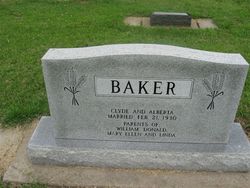
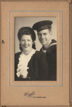
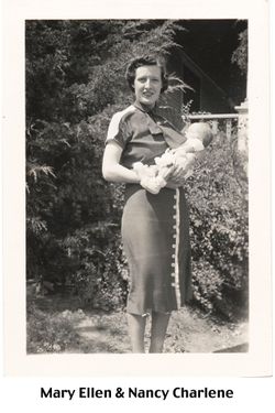
| Description | : | Margaret Eloise Baker was born October 25, 1911 on the family's Turkey Creek farm, south of Eldorado, Kansas, the daughter of Charles Gellette Baker and Ellen Blanche (Dewar) Baker. On December 28, 1931 she was married to Noval Lee Faires by Judge V.P. Mooney. After they were married, Margaret & Noval lived most of their lives in or around Eldorado, except for a few years in Madison, Kansas in the late 1940's and early 1950's. Margaret was a member of DAR, "Daughters of the American Revolution" and was active in the First United Methodist Church in Eldorado. Margaret passed away on... Read More |
frequently asked questions (FAQ):
-
Where is Margaret Eloise Baker Faires's memorial?
Margaret Eloise Baker Faires's memorial is located at: Ellesmere Public Cemetery, Leeston, Selwyn District, New Zealand.
-
When did Margaret Eloise Baker Faires death?
Margaret Eloise Baker Faires death on 15 Oct 1995 in El Dorado, Butler County, Kansas, USA
-
Where are the coordinates of the Margaret Eloise Baker Faires's memorial?
Latitude: -43.7775690
Longitude: 172.2599220
Family Members:
Parent
Spouse
Siblings
Children
Flowers:
Nearby Cemetories:
1. Ellesmere Public Cemetery
Leeston, Selwyn District, New Zealand
Coordinate: -43.7775690, 172.2599220
2. Ellesmere Catholic Cemetery
Leeston, Selwyn District, New Zealand
Coordinate: -43.7845860, 172.2690990
3. Bishops Corner Cemetery
Southbridge, Selwyn District, New Zealand
Coordinate: -43.7824100, 172.2422900
4. St James Churchyard
Southbridge, Selwyn District, New Zealand
Coordinate: -43.8092360, 172.2502680
5. Killinchy Cemetery
Leeston, Selwyn District, New Zealand
Coordinate: -43.7325610, 172.2411540
6. Sedgemere Cemetery
Sedgemere, Selwyn District, New Zealand
Coordinate: -43.8366600, 172.3149500
7. St Luke's Anglican Churchyard
Brookside, Selwyn District, New Zealand
Coordinate: -43.6903100, 172.3029000
8. Brookside Cemetery
Brookside, Selwyn District, New Zealand
Coordinate: -43.6751800, 172.2683700
9. Hone Wetere Churchyard
Taumutu, Selwyn District, New Zealand
Coordinate: -43.8567680, 172.3586330
10. Dunsandel Cemetery
Dunsandel, Selwyn District, New Zealand
Coordinate: -43.6710940, 172.1382620
11. Dorie Cemetery
Dorie, Ashburton District, New Zealand
Coordinate: -43.8772900, 172.0862500
12. St Mary's Churchyard
Springston, Selwyn District, New Zealand
Coordinate: -43.6446560, 172.4263590
13. Kyle Cemetery
Dorie, Ashburton District, New Zealand
Coordinate: -43.9193236, 172.0979192
14. Rakaia Cemetery
Rakaia, Ashburton District, New Zealand
Coordinate: -43.7548910, 171.9939270
15. Springston Cemetery
Lincoln, Selwyn District, New Zealand
Coordinate: -43.6404360, 172.4509420
16. Lincoln Cemetery
Lincoln, Selwyn District, New Zealand
Coordinate: -43.6311790, 172.4862570
17. Weedons Cemetery
Weedons, Selwyn District, New Zealand
Coordinate: -43.5670010, 172.4015870
18. Chertsey Cemetery
Chertsey, Ashburton District, New Zealand
Coordinate: -43.8030500, 171.9319400
19. Shands Road Cemetery
Prebbleton, Selwyn District, New Zealand
Coordinate: -43.5792540, 172.4888630
20. Prebbleton Cemetery
Prebbleton, Selwyn District, New Zealand
Coordinate: -43.5887200, 172.5053500
21. St Paul's Anglican Church Cemetery
West Melton, Selwyn District, New Zealand
Coordinate: -43.5261700, 172.3701800
22. Greendale Cemetery
Greendale, Selwyn District, New Zealand
Coordinate: -43.5447560, 172.0772460
23. Church of the Epiphany Churchyard
Teddington, Christchurch City, New Zealand
Coordinate: -43.7016200, 172.6182200
24. All Saint's Churchyard
Prebbleton, Selwyn District, New Zealand
Coordinate: -43.5781040, 172.5131430

