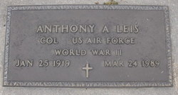
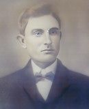
Col Anthony Andres “Tony” Leis
| Birth | : | 25 Jan 1919 Kansas, USA |
| Death | : | 24 Mar 1989 Mesa, Maricopa County, Arizona, USA |
| Burial | : | Saint Marys Cemetery, Garden Plain, Sedgwick County, USA |
| Coordinate | : | 37.7068300, -97.6430500 |
| Plot | : | Section D, Row 11, Grave 14 |
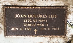
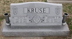
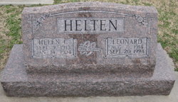
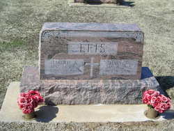
| Description | : | Wichita Eagle, Sunday, March 26, 1989 COL. ANTHONY A. LEIS, 70, of Colorado Springs, former Garden Plain resident, retired Air Force colonel, died Friday, March 24, 1989. Rosary 7 p.m. Wedneday, service 11 a.m. Thursday, both at St. Mary's Catholic Church, Aleppo. Survivors: wife, Joan; son, Daniel of Hays; daughter, Sister Rebecca of Clyde, Mo.; brothers, Leonard, Lawrence, both of Garden Plain; sisters, Marie Leis, Helen Helten, both of Aleppo, Agnes Kruse of Colwich; four grandchildren. Memorial has been established with St. Joseph's Educational Foundation, Hays. Wulf Mortuary, Garden Plain. ------ Tony was a graduate of Garden Plain... Read More |
frequently asked questions (FAQ):
-
Where is Col Anthony Andres “Tony” Leis's memorial?
Col Anthony Andres “Tony” Leis's memorial is located at: Saint Marys Cemetery, Garden Plain, Sedgwick County, USA.
-
When did Col Anthony Andres “Tony” Leis death?
Col Anthony Andres “Tony” Leis death on 24 Mar 1989 in Mesa, Maricopa County, Arizona, USA
-
Where are the coordinates of the Col Anthony Andres “Tony” Leis's memorial?
Latitude: 37.7068300
Longitude: -97.6430500
Family Members:
Parent
Spouse
Siblings
Children
Flowers:
Nearby Cemetories:
1. Saint Marys Cemetery
Garden Plain, Sedgwick County, USA
Coordinate: 37.7068300, -97.6430500
2. Mulkey Cemetery
Garden Plain, Sedgwick County, USA
Coordinate: 37.7071495, -97.6878967
3. Saint Anthony Cemetery
Garden Plain, Sedgwick County, USA
Coordinate: 37.6535988, -97.6838989
4. Calvary Methodist Cemetery
Garden Plain, Sedgwick County, USA
Coordinate: 37.6528015, -97.6841965
5. Pleasant Ridge Cemetery
Goddard, Sedgwick County, USA
Coordinate: 37.6777992, -97.5627975
6. Saint Marks Cemetery
Saint Marks, Sedgwick County, USA
Coordinate: 37.7363014, -97.5613022
7. Afton Cemetery
Goddard, Sedgwick County, USA
Coordinate: 37.6338997, -97.6057968
8. Saint Joseph Church Cemetery
Ost, Reno County, USA
Coordinate: 37.7485100, -97.7316550
9. Saint Joseph Cemetery
Andale, Sedgwick County, USA
Coordinate: 37.7938004, -97.6376038
10. Saint Paul Lutheran Cemetery
Cheney, Sedgwick County, USA
Coordinate: 37.6628000, -97.7424500
11. Sacred Heart Catholic Cemetery
Colwich, Sedgwick County, USA
Coordinate: 37.7798004, -97.5447006
12. Antioch Cemetery
Reno County, USA
Coordinate: 37.7850490, -97.7360050
13. Pioneer Cemetery
Cheney, Sedgwick County, USA
Coordinate: 37.6471300, -97.7861400
14. Mount Vernon Cemetery
Mount Vernon, Kingman County, USA
Coordinate: 37.7043991, -97.8158035
15. Old Saint Johns Cemetery
Viola, Sedgwick County, USA
Coordinate: 37.5822868, -97.5706635
16. Resthaven Gardens of Memory
Wichita, Sedgwick County, USA
Coordinate: 37.6666985, -97.4772034
17. Eldridge Cemetery
Colwich, Sedgwick County, USA
Coordinate: 37.8166008, -97.5372009
18. Maize Cemetery
Maize, Sedgwick County, USA
Coordinate: 37.7792015, -97.4897003
19. Fairview Cemetery
Cheney, Sedgwick County, USA
Coordinate: 37.6194000, -97.7861023
20. Resurrection Cemetery and Mausoleum
Wichita, Sedgwick County, USA
Coordinate: 37.7131250, -97.4623780
21. Mount Hope Cemetery
Mount Hope, Sedgwick County, USA
Coordinate: 37.8546982, -97.6744003
22. Jamesburg Park Cemetery
Wichita, Sedgwick County, USA
Coordinate: 37.7160988, -97.4449997
23. Covenant Presbyterian Church Columbarium
Wichita, Sedgwick County, USA
Coordinate: 37.7152678, -97.4436548
24. Saint John's Cemetery
Viola, Sedgwick County, USA
Coordinate: 37.5644302, -97.5557480

