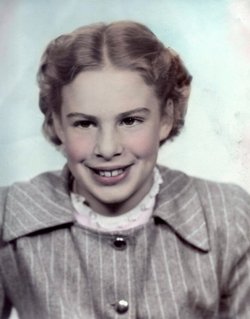
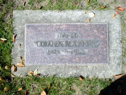
Colleen Marcella Carkin
| Birth | : | 1 Jun 1939 Seattle, King County, Washington, USA |
| Death | : | 6 Jul 1975 Seattle, King County, Washington, USA |
| Burial | : | Friendship Baptist Church Cemetery, Philpot, Daviess County, USA |
| Coordinate | : | 37.6520600, -86.9565100 |
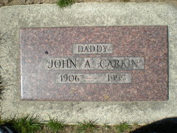
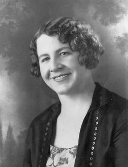
| Description | : | She was the daughter of John Alonzo Carkin Jr. and Maud Ella Egbert. She married Edgar Arnold Royer on June 25, 1954 in Puyallup Washington |
frequently asked questions (FAQ):
-
Where is Colleen Marcella Carkin's memorial?
Colleen Marcella Carkin's memorial is located at: Friendship Baptist Church Cemetery, Philpot, Daviess County, USA.
-
When did Colleen Marcella Carkin death?
Colleen Marcella Carkin death on 6 Jul 1975 in Seattle, King County, Washington, USA
-
Where are the coordinates of the Colleen Marcella Carkin's memorial?
Latitude: 37.6520600
Longitude: -86.9565100
Family Members:
Parent
Siblings
Flowers:
Nearby Cemetories:
1. Friendship Baptist Church Cemetery
Philpot, Daviess County, USA
Coordinate: 37.6520600, -86.9565100
2. Jackson Cemetery
Masonville, Daviess County, USA
Coordinate: 37.6397018, -86.9593964
3. Passionist Monastery Cemetery
Whitesville, Daviess County, USA
Coordinate: 37.6674350, -86.9092460
4. Richardson Jones Cemetery
Habit, Daviess County, USA
Coordinate: 37.6865005, -86.9959030
5. Pleasant Point Baptist Cemetery
Pleasant Ridge, Daviess County, USA
Coordinate: 37.6095600, -86.9947000
6. Edge Cemetery
Whitesville, Daviess County, USA
Coordinate: 37.6491670, -86.8883330
7. Mobberly Cemetery
Masonville, Daviess County, USA
Coordinate: 37.6778000, -87.0204600
8. Bethabara Baptist Church Cemetery
Habit, Daviess County, USA
Coordinate: 37.7033005, -86.9944000
9. Karn Family Cemetery
Philpot, Daviess County, USA
Coordinate: 37.7097740, -86.9388123
10. Karn's Grove Baptist Church Cemetery
Philpot, Daviess County, USA
Coordinate: 37.7102000, -86.9390600
11. Graves Family Cemetery
Ohio County, USA
Coordinate: 37.5919912, -86.9651932
12. Old Bells Run Cemetery
Bells Run, Ohio County, USA
Coordinate: 37.5937400, -86.9280300
13. Bell's Run Cemetery
Bells Run, Ohio County, USA
Coordinate: 37.5929500, -86.9293900
14. Barnhill Cemetery
Philpot, Daviess County, USA
Coordinate: 37.7150650, -86.9604874
15. Masonville United Methodist Church Cemetery
Masonville, Daviess County, USA
Coordinate: 37.6716900, -87.0358700
16. Saint Mary of the Woods Cemetery
Whitesville, Daviess County, USA
Coordinate: 37.6605988, -86.8711014
17. Red Hill Cemetery
Utica, Daviess County, USA
Coordinate: 37.6165300, -87.0424000
18. Adcock-Pursell-Simpson Cemetery
Philpot, Daviess County, USA
Coordinate: 37.7323390, -86.9503300
19. Barnetts Knob Cemetery
Whitesville, Daviess County, USA
Coordinate: 37.6753006, -86.8578033
20. Cates Cemetery
Whitesville, Daviess County, USA
Coordinate: 37.6819000, -86.8574982
21. Providence United Methodist Cemetery
Philpot, Daviess County, USA
Coordinate: 37.7320800, -86.9198200
22. Dodson-King Cemetery
Buford, Ohio County, USA
Coordinate: 37.5667000, -86.9558029
23. Union Grove Cemetery
Bells Run, Ohio County, USA
Coordinate: 37.5710080, -86.9119000
24. Gabbert Family Plot
Philpot, Daviess County, USA
Coordinate: 37.7406080, -86.9639350


