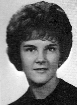
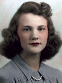
Constance Sue “Connie” King Christensen
| Birth | : | 15 Oct 1944 Kingman, Mohave County, Arizona, USA |
| Death | : | 17 Dec 1967 Council Bluffs, Pottawattamie County, Iowa, USA |
| Burial | : | Moorestown Friends Cemetery, Moorestown, Burlington County, USA |
| Coordinate | : | 39.9661522, -74.9430237 |
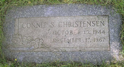
| Inscription | : | Connie S. Christensen October 15, 1944 December 17, 1967 |
| Description | : | Council Bluffs Nonpareil December 6, 1967 MOTHER HURT; BABY UNINJURED NEOLA -- Mrs. Larry Christensen, 23, Neola, was reported in fair condition at Jennie Edmundson Hospital in Council Bluffs after suffering back injuries in a one-car accident north of here. ..Mrs. Christensen told authorities her car skidded on wet paving at the approach to a bridge on Highway 64, struck the bridge, then rolled down an embankment. ..Her six-month-old son, Scott, was thrown from the car as it overturned. The infant was not injured. ..Mrs. Christensen and the baby were taken to the hospital by the Neola Fire Department rescue unit. ----------------- Council Bluffs Nonpareil December 18, 1967 CRASH... Read More |
frequently asked questions (FAQ):
-
Where is Constance Sue “Connie” King Christensen's memorial?
Constance Sue “Connie” King Christensen's memorial is located at: Moorestown Friends Cemetery, Moorestown, Burlington County, USA.
-
When did Constance Sue “Connie” King Christensen death?
Constance Sue “Connie” King Christensen death on 17 Dec 1967 in Council Bluffs, Pottawattamie County, Iowa, USA
-
Where are the coordinates of the Constance Sue “Connie” King Christensen's memorial?
Latitude: 39.9661522
Longitude: -74.9430237
Family Members:
Parent
Flowers:
Nearby Cemetories:
1. Moorestown Friends Cemetery
Moorestown, Burlington County, USA
Coordinate: 39.9661522, -74.9430237
2. Saint Matthew Lutheran Church Garden of Remembranc
Moorestown, Burlington County, USA
Coordinate: 39.9684660, -74.9444600
3. First Baptist Church Cemetery
Moorestown, Burlington County, USA
Coordinate: 39.9644737, -74.9483109
4. Trinity Episcopal Churchyard
Moorestown, Burlington County, USA
Coordinate: 39.9634056, -74.9507599
5. First Presbyterian Church Cemetery
Moorestown, Burlington County, USA
Coordinate: 39.9795700, -74.9501600
6. First United Methodist Church Memorial Garden
Moorestown, Burlington County, USA
Coordinate: 39.9583720, -74.9623130
7. Mount Carmel Cemetery
Moorestown, Burlington County, USA
Coordinate: 39.9580994, -74.9741974
8. Covenant Presbyterian Church Memorial Garden
Cinnaminson, Burlington County, USA
Coordinate: 39.9963890, -74.9687930
9. Asbury United Methodist Church Cemetery
Cinnaminson, Burlington County, USA
Coordinate: 40.0042992, -74.9779968
10. Trinity AME Church Cemetery
Cinnaminson, Burlington County, USA
Coordinate: 39.9848600, -74.9989290
11. Westfield Friends Burial Ground
Cinnaminson, Burlington County, USA
Coordinate: 39.9952100, -74.9925100
12. Lakeview Memorial Park
Cinnaminson, Burlington County, USA
Coordinate: 40.0036354, -74.9818802
13. Colestown Cemetery
Colestown, Camden County, USA
Coordinate: 39.9333000, -74.9918976
14. Evesham Friends Cemetery
Mount Laurel, Burlington County, USA
Coordinate: 39.9351130, -74.8915510
15. Mount Laurel Cemetery
Mount Laurel, Burlington County, USA
Coordinate: 39.9272003, -74.8977966
16. Eldridge Cemetery
Mount Laurel, Burlington County, USA
Coordinate: 39.9268837, -74.8968887
17. Christian Brethren Burying Ground
Delran, Burlington County, USA
Coordinate: 40.0192909, -74.9492874
18. Darnell Family Cemetery
Mount Laurel, Burlington County, USA
Coordinate: 39.9535520, -74.8728800
19. Palmyra Moravian Church Cemetery
Cinnaminson, Burlington County, USA
Coordinate: 39.9881200, -75.0108670
20. Jacob's Chapel Cemetery
Mount Laurel, Burlington County, USA
Coordinate: 39.9297670, -74.8852350
21. Bridgeboro Methodist Cemetery
Bridgeboro, Burlington County, USA
Coordinate: 40.0233879, -74.9337006
22. Mount Laurel Friends Burying Ground
Mount Laurel, Burlington County, USA
Coordinate: 39.9286000, -74.8853920
23. Jesus Bread of Life Catholic Cemetery
Mount Laurel, Burlington County, USA
Coordinate: 39.9773600, -74.8673100
24. Christs Bible Church Cemetery
Pennsauken, Camden County, USA
Coordinate: 39.9628300, -75.0250500


