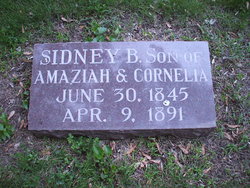
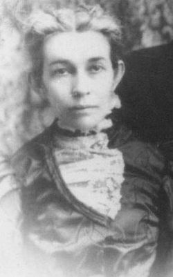
Cornelia Waite Cannon
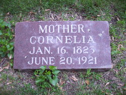
| Birth | : | 16 Jan 1823 Brookfield, Madison County, New York, USA |
| Death | : | 20 Jun 1921 Mason City, Cerro Gordo County, Iowa, USA |
| Burial | : | St John the Divine Churchyard, Pemberton, Metropolitan Borough of Wigan, England |
| Coordinate | : | 53.5373860, -2.6823840 |
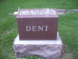
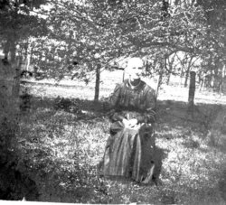
| Description | : | 1921 - Mrs. Cornelia Cannon, one of North Iowa's oldest Citizen's Buried Notes from Florence Boudrou Emme - no source cited. Last rites for Cornelia Cannon, Cerro Gordo woman, whose life time spanned the years from the time James Monroe, author of the Monroe Doctrine, was president, to June 20, 1921, were said at the home of her daughter, Mrs. T. W. Dent, Wednesday afternoon. The Rev. H. S. Wilkinson of the First M. E. Church officiating at the funeral services and Mrs. H. W. Barclay and Miss Ruth Stevens sang three appropriate solos. The body... Read More |
frequently asked questions (FAQ):
-
Where is Cornelia Waite Cannon's memorial?
Cornelia Waite Cannon's memorial is located at: St John the Divine Churchyard, Pemberton, Metropolitan Borough of Wigan, England.
-
When did Cornelia Waite Cannon death?
Cornelia Waite Cannon death on 20 Jun 1921 in Mason City, Cerro Gordo County, Iowa, USA
-
Where are the coordinates of the Cornelia Waite Cannon's memorial?
Latitude: 53.5373860
Longitude: -2.6823840
Family Members:
Parent
Spouse
Siblings
Children
Flowers:
Nearby Cemetories:
1. St John the Divine Churchyard
Pemberton, Metropolitan Borough of Wigan, England
Coordinate: 53.5373860, -2.6823840
2. St. Matthew Churchyard
Pemberton, Metropolitan Borough of Wigan, England
Coordinate: 53.5290100, -2.6721300
3. Salem Churchyard
Orrell, Metropolitan Borough of Wigan, England
Coordinate: 53.5331572, -2.7107046
4. St. Paul's Church of England Churchyard
Wigan, Metropolitan Borough of Wigan, England
Coordinate: 53.5278761, -2.6536048
5. St James Roman Catholic Churchyard
Orrell, Metropolitan Borough of Wigan, England
Coordinate: 53.5300000, -2.7140000
6. St Thomas the Martyr Churchyard
Up Holland, West Lancashire District, England
Coordinate: 53.5402980, -2.7195920
7. All Saints Churchyard
Wigan, Metropolitan Borough of Wigan, England
Coordinate: 53.5458134, -2.6334023
8. St. Joseph's College
Up Holland, West Lancashire District, England
Coordinate: 53.5525740, -2.7307890
9. Lower Ince Cemetery
Ince in Makerfield, Metropolitan Borough of Wigan, England
Coordinate: 53.5315670, -2.6209900
10. Gidlow Cemetery
Standish, Metropolitan Borough of Wigan, England
Coordinate: 53.5681220, -2.6437140
11. Ince-in-Makerfield cemetery
Ince in Makerfield, Metropolitan Borough of Wigan, England
Coordinate: 53.5323940, -2.6176660
12. Holy Trinity Churchyard
Ashton-In-Makerfield, Metropolitan Borough of Wigan, England
Coordinate: 53.4989280, -2.6688000
13. St Catharine Churchyard
Wigan, Metropolitan Borough of Wigan, England
Coordinate: 53.5461800, -2.6168400
14. St Marie Churchyard
Standish, Metropolitan Borough of Wigan, England
Coordinate: 53.5844610, -2.6704070
15. St Wilfrid Churchyard
Standish, Metropolitan Borough of Wigan, England
Coordinate: 53.5868240, -2.6616530
16. St Mary Roman Catholic Churchyard
Billinge, Metropolitan Borough of St Helens, England
Coordinate: 53.4909850, -2.7180090
17. St. Joseph's Roman Catholic Church Cemetery
Wrightington, West Lancashire District, England
Coordinate: 53.5923300, -2.7010200
18. St. Michael's Churchyard
Dalton, West Lancashire District, England
Coordinate: 53.5670360, -2.7640390
19. St Thomas Churchyard
Ashton-In-Makerfield, Metropolitan Borough of Wigan, England
Coordinate: 53.4856362, -2.6402671
20. St Thomas' Churchyard (Heath Road Extension)
Ashton-In-Makerfield, Metropolitan Borough of Wigan, England
Coordinate: 53.4850470, -2.6345810
21. St. John the Evangelist Churchyard
Abram, Metropolitan Borough of Wigan, England
Coordinate: 53.5090290, -2.5941470
22. St David Churchyard
Haigh, Metropolitan Borough of Wigan, England
Coordinate: 53.5758550, -2.5960800
23. All Saints Parish Churchyard
Hindley, Metropolitan Borough of Wigan, England
Coordinate: 53.5341110, -2.5707090
24. St. Paul's Churchyard
Skelmersdale, West Lancashire District, England
Coordinate: 53.5502050, -2.7929450

