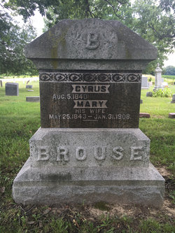
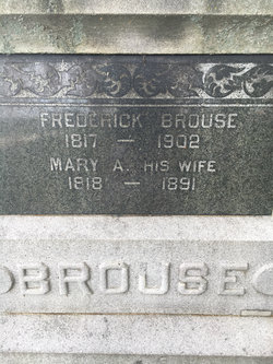
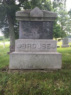
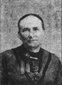
Cyrus Brouse
| Birth | : | 5 Aug 1840 Ohio, USA |
| Death | : | 23 Jul 1925 California, Branch County, Michigan, USA |
| Burial | : | Pleasant View Cemetery, Post Falls, Kootenai County, USA |
| Coordinate | : | 47.6961000, -117.0111000 |
| Description | : | Married 1st: Mary Tuttle on Jan. 1, 1861 in Ashland County, Ohio. Married 2nd: Carrie Huldah (Mason) Moore on July 13, 1909 in Steuben County, Indiana. |
frequently asked questions (FAQ):
-
Where is Cyrus Brouse's memorial?
Cyrus Brouse's memorial is located at: Pleasant View Cemetery, Post Falls, Kootenai County, USA.
-
When did Cyrus Brouse death?
Cyrus Brouse death on 23 Jul 1925 in California, Branch County, Michigan, USA
-
Where are the coordinates of the Cyrus Brouse's memorial?
Latitude: 47.6961000
Longitude: -117.0111000
Family Members:
Parent
Spouse
Children
Flowers:
Nearby Cemetories:
1. Pleasant View Cemetery
Post Falls, Kootenai County, USA
Coordinate: 47.6961000, -117.0111000
2. Evergreen Cemetery
Post Falls, Kootenai County, USA
Coordinate: 47.7358017, -116.9464035
3. Post Falls 7th Day Adventist
Kootenai County, USA
Coordinate: 47.7309600, -116.9044010
4. Saint John The Baptist Antiochian Orthodox Church
Post Falls, Kootenai County, USA
Coordinate: 47.7255000, -116.8842000
5. Kootenai County Cemetery
Post Falls, Kootenai County, USA
Coordinate: 47.7052803, -116.8627777
6. Saint Josephs Cemetery
Trentwood, Spokane County, USA
Coordinate: 47.6996994, -117.1632996
7. Mount Calvary Cemetery
Rathdrum, Kootenai County, USA
Coordinate: 47.8109055, -116.9901505
8. Saltese Cemetery
Greenacres, Spokane County, USA
Coordinate: 47.6278000, -117.1660995
9. Spokane Valley Church of the Nazarene Columbarium
Spokane, Spokane County, USA
Coordinate: 47.6393000, -117.1948000
10. Prairie View Cemetery
Coeur d'Alene, Kootenai County, USA
Coordinate: 47.7369385, -116.8083267
11. Riverview Cemetery
Coeur d'Alene, Kootenai County, USA
Coordinate: 47.6852798, -116.7916718
12. Forest Cemetery
Coeur d'Alene, Kootenai County, USA
Coordinate: 47.6833600, -116.7888700
13. Pine Grove Cemetery
Rathdrum, Kootenai County, USA
Coordinate: 47.8183100, -116.8736200
14. Coeur d'Alene Memorial Gardens
Coeur d'Alene, Kootenai County, USA
Coordinate: 47.7380250, -116.7879720
15. Saint Lukes Columbarium
Coeur d'Alene, Kootenai County, USA
Coordinate: 47.6767400, -116.7794800
16. Saint Pius Parish Cemetery
Coeur d'Alene, Kootenai County, USA
Coordinate: 47.7038050, -116.7771900
17. South Pines Cemetery
Spokane, Spokane County, USA
Coordinate: 47.6277000, -117.2261500
18. Bestland Cemetery
Coeur d'Alene, Kootenai County, USA
Coordinate: 47.7033005, -116.7727966
19. Pines Cemetery
Spokane Valley, Spokane County, USA
Coordinate: 47.6425018, -117.2416992
20. Saint Thomas Cemetery
Coeur d'Alene, Kootenai County, USA
Coordinate: 47.6727982, -116.7536011
21. Saint John Vianney Catholic Church Columbarium
Spokane, Spokane County, USA
Coordinate: 47.6619000, -117.2715000
22. Chester Community Cemetery
Chester, Spokane County, USA
Coordinate: 47.6138802, -117.2486343
23. Loffs Bay Cemetery
Coeur d'Alene, Kootenai County, USA
Coordinate: 47.5663900, -116.8258470
24. Pleasant Prairie Cemetery
Spokane, Spokane County, USA
Coordinate: 47.7305984, -117.2752991

