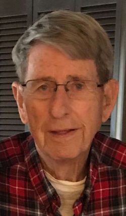
| Birth | : | 8 Jun 1914 Story County, Iowa, USA |
| Death | : | 18 Feb 1998 Wentzville, St. Charles County, Missouri, USA |
| Burial | : | Ruru Lawn Cemetery, Bromley, Christchurch City, New Zealand |
| Coordinate | : | -43.5322470, 172.6918010 |
| Description | : | Son of Fay E. and Florence (Bates) Hand of Story Co., Iowa. Grad. from Collins High School in Maxwell, Iowa in May 1931. Enlisted in the U.S. Navy on 18 August 1933 at Des Moines, Iowa. Served through World War II as a flight instructor. Two ships on which he served were the U.S.S. San Francisco and the U.S.S. Portland. He became a Navy recruiter and served several years of duty in Beatrice, Gage County, NE in the mid 1950's. Retired from the Navy after 26 years of service. Member of Wentzville American Legion... Read More |
frequently asked questions (FAQ):
-
Where is Dale Edward Hand's memorial?
Dale Edward Hand's memorial is located at: Ruru Lawn Cemetery, Bromley, Christchurch City, New Zealand.
-
When did Dale Edward Hand death?
Dale Edward Hand death on 18 Feb 1998 in Wentzville, St. Charles County, Missouri, USA
-
Where are the coordinates of the Dale Edward Hand's memorial?
Latitude: -43.5322470
Longitude: 172.6918010
Family Members:
Flowers:
Nearby Cemetories:
1. Ruru Lawn Cemetery
Bromley, Christchurch City, New Zealand
Coordinate: -43.5322470, 172.6918010
2. Canterbury Provincial Memorial
Bromley, Christchurch City, New Zealand
Coordinate: -43.5329620, 172.6896830
3. Memorial Park Cemetery
Bromley, Christchurch City, New Zealand
Coordinate: -43.5291840, 172.6877410
4. Linwood Cemetery
Linwood, Christchurch City, New Zealand
Coordinate: -43.5299220, 172.6828180
5. Bromley Cemetery
Bromley, Christchurch City, New Zealand
Coordinate: -43.5384980, 172.6862960
6. Canterbury Memorial Gardens and Crematorium
Bromley, Christchurch City, New Zealand
Coordinate: -43.5420790, 172.6893340
7. Woolston Cemetery
Woolston, Christchurch City, New Zealand
Coordinate: -43.5559770, 172.6825880
8. Avonside Anglican Cemetery
Avonside, Christchurch City, New Zealand
Coordinate: -43.5265780, 172.6585100
9. All Saints Church Cemetery
Burwood, Christchurch City, New Zealand
Coordinate: -43.4999650, 172.6865820
10. Blessed Sacrament Cathedral
Christchurch, Christchurch City, New Zealand
Coordinate: -43.5384250, 172.6458880
11. Barbadoes Street Cemetery
Christchurch, Christchurch City, New Zealand
Coordinate: -43.5230370, 172.6458760
12. Addington Cemetery
Addington, Christchurch City, New Zealand
Coordinate: -43.5434880, 172.6235790
13. Sydenham Cemetery
Sydenham, Christchurch City, New Zealand
Coordinate: -43.5582330, 172.6254900
14. Lyttelton Anglican Cemetery
Lyttelton, Christchurch City, New Zealand
Coordinate: -43.5985240, 172.7226520
15. St Paul's Anglican Church Cemetery
Papanui, Christchurch City, New Zealand
Coordinate: -43.4966540, 172.6067210
16. Lyttelton Cemetery
Lyttelton, Christchurch City, New Zealand
Coordinate: -43.6018530, 172.7255220
17. Belfast Cemetery
Belfast, Christchurch City, New Zealand
Coordinate: -43.4532460, 172.6424400
18. St Peter's Anglican Churchyard
Upper Riccarton, Christchurch City, New Zealand
Coordinate: -43.5317570, 172.5701330
19. Waimairi Cemetery
Burnside, Christchurch City, New Zealand
Coordinate: -43.4997760, 172.5773860
20. Mount Magdala Cemetery
Halswell, Christchurch City, New Zealand
Coordinate: -43.5622700, 172.5672600
21. Diamond Harbour Cemetery
Diamond Harbour, Christchurch City, New Zealand
Coordinate: -43.6237700, 172.7410400
22. St. Mary's Anglican Church Cemetery
Halswell, Christchurch City, New Zealand
Coordinate: -43.5794830, 172.5686440
23. Harewood Memorial Gardens & Crematorium
Harewood, Christchurch City, New Zealand
Coordinate: -43.4642810, 172.5845430
24. Avonhead Memorial Cemetery
Avonhead, Christchurch City, New Zealand
Coordinate: -43.5095390, 172.5503920


