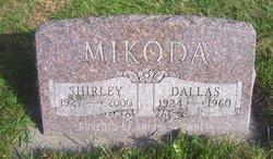
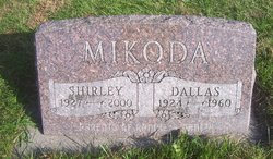
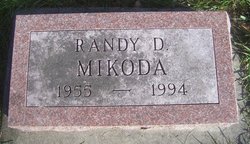
Dallas Dean Mikoda
| Birth | : | 30 Sep 1924 Tama, Tama County, Iowa, USA |
| Death | : | Mar 1960 Tama County, Iowa, USA |
| Burial | : | Moontown Cemetery, Jefferson County, USA |
| Coordinate | : | 38.0186005, -90.5828018 |
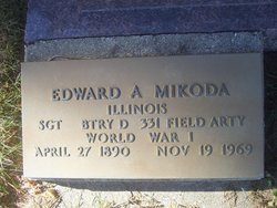
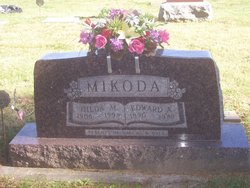
| Description | : | The Belle Plaine Union, Wednesday, March 16th, 1960 page 1 Flu, followed by pneumonia, caused the death of Dallas Mikoda at 7 a.m. Friday, March 11, 1960 at his home in the Irving community. Mr. Mikoda was born Sept 30, 1924, at Elberon; and was the son of Edward and Hilda Hennings Mikoda. He received his education in the rural schools of Benton county and was a graduate of the Elberon high school. In 1947 he married Shirley McMillan, Belle Plaine. The couple farmed near Elberon and Irving. Surviving are his wife; two sons, Ronnie, 12, and Randy, 4, a... Read More |
frequently asked questions (FAQ):
-
Where is Dallas Dean Mikoda's memorial?
Dallas Dean Mikoda's memorial is located at: Moontown Cemetery, Jefferson County, USA.
-
When did Dallas Dean Mikoda death?
Dallas Dean Mikoda death on Mar 1960 in Tama County, Iowa, USA
-
Where are the coordinates of the Dallas Dean Mikoda's memorial?
Latitude: 38.0186005
Longitude: -90.5828018
Family Members:
Parent
Spouse
Siblings
Children
Flowers:
Nearby Cemetories:
1. Moontown Cemetery
Jefferson County, USA
Coordinate: 38.0186005, -90.5828018
2. Hamman Cemetery
Jefferson County, USA
Coordinate: 38.0318985, -90.5742035
3. Robert's Gravesite
St. Francois County, USA
Coordinate: 38.0087260, -90.6172080
4. Cole Cemetery
St. Francois County, USA
Coordinate: 38.0028000, -90.6166992
5. Primrose Cemetery
St. Francois County, USA
Coordinate: 37.9910000, -90.5638000
6. Vinyard Family Cemetery
Blackwell, Jefferson County, USA
Coordinate: 38.0471992, -90.6050034
7. Aly Cemetery
St. Francois County, USA
Coordinate: 38.0285988, -90.6391983
8. Pinson Cemetery
Blackwell, St. Francois County, USA
Coordinate: 38.0457993, -90.6331024
9. Old Blackwell Cemetery
St. Francois County, USA
Coordinate: 38.0624500, -90.6173500
10. Adams-Hillcrest Cemetery
Bonne Terre, St. Francois County, USA
Coordinate: 37.9735985, -90.5436020
11. Appleberry Cemetery
St. Francois County, USA
Coordinate: 37.9893990, -90.5119019
12. Avoca Cemetery
De Soto, Jefferson County, USA
Coordinate: 38.0545807, -90.5121536
13. Settle Cemetery
St. Francois County, USA
Coordinate: 37.9519005, -90.5967026
14. Wheelehon Cemetery
St. Francois County, USA
Coordinate: 37.9399790, -90.5412120
15. Mount Olive Cemetery
De Soto, Jefferson County, USA
Coordinate: 38.0802800, -90.5069900
16. Dripping Springs Cemetery
Jefferson County, USA
Coordinate: 38.1034600, -90.5483200
17. Peter B. Frazier Cemetery
De Soto, Jefferson County, USA
Coordinate: 38.0522220, -90.4719440
18. Saint Joseph Cemetery
Bonne Terre, St. Francois County, USA
Coordinate: 37.9282990, -90.5441971
19. Edwards Cemetery
De Soto, Jefferson County, USA
Coordinate: 38.1095374, -90.5452866
20. Perret Cemetery
St. Francois County, USA
Coordinate: 37.9667015, -90.4768982
21. Germania Cemetery
Bonne Terre, St. Francois County, USA
Coordinate: 37.9211006, -90.6141968
22. Rouggly Cemetery
St. Francois County, USA
Coordinate: 38.0097008, -90.4546967
23. Bonne Terre Cemetery
Bonne Terre, St. Francois County, USA
Coordinate: 37.9173000, -90.5393000
24. Lester Cemetery
St. Francois County, USA
Coordinate: 38.0306015, -90.4477997

