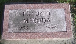
Randy Dean Mikoda
| Birth | : | 2 Apr 1955 Belle Plaine, Benton County, Iowa, USA |
| Death | : | 11 Mar 1994 Iowa City, Johnson County, Iowa, USA |
| Burial | : | West Frantz Cemetery, Oakley, Macon County, USA |
| Coordinate | : | 39.9040756, -88.7891006 |
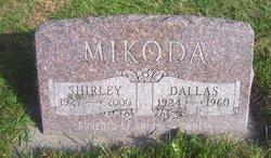
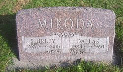
| Description | : | The Belle Plaine Union, Wednesday, March 16th, 1994 page 4 Funeral services for Randy Dean Mikoda, 38, were Tuesday, March 15, at Russell Overton Funeral Home, Belle Plaine. The Rev. George Mullins officiated. Mikoda died Friday, March 11, 1994. He became ill March 5 with pneumonia and cancer. He entered the Marengo Hospital and later was flown to the University Hospitals and Clinics in Iowa City where he died. Burial was in National Cemetery, Vining. Randy Mikoda was born April 2, 1955, at the Corn Belt Hospital, Belle Plaine. He was the son of Dallas and Shirley McMillen Mikoda. He... Read More |
frequently asked questions (FAQ):
-
Where is Randy Dean Mikoda's memorial?
Randy Dean Mikoda's memorial is located at: West Frantz Cemetery, Oakley, Macon County, USA.
-
When did Randy Dean Mikoda death?
Randy Dean Mikoda death on 11 Mar 1994 in Iowa City, Johnson County, Iowa, USA
-
Where are the coordinates of the Randy Dean Mikoda's memorial?
Latitude: 39.9040756
Longitude: -88.7891006
Family Members:
Parent
Siblings
Flowers:
Nearby Cemetories:
1. West Frantz Cemetery
Oakley, Macon County, USA
Coordinate: 39.9040756, -88.7891006
2. Peck Cemetery
Oakley, Macon County, USA
Coordinate: 39.9263992, -88.7671967
3. Cross Cemetery
Oakley, Macon County, USA
Coordinate: 39.9006004, -88.8268967
4. Cerro Gordo Cemetery
Cerro Gordo, Piatt County, USA
Coordinate: 39.8969421, -88.7386093
5. Ritchie Cemetery
Oakley, Macon County, USA
Coordinate: 39.8842010, -88.8419037
6. Union Cemetery
Oreana, Macon County, USA
Coordinate: 39.9202766, -88.8488922
7. Wheeler Cemetery
Oakley, Macon County, USA
Coordinate: 39.8833008, -88.8581009
8. Garver Cemetery
Oreana, Macon County, USA
Coordinate: 39.9008331, -88.8747253
9. Ridge Cemetery
Long Creek Township, Macon County, USA
Coordinate: 39.8363991, -88.7830963
10. East Frantz Cemetery
Cerro Gordo, Piatt County, USA
Coordinate: 39.9310970, -88.6972730
11. Dunbar Cemetery
Friends Creek Township, Macon County, USA
Coordinate: 39.9797500, -88.7832900
12. Lester R Barnett Memorial Cemetery
Decatur, Macon County, USA
Coordinate: 39.8511100, -88.8661000
13. Croninger Cemetery
Cisco, Piatt County, USA
Coordinate: 39.9734530, -88.7267230
14. North Fork Cemetery
Long Creek, Macon County, USA
Coordinate: 39.8463898, -88.8752747
15. Clover Cemetery
Willow Branch Township, Piatt County, USA
Coordinate: 39.9690390, -88.7111680
16. Friends Creek Cemetery
Argenta, Macon County, USA
Coordinate: 39.9921989, -88.8031006
17. Dillow Cemetery
Willow Branch Township, Piatt County, USA
Coordinate: 39.9673660, -88.7022140
18. Saint Johns Lutheran Cemetery
Decatur, Macon County, USA
Coordinate: 39.8637886, -88.8975677
19. Florey Cemetery
Long Creek, Macon County, USA
Coordinate: 39.8107986, -88.8319016
20. Spangler Cemetery
Decatur, Macon County, USA
Coordinate: 39.8511009, -88.8989029
21. Brown Cemetery
Argenta, Macon County, USA
Coordinate: 40.0039620, -88.8206160
22. Point Pleasant Cemetery
Long Creek, Macon County, USA
Coordinate: 39.8055992, -88.8274994
23. Peach Orchard Cemetery (Defunct)
Decatur, Macon County, USA
Coordinate: 39.8942020, -88.9254740
24. LaPlace Cemetery
LaPlace, Piatt County, USA
Coordinate: 39.8168983, -88.7067032


