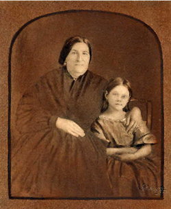
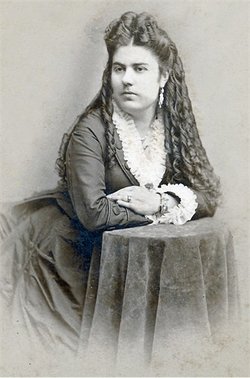
| Birth | : | 1799 Billerica, Middlesex County, Massachusetts, USA |
| Death | : | 25 Jan 1865 Santa Barbara, Santa Barbara County, California, USA |
| Burial | : | Grandview Cemetery, Elk Creek, Johnson County, USA |
| Coordinate | : | 40.3274994, -96.1042023 |
| Inscription | : | In Memory of Daniel A. Hill a native of Billerica Mass. and a resident of California since 1823. Who died at this place the 25 January 1865. Aged 68 years. |
| Description | : | Daniel was the son of Job Hill and Susan Blanchard. He married Maria Rafaela Sabina Luisa Ortega y Olivares at Mission San Buenaventura on August 11, 1825. |
frequently asked questions (FAQ):
-
Where is Daniel Antonio Hill's memorial?
Daniel Antonio Hill's memorial is located at: Grandview Cemetery, Elk Creek, Johnson County, USA.
-
When did Daniel Antonio Hill death?
Daniel Antonio Hill death on 25 Jan 1865 in Santa Barbara, Santa Barbara County, California, USA
-
Where are the coordinates of the Daniel Antonio Hill's memorial?
Latitude: 40.3274994
Longitude: -96.1042023
Family Members:
Parent
Spouse
Siblings
Children
Flowers:
Nearby Cemetories:
1. Grandview Cemetery
Elk Creek, Johnson County, USA
Coordinate: 40.3274994, -96.1042023
2. Mount Hope Cemetery
Elk Creek, Johnson County, USA
Coordinate: 40.2976000, -96.1406000
3. Saint Frederick Cemetery
Johnson, Nemaha County, USA
Coordinate: 40.3671989, -96.0475006
4. Tecumseh Cemetery
Tecumseh, Johnson County, USA
Coordinate: 40.3645000, -96.1800000
5. Martin Luther Church Cemetery
Nemaha County, USA
Coordinate: 40.3345040, -96.0098670
6. Spring Creek Cemetery
Johnson County, USA
Coordinate: 40.3992004, -96.1222000
7. Trinity Lutheran Cemetery
Nemaha County, USA
Coordinate: 40.3058014, -96.0093994
8. Saint James Lutheran Cemetery
Nemaha County, USA
Coordinate: 40.2757500, -96.0161500
9. Mount Zion Cemetery
Nemaha County, USA
Coordinate: 40.2761002, -96.0113983
10. Saint Peters Lutheran Church Cemetery
Steinauer, Pawnee County, USA
Coordinate: 40.2555000, -96.1801000
11. Saint Andrews Cemetery
Tecumseh, Johnson County, USA
Coordinate: 40.3918991, -96.1999969
12. Saint Matthews Lutheran Cemetery
Johnson, Nemaha County, USA
Coordinate: 40.4073060, -96.0086500
13. Clear Creek Cemetery
Table Rock, Pawnee County, USA
Coordinate: 40.2193985, -96.1391983
14. Saint Johns Lutheran Cemetery
Auburn, Nemaha County, USA
Coordinate: 40.3335000, -95.9576000
15. Johnson Cemetery
Johnson, Nemaha County, USA
Coordinate: 40.4142000, -96.0052300
16. Saint Johns Cemetery
Table Rock, Pawnee County, USA
Coordinate: 40.2148000, -96.0657000
17. Zion Lutheran Church Cemetery
Johnson, Nemaha County, USA
Coordinate: 40.4287000, -96.0099000
18. Beranek Cemetery
Table Rock, Pawnee County, USA
Coordinate: 40.2042007, -96.1607971
19. Saint Pauls United Church of Christ Cemetery
Tecumseh, Johnson County, USA
Coordinate: 40.2996000, -96.2742000
20. Saint Pauls Lutheran Cemetery
Auburn, Nemaha County, USA
Coordinate: 40.3771230, -95.9328000
21. Table Rock Cemetery
Table Rock, Pawnee County, USA
Coordinate: 40.1791400, -96.1037400
22. Saint Anthonys Cemetery
Steinauer, Pawnee County, USA
Coordinate: 40.2075005, -96.2189026
23. Mount Hope Church Cemetery
Cook, Johnson County, USA
Coordinate: 40.4775000, -96.1233000
24. Rinne Cemetery
Pawnee County, USA
Coordinate: 40.2472000, -96.2742004


