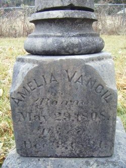
| Birth | : | 26 May 1813 Jackson County, Illinois, USA |
| Death | : | 3 Jan 1864 Douglas County, Kansas, USA |
| Burial | : | Jones Cemetery, Lawrence, Douglas County, USA |
| Coordinate | : | 38.8936950, -95.3620840 |
| Inscription | : | Aged 50 yrs 7 mos 8 days |
| Description | : | The 1855 Kansas Territory census, while incomplete, lists Daniel Vancil and his family as settlers in the Bloomington area of Douglas County, Kansas. The town site of Bloomington, now abandoned, was located in Section 24, about one mile east of the present day Clinton and approximately one mile north of the Adams Campus (University of Kansas) where this cemetery is located. |
frequently asked questions (FAQ):
-
Where is Daniel Vancil's memorial?
Daniel Vancil's memorial is located at: Jones Cemetery, Lawrence, Douglas County, USA.
-
When did Daniel Vancil death?
Daniel Vancil death on 3 Jan 1864 in Douglas County, Kansas, USA
-
Where are the coordinates of the Daniel Vancil's memorial?
Latitude: 38.8936950
Longitude: -95.3620840
Family Members:
Spouse
Children
Flowers:
Nearby Cemetories:
1. Jones Cemetery
Lawrence, Douglas County, USA
Coordinate: 38.8936950, -95.3620840
2. Johnson Cemetery
Douglas County, USA
Coordinate: 38.8857700, -95.3545300
3. Clinton Cemetery
Clinton, Douglas County, USA
Coordinate: 38.9136009, -95.4105988
4. Dutton Cemetery
Douglas County, USA
Coordinate: 38.8989800, -95.2790600
5. Corpus Christi Catholic Church Columbarium
Lawrence, Douglas County, USA
Coordinate: 38.9572250, -95.3238450
6. Washington Creek Cemetery
Lone Star, Douglas County, USA
Coordinate: 38.8273800, -95.3997900
7. Colyer Cemetery
Worden, Douglas County, USA
Coordinate: 38.8189011, -95.3625031
8. Pleasant Hill Cemetery
Pleasant Grove, Douglas County, USA
Coordinate: 38.8535995, -95.2794037
9. Williams Cemetery
Willow Springs Township, Douglas County, USA
Coordinate: 38.8188460, -95.3354070
10. Richland Cemetery
Lawrence, Douglas County, USA
Coordinate: 38.8768997, -95.2630997
11. Rock Creek Cemetery
Douglas County, USA
Coordinate: 38.8488998, -95.4561005
12. Mound View Cemetery
Stull, Douglas County, USA
Coordinate: 38.9425011, -95.4558029
13. First Presbyterian Church Memorial Garden
Lawrence, Douglas County, USA
Coordinate: 38.9414900, -95.2641600
14. Marshall Cemetery
Douglas County, USA
Coordinate: 38.9040800, -95.2446700
15. Twin Mound Cemetery
Clinton, Douglas County, USA
Coordinate: 38.8692017, -95.4819031
16. Pioneer Cemetery
Lawrence, Douglas County, USA
Coordinate: 38.9528008, -95.2611008
17. Davis Cemetery
Lawrence, Douglas County, USA
Coordinate: 38.9722500, -95.2831100
18. Saint Johns Cemetery
Worden, Douglas County, USA
Coordinate: 38.7959000, -95.3349000
19. Breeze Family Cemetery
Pleasant Grove, Douglas County, USA
Coordinate: 38.8472800, -95.2480400
20. Lyon Family Cemetery
Lawrence, Douglas County, USA
Coordinate: 38.9877440, -95.3166530
21. Ulrich Cemetery
Pleasant Grove, Douglas County, USA
Coordinate: 38.8395740, -95.2531810
22. Riggs Family Cemetery
Clinton, Douglas County, USA
Coordinate: 38.8949300, -95.4978100
23. Stull Cemetery
Stull, Douglas County, USA
Coordinate: 38.9714203, -95.4546204
24. Kennedy Cemetery
Douglas County, USA
Coordinate: 38.9112900, -95.2269200


